Circular Mampodre Massif from Maraña.
Mampodre massif
The Mampodre Massif is a small limestone massif located in the northeast of the province of Leon, a unique place of incomparable beauty.
How to get there
To reach the town of Maraña in León from Riaño, follow the CL635 road and take the turning to the left after Acebedo.
If you are coming from Puerto de Tarna, take the turn-off to the right before reaching Acebedo.

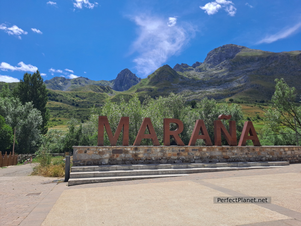
Maraña
Maraña
If you come by van and/or motorhome you have a free camping area on the outskirts of Maraña with access to the river.
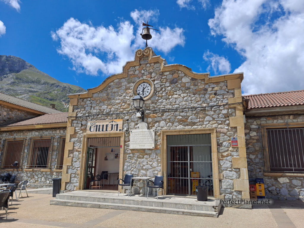
In Maraña you can find a hostel, two bars, the one in the square has lunch and dinner service every day, fountains, children's playground and also a climbing area (in the hostel you can rent equipment) all in a spectacular setting.
Maraña
Description
We start our route from the town of Maraña in León. We set off early in the morning heading west along a wide tarmac track. After about 200 metres we take a turn-off to our left to cross the river and continue along a track that sometimes gets lost in the meadows.
La Polinosa peak
We continue along the path until we reach a shepherds' hut where we turn off to the left and return to the path again.
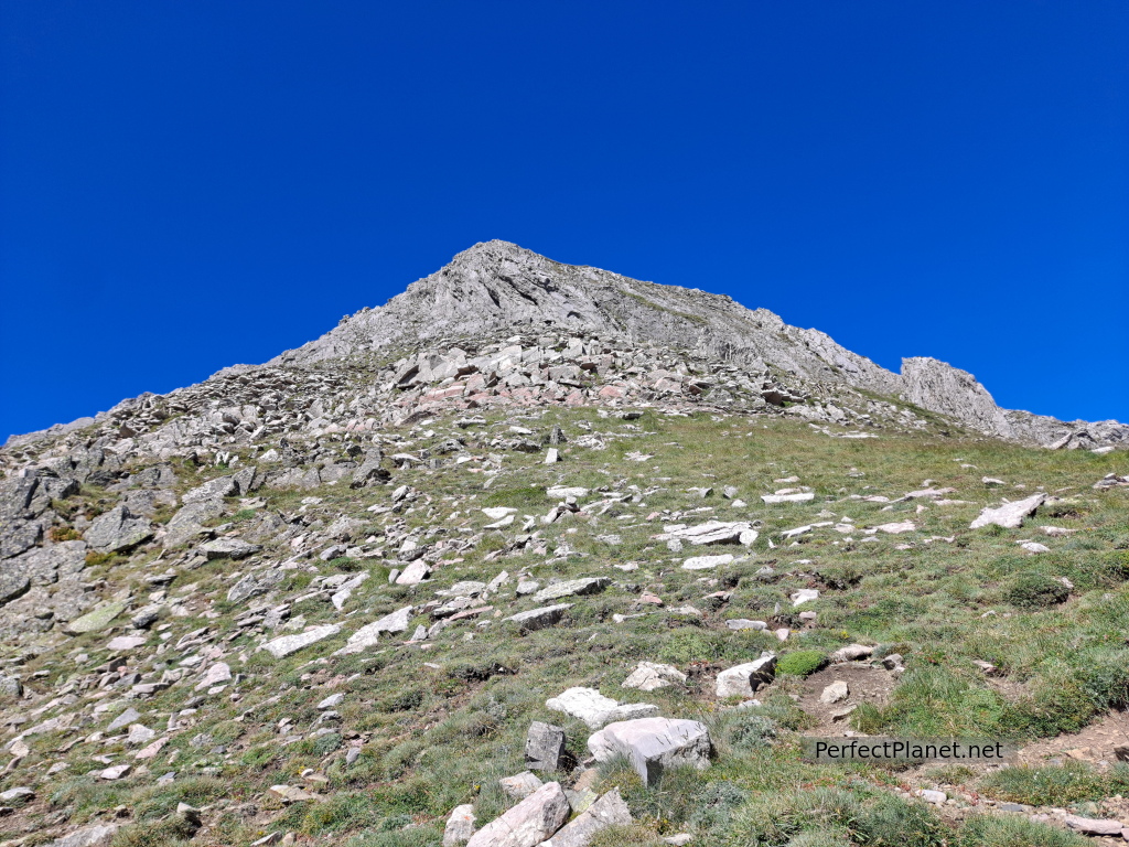
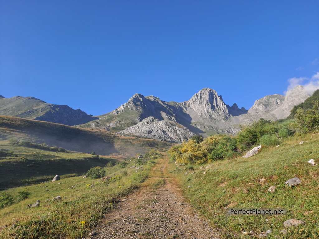
For about a kilometre we go up the stream until the valley begins to open up and we can see our first objective in the background, the Polinosa peak. Once in the valley we have to cross a meadow on the right until we find a path (not very well marked at the beginning) that takes us to the Valverde pass. On the last stretch of the ascent the path is very well marked.
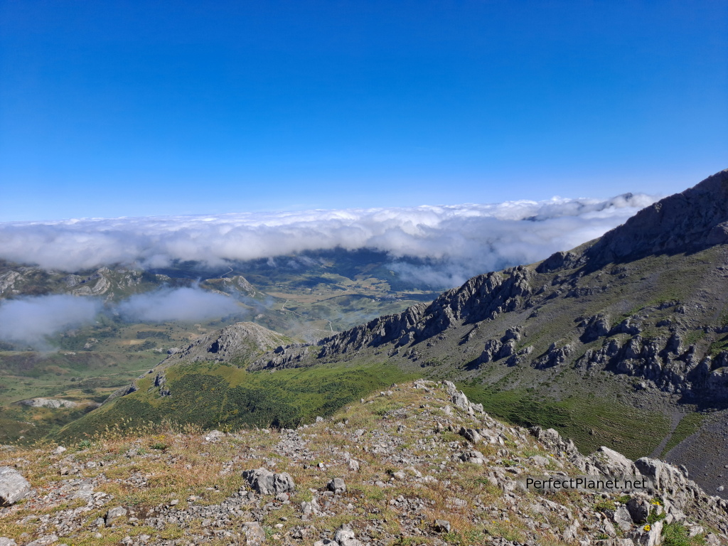
Views
There are NO signposts along the entire route except for milestones and well-marked paths.
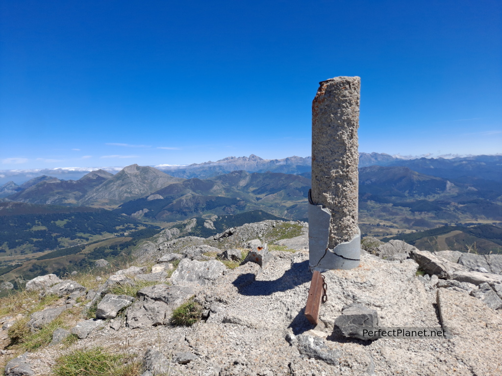
From the Valverde pass we follow the milestones to our left to climb to Polinosa (2,159 metres).
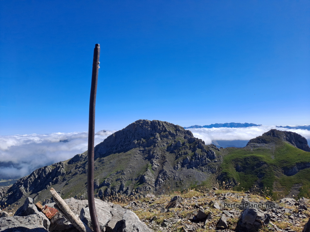
La Polinosa peak
360º views, Susarón, Torre peak, Peña los Vientos, Peña Ten, Picos de Europa, Gilbo, Yordas, Porma reservoir... and the rest of the peaks of Mampodre. Brutal...
Views
We crest to our right to descend in a few metres to the Cervunal pass.
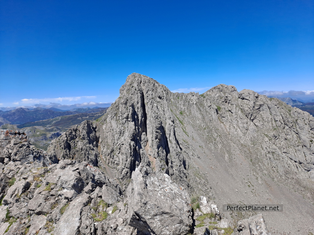
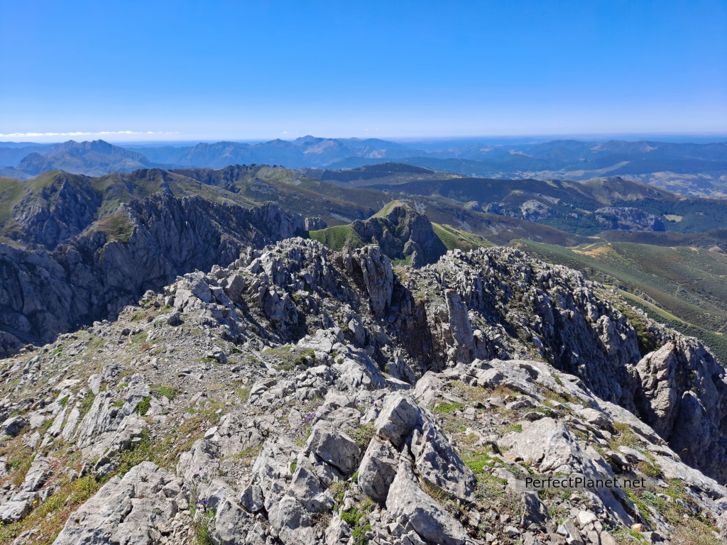
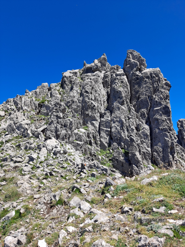
We climb straight up to a small peak (2,134 metres) which is the antechamber to the peak of Valcerrao or Cervunal (2,168 metres). We descend along the grassy path until we reach another pass from where we take the path to Peña de La Cruz (2,192 metres), the highest peak in the Mampodre massif.
Cervunal peak
The ascent is fun and short, but we have to throw out our hands from time to time and we enjoy it a lot.
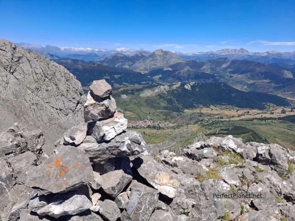
Once at the top we are once again amazed by the views.
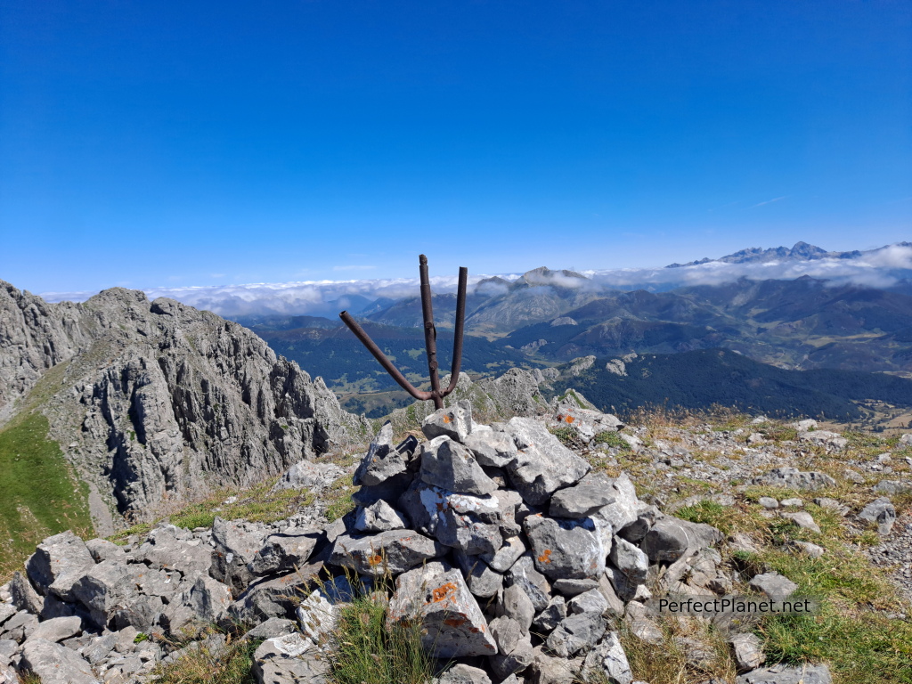
Peña de la Cruz peak
Peña de la Cruz peak
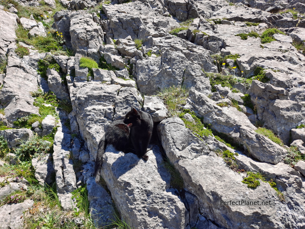
We descend along the same path and meet a couple who are carrying a cat but it is not theirs, it has been following them since the village, it is very friendly.
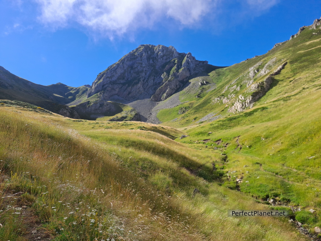
We continue our route now to climb the Peñas del Convento but without losing altitude.
Convento peak
We start climbing again until we reach the main milestone.
We descend from the crags until we reach the pass on our left where we descend towards the Mampodre lagoon.
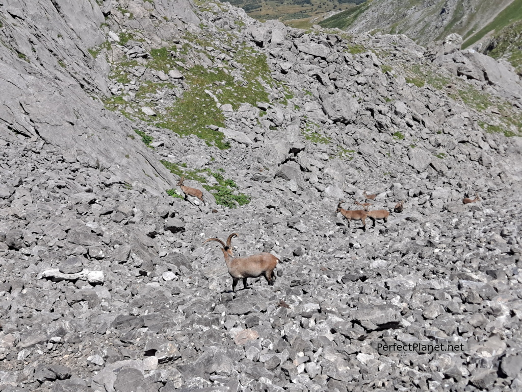
At first the descent is grass and some path, then it is a large rock with milestones that is very easy to descend. We come across a group of 12 wild goats and they don't even flinch when they see us.
We continue leaving the large rocks behind to continue along a mixed path, sometimes grassy, sometimes well-hit rocky, until we reach the Mampodre lagoon.
The views of the glacial cirque of Mampodre and the peaks of Valjarto and Mediodía are brutal.
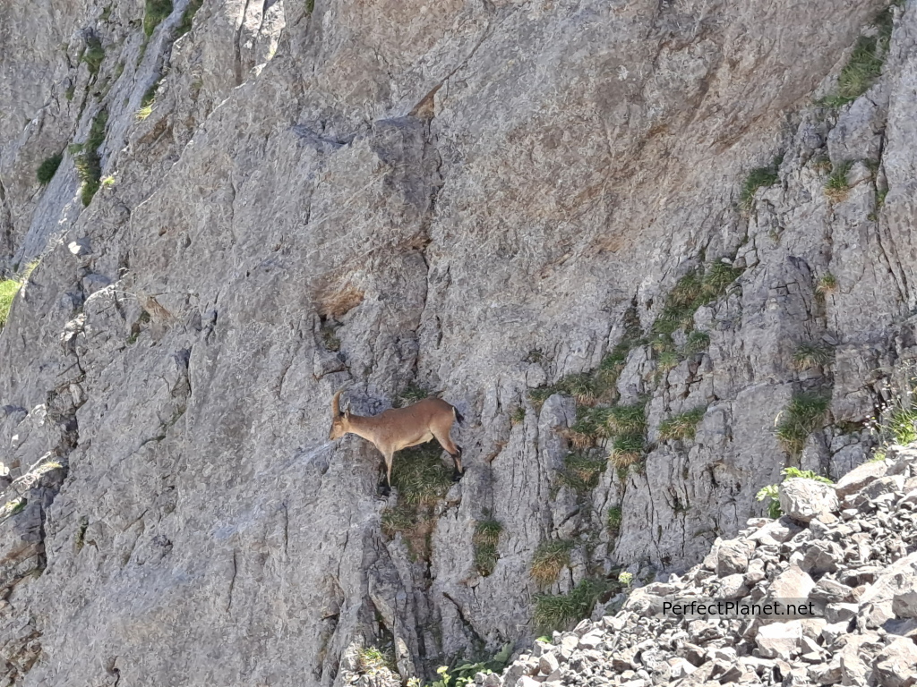
Goats
From here, a meadow with a somewhat lost path that is not well marked but easy to follow because the grass is well trodden.
We reach the Loma del Acebal pass where we take a path that leads us to the beech forest. We are lucky enough to see a huge fox among the cows.
From the forest we have to descend in a straight line without a path until we reach the track that will lead us back to Maraña.
Distance 12.5 kilometres
Difference in altitude 1,200 metres
Circular route
Moderate difficulty
Whoever makes full or partial use of this track and its additional information, assumes full responsibility for the risks inherent in the practice of the activity, this information is for guidance purposes only.
Map
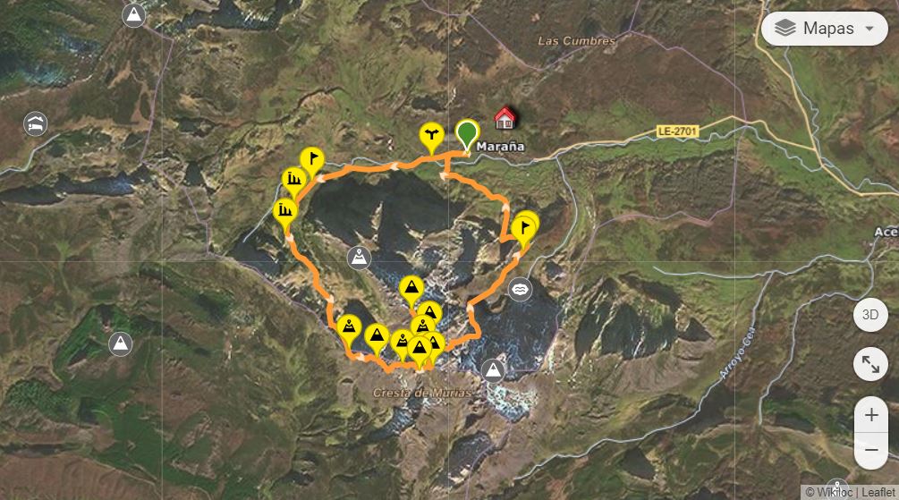
Map
- Log in to post comments