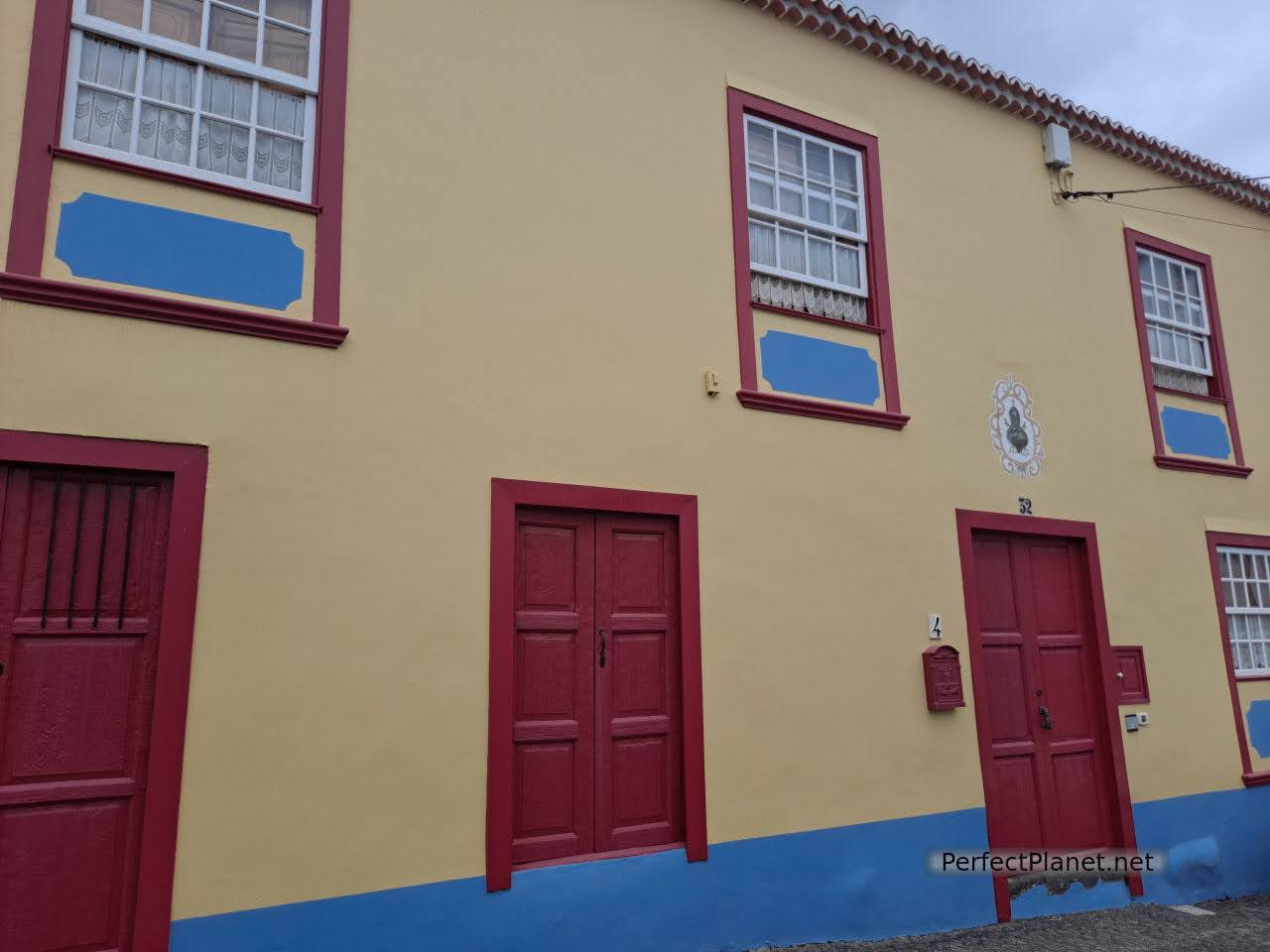
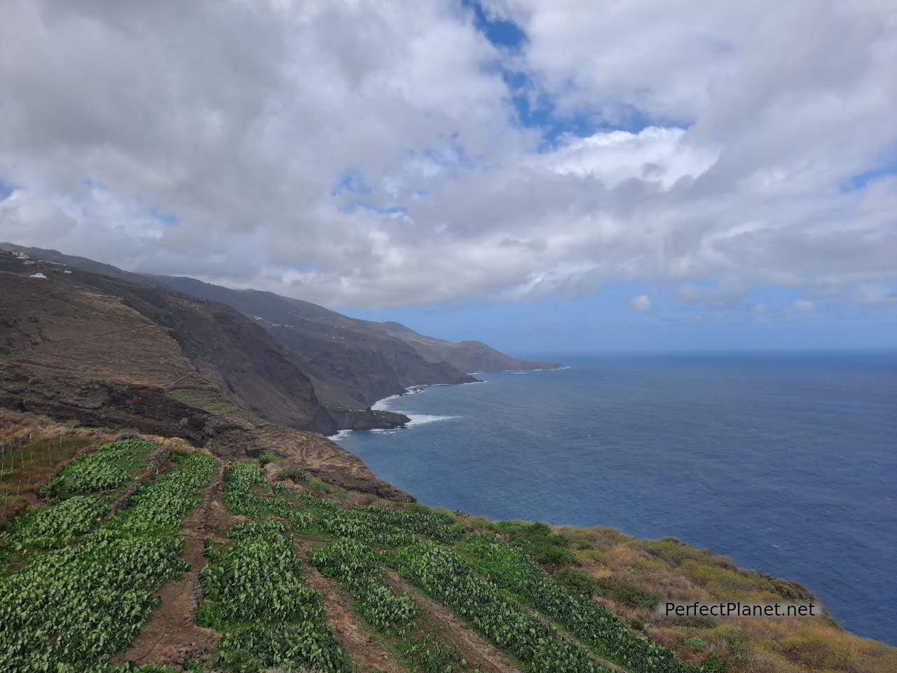
With just over seven hundred square kilometres, the island of La Palma, popularly known as the Isla Bonita, lives up to its name with one of the most incredible landscapes of all the Canary Islands.
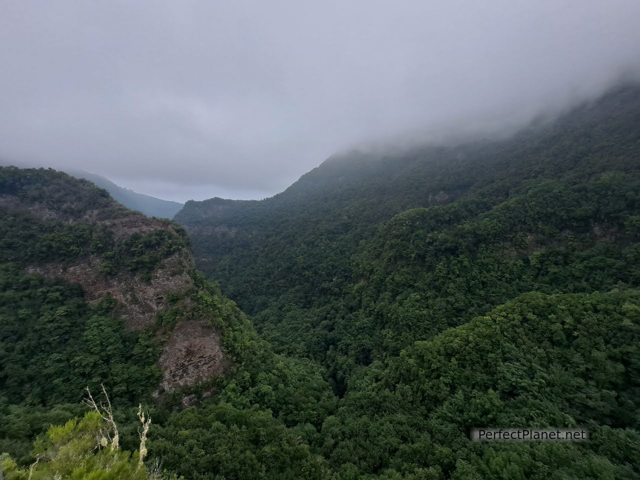
Caldera de Taburiente
Beaches, mountains, volcanoes, endemic forests, waterfalls, natural pools, charming villages, a sustainable tourist destination where you can enjoy one of the best skies in the world, delicious cuisine and charming, hard-working, friendly and generous people make this destination one of the most visited in the Canary Islands. Will you join us?
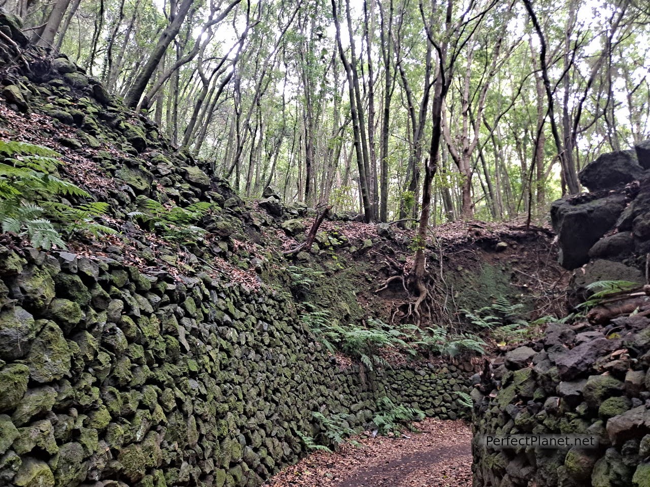
Cubo la Galga
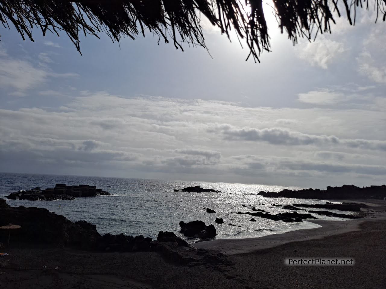
Salt flats of fuencaliente
What to see and do 6 days in La Palma
Due to the eruption of the Cumbre Vieja volcano, the trails in the municipalities of Villa de Mazo, Fuencaliente and El Paso are closed. We make you an alternative proposal without visiting part of the Caldera de Taburiente National Park, however we will indicate you the most important trails and places inside the Caldera that we will do on our next visit.

Caldera de Taburiente
Day 1. Salt flats and Fuencaliente lighthouse. San Antonio and Teneguía volcano .
Day 2. Roque de los Muchachos, Dragos viewpoint, Veta beach, Porís de la Candelaria, Time viewpoint.
Day 3. Los Cancajos, Santa Cruz de la Palma, Concepción viewpoint, Nogales beach.
Day 4. Route of Tilos by Springs of Marcos and Cordero, San Andrés, Charco Azul.
Day 6. Cubo de la Galga, San Bartolo viewpoint, La Nieve peak.
Cubo la Galga
You may also be interested in: La Gomera in 5 days, El Hierro in 3 days , South Tenerife.
How to get there
By plane. The island of La Palma has a small airport with international connections. It receives passengers from the islands and the mainland almost daily. It is located 8 kilometres from Santa Cruz de la Palma.
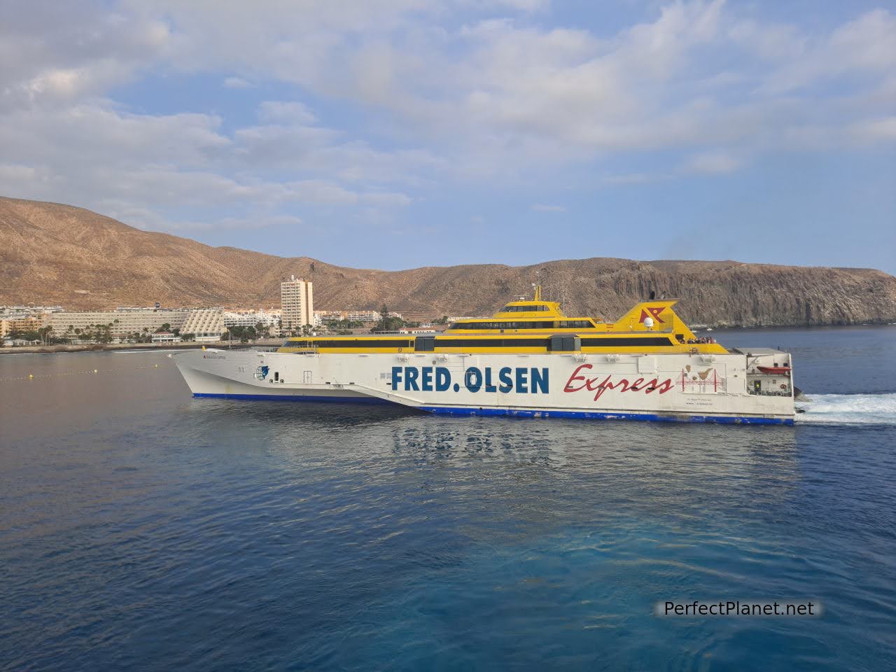
By boat. We took the ferry from the island of La Gomera. It takes two and a half hours if you go direct, or about four hours if you call at Puerto de los Cristianos in Tenerife.
Poris de Candelaria
There are two ferry companies, Fred Olsen and Naviera de Armas, we travelled with the latter which we found cheaper. The boats are punctual, you can travel with your rented car (you must inform your car rental company beforehand).
It is advisable to be there at least one hour before the ferry departs if you have a car or half an hour if you don't. It takes about half an hour to complete the journey. It takes about half an hour to complete embarkation and disembarkation of all passengers, which should be taken into account if you have other connections.
Ferry
Ferry from La Gomera to La Palma with stopover in Tenerife: 67€/ 2 pax.
In the case of Naviera de Armas, if you make more than one trip on the same day with the same company, the second trip is free. We have not seen this reflected on their website, so you have to do it by phone. In our case we bought all the tickets and when we found out about it we claimed it by phone. Once you have bought the ticket, if you call within 72 hours of the ferry's departure they refund you the full amount of the second fare, if 72 hours are missing they keep a commission of about €7 per passenger.
La Nieve peak
Getting around the island
We rent a car with the company CICAR. Fully comprehensive insurance with no excess and no mileage limit. They give you the car with an empty tank and that's how you have to return it. They work very well, new vehicles in very good condition. They have several collection and delivery points, and you can take it to other islands (with prior notice to the company), although you must return it to the island of origin.
Filling up in the Canary Islands is cheaper than on the mainland but if you want to see the prices of nearby petrol stations we recommend you use the app. (My Petrol Stations)
Caldera de Taburiente
Bus. This is the most widely used public transport in the Canary Islands. Buses (guaguas) cover practically all parts of the island and are very practical to combine with long walks.
Accommodation
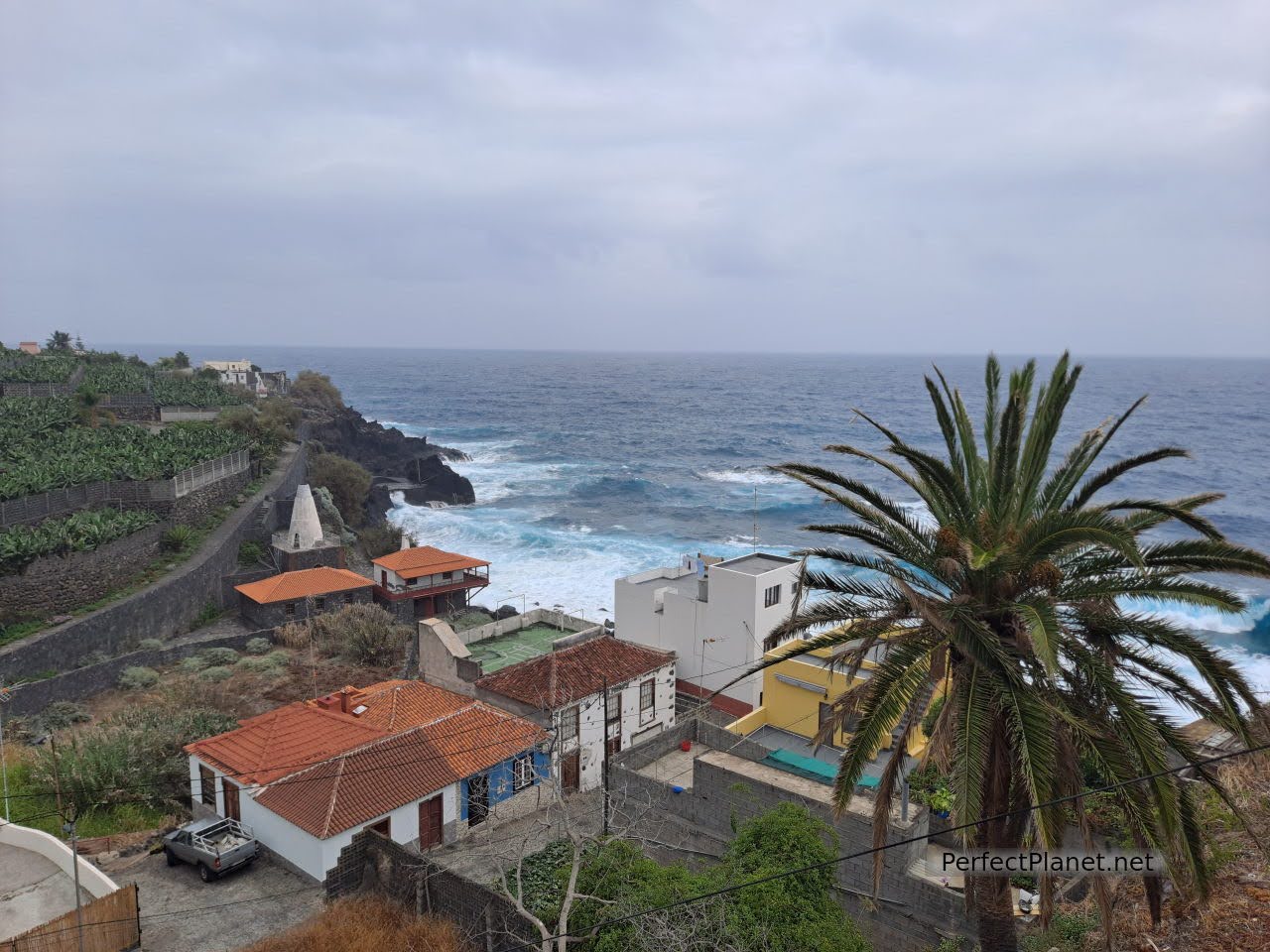
We stayed in a small beach cottage in La Salemera on the east coast of the island, about 15 kilometres from Santa Cruz de la Palma. The reservation was made through Booking. Price 40€/night.
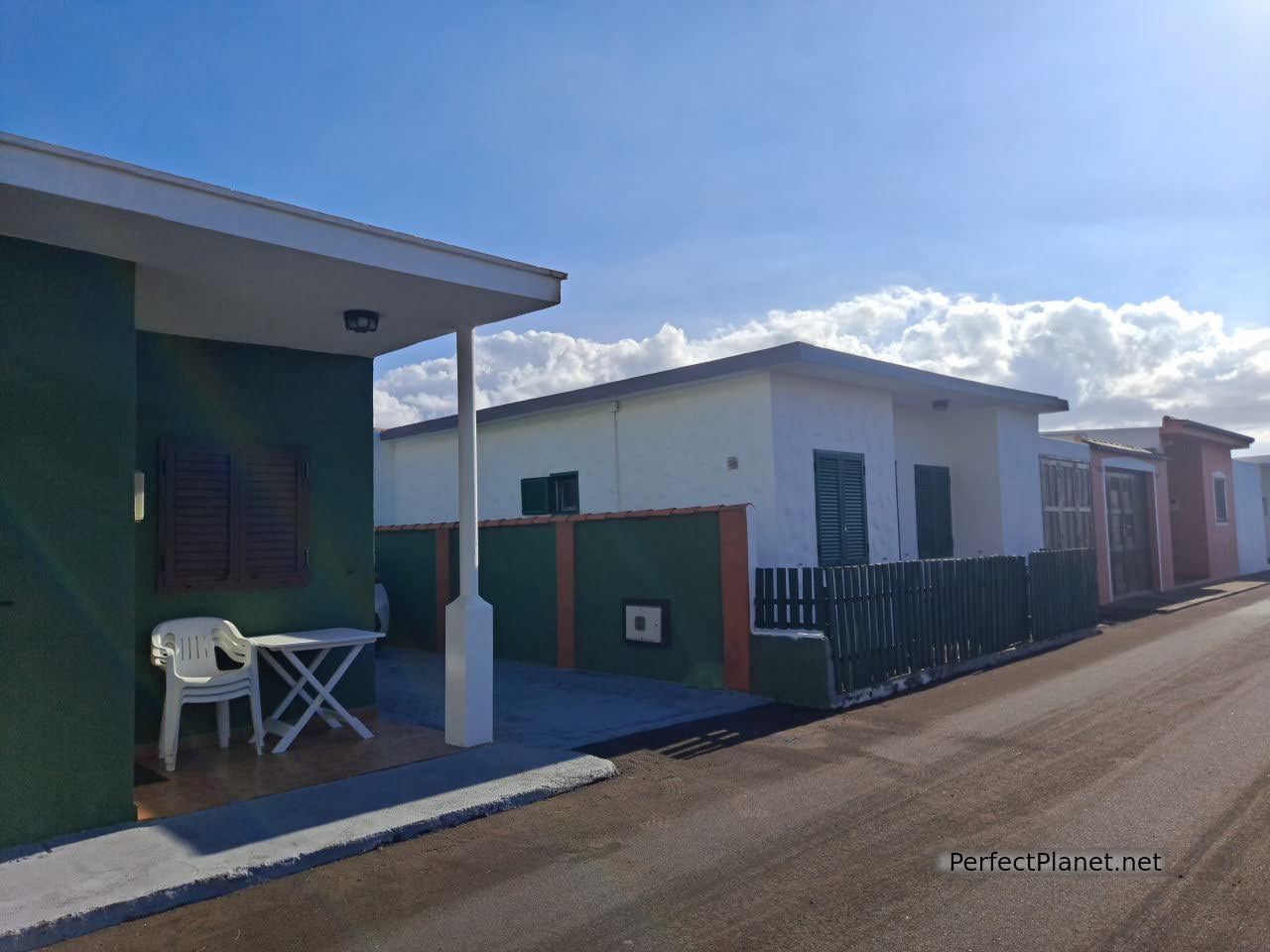
Our accommodation
The reception was incredible, fruit basket, a bottle of wine (delicious) and a bottle of water, what more could you ask for? No wifi but it's a marvel all the same.
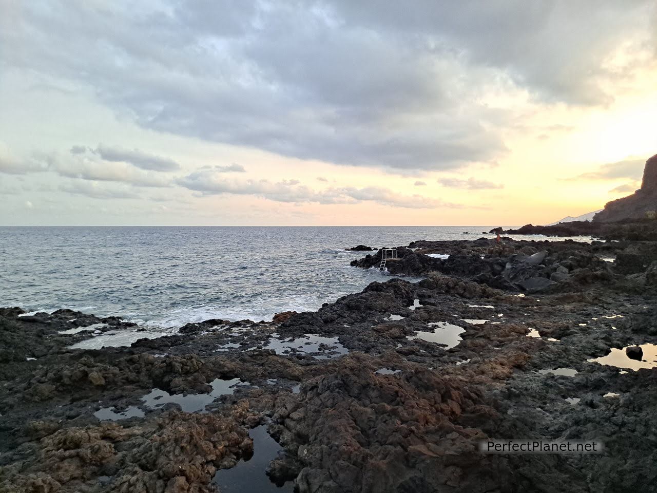
Salemera beach

Salemera beach
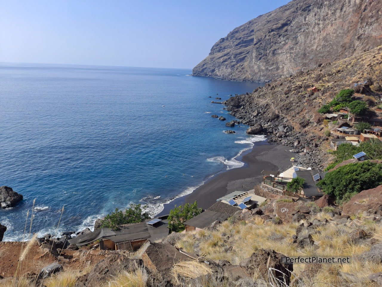
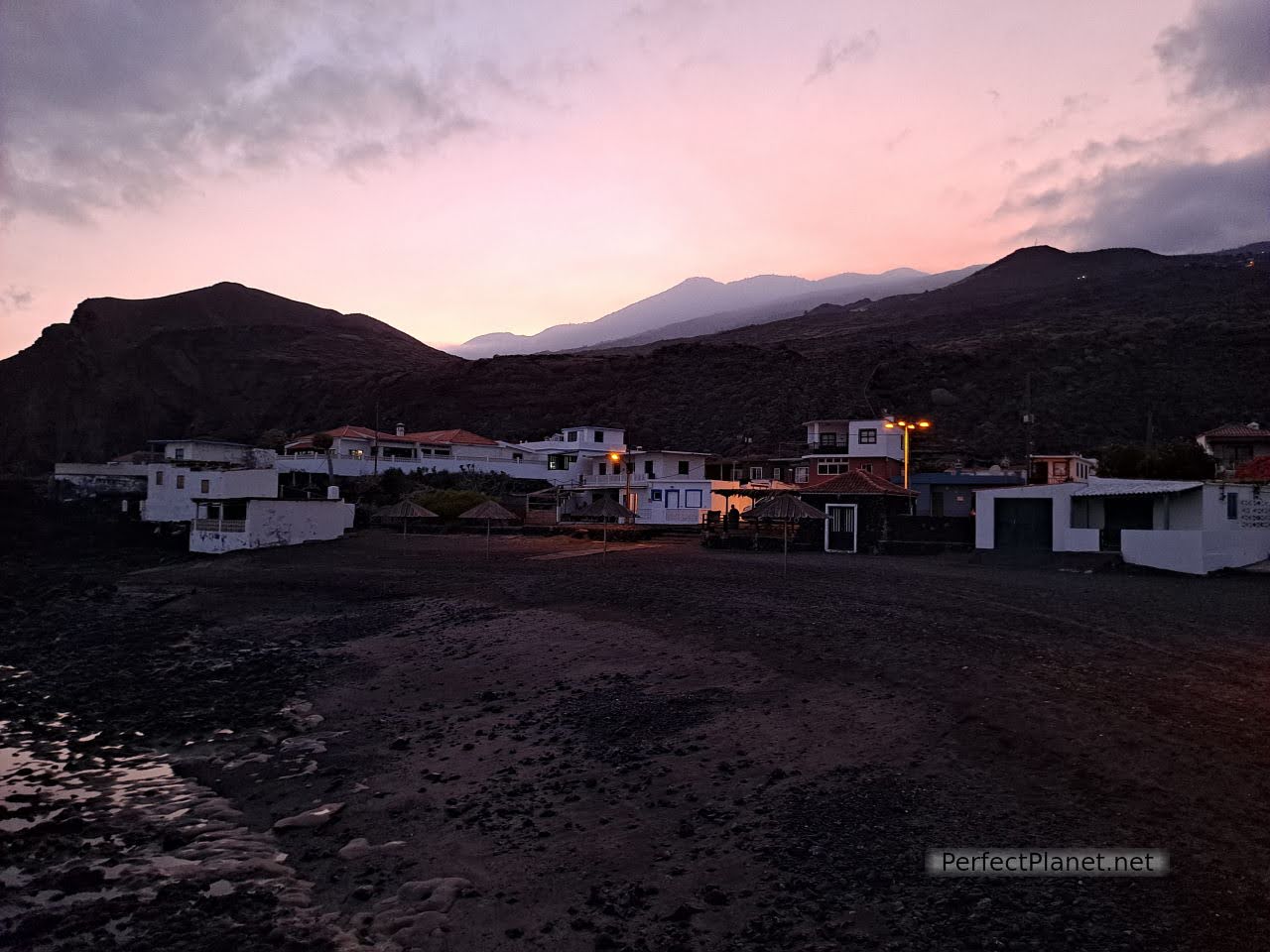
We highly recommend it. Salemera beach belongs to Villa de Mazo. A small fishing village with humble houses, a small beach and a beach bar make up this beautiful place. Don't forget to visit it because it is well worth it. Kiosk Salemera beach, two cañas 2,7€.

Kiosk Salemera beach
Salemera beach
Gastronomy
The traditional gastronomy of La Palma coexists with a more avant-garde cuisine based on local products. From the sugar cane rum of San Andrés y Sauces to the D.O. wine that grows on the volcanic slopes, especially that produced from the Malvasia grape, which for centuries was one of the island's main sources of income.
Fruit. Although the undisputed king is the banana, other tropical and subtropical fruits such as avocados, mangos, papayas, guavas, oranges, mandarins... are also grown here. Delicious.
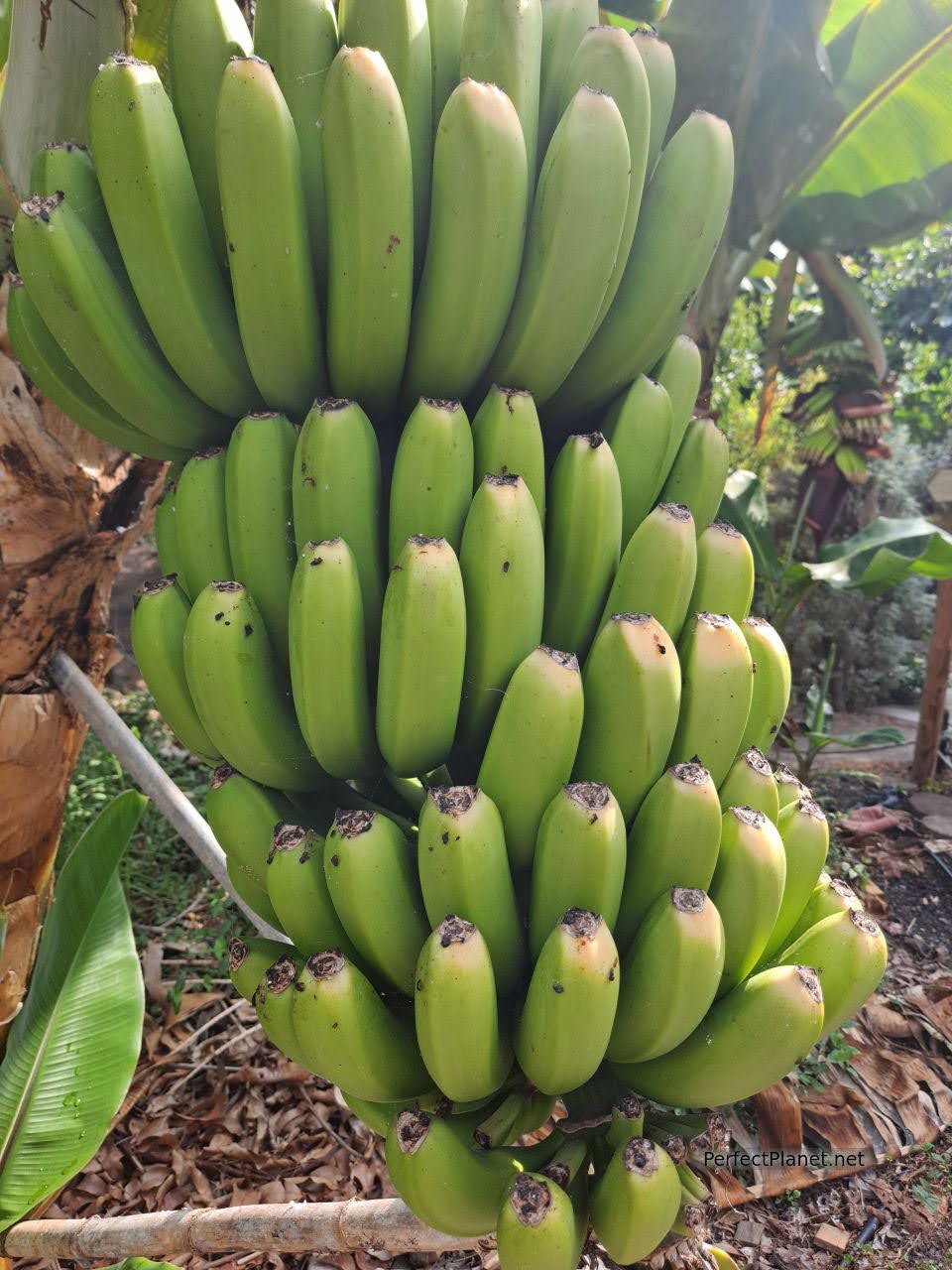
Banana
And as in the rest of the Canary Islands, we can't forget to mention its cheeses (especially goat's cheese), the mojo (spicy, thanks to the palm pepper), wrinkled potatoes, gofio (millet or toasted wheat flour that accompanies dishes and desserts) or desserts made from almonds and sugar cane such as rapadura, almendrados or bienmesabe.
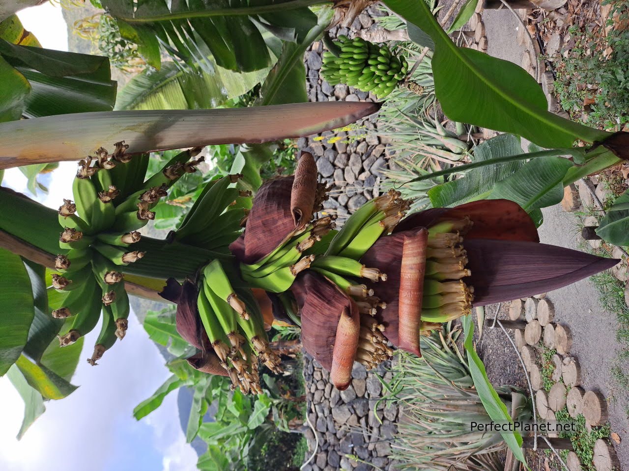
Banana flower
Travel insurance
We always recommend that you take out insurance before you start your trip. Both Mondo and Iati offer the best conditions on the market.
Since the arrival of Covid-19, it is essential to have travel insurance. In addition to medical assistance, these insurances offer many other coverages that are adapted to each traveller without having to advance money or excesses.
The price varies depending on the coverage and the duration of the trip. For example, insurance to the Canary Islands for three weeks costs around €28 per person with Iati.
We are going to distribute the island by zones to recommend you plans for the whole day, due to the eruption of the Cumbrevieja volcano it is not possible to visit the interior of the Caldera de Taburiente so we propose spectacular alternatives.
El Tablado
Day 1. Salt flat and Fuencaliente lighthouse. San Antonio and Teneguía volcano.
We suggest you dedicate a day to the southern part of the island, remember that the order does not have to be the same, we leave that up to you.
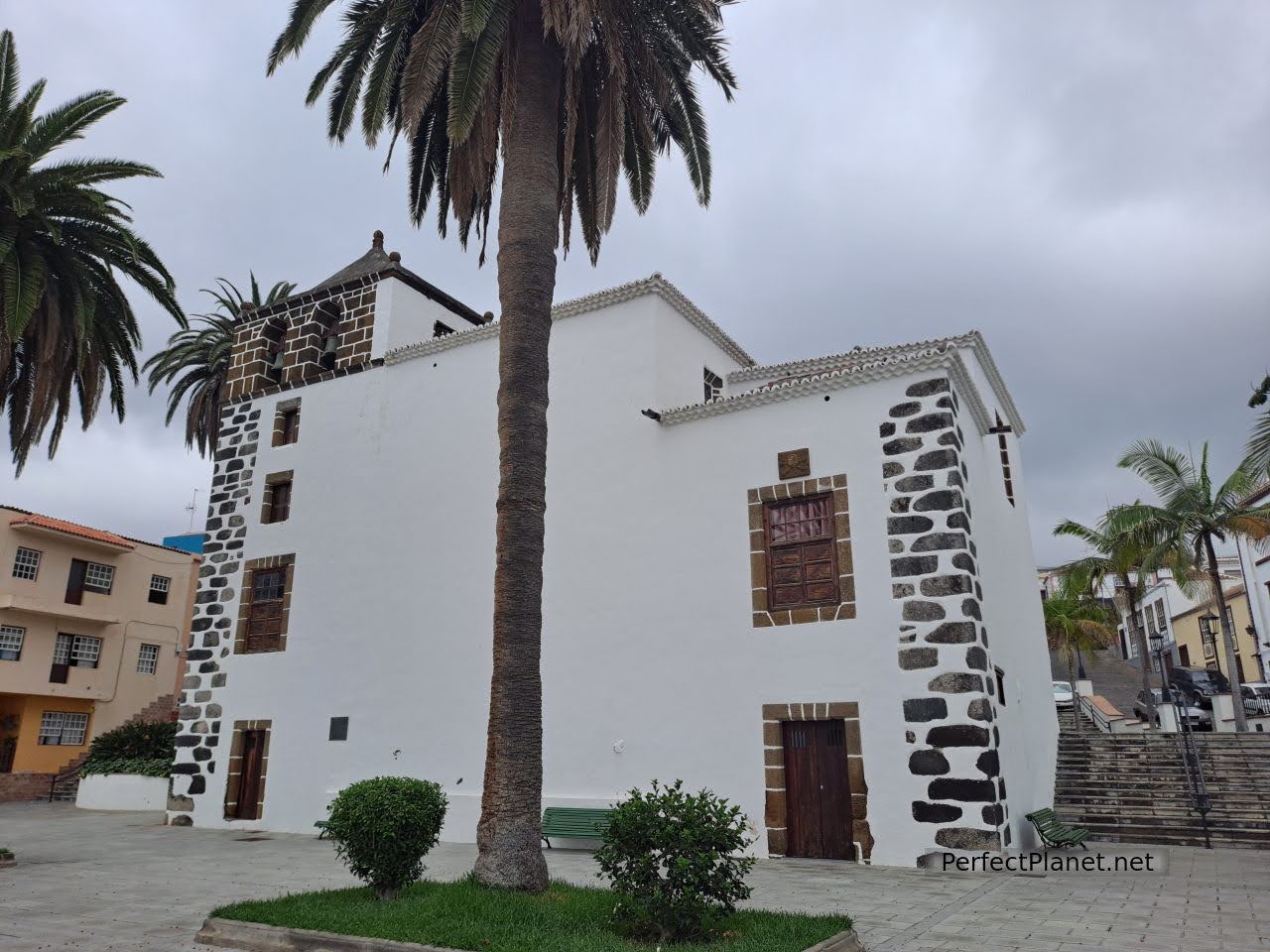
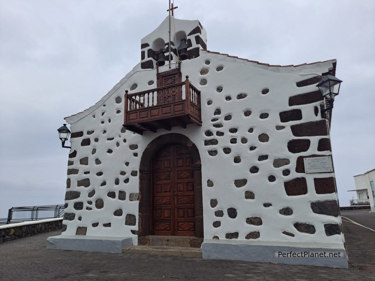
First stop Los Canarios, in the municipality of Fuencaliente de La Palma, whose name comes from the medicinal thermal waters of what is known as Fuente Santa.
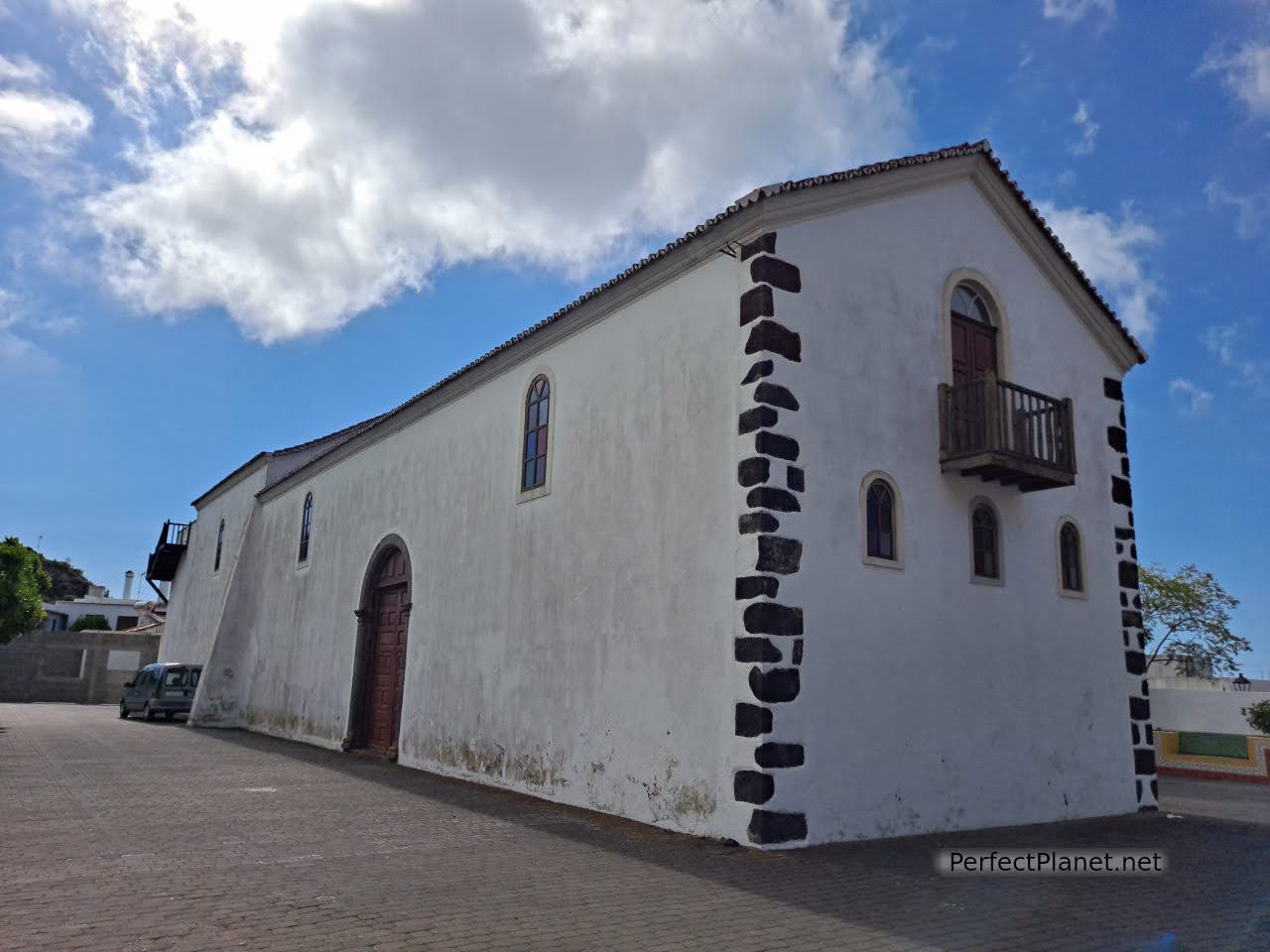
San Antonio Abad church
Highlights include the Church of San Antonio Abad, the Fountain of Wine or the Minerva Square where the traditional Carnival talcum "powder battles" are held, a custom that is widespread throughout the island, especially in Santa Cruz de La Palma, where the Carnaval de los Indianos is held, which dates back to the custom inherited from the Cubans of bleaching their skin. It must be amazing!
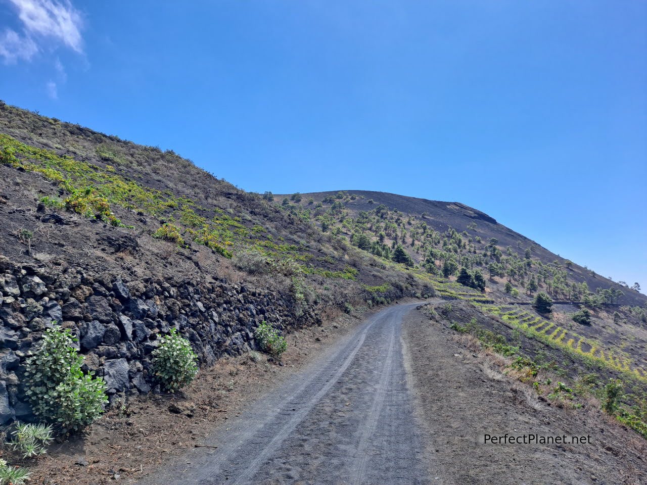
The Fountain of Wine. The municipality of Fuencaliente is closely linked to the grape harvest. Vines grow on its volcanic sandy slopes and during the harvest festival in August the fountain gushes up to three thousand litres of wine! Traditional dishes such as papas arrugadas (wrinkled potatoes) or frangollo (dessert) are shared with good wines.
Fountain of wine
In the small square where the tourist office is located there are information panels about the history of the town.
We recommend you to have a coffee or a snack or simply buy bread at the Zulay bakery.
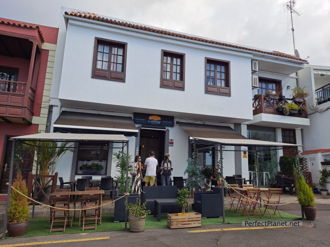
Zulay bakery
A few kilometres to the south is the San Antonio Volcano Visitor Centre, in the area known as Cumbre Vieja. Entrance fee 5€/pax (Canarian residents free of charge).
San Antonio volcano
It has explanatory and audiovisual panels where you can learn about the formation and evolution of the Canary Islands, in particular the island of La Palma and the volcanoes belonging to the municipality of Fuencaliente. You can even experience what an earthquake feels like thanks to a simulator located outside the building.
San Antonio volcano
A path leads to the top of the San Antonio volcano (last eruption in 1677). You can admire its crater and the flora that has grown inside it. From the viewpoint you can enjoy impressive views of the Teneguía volcano.
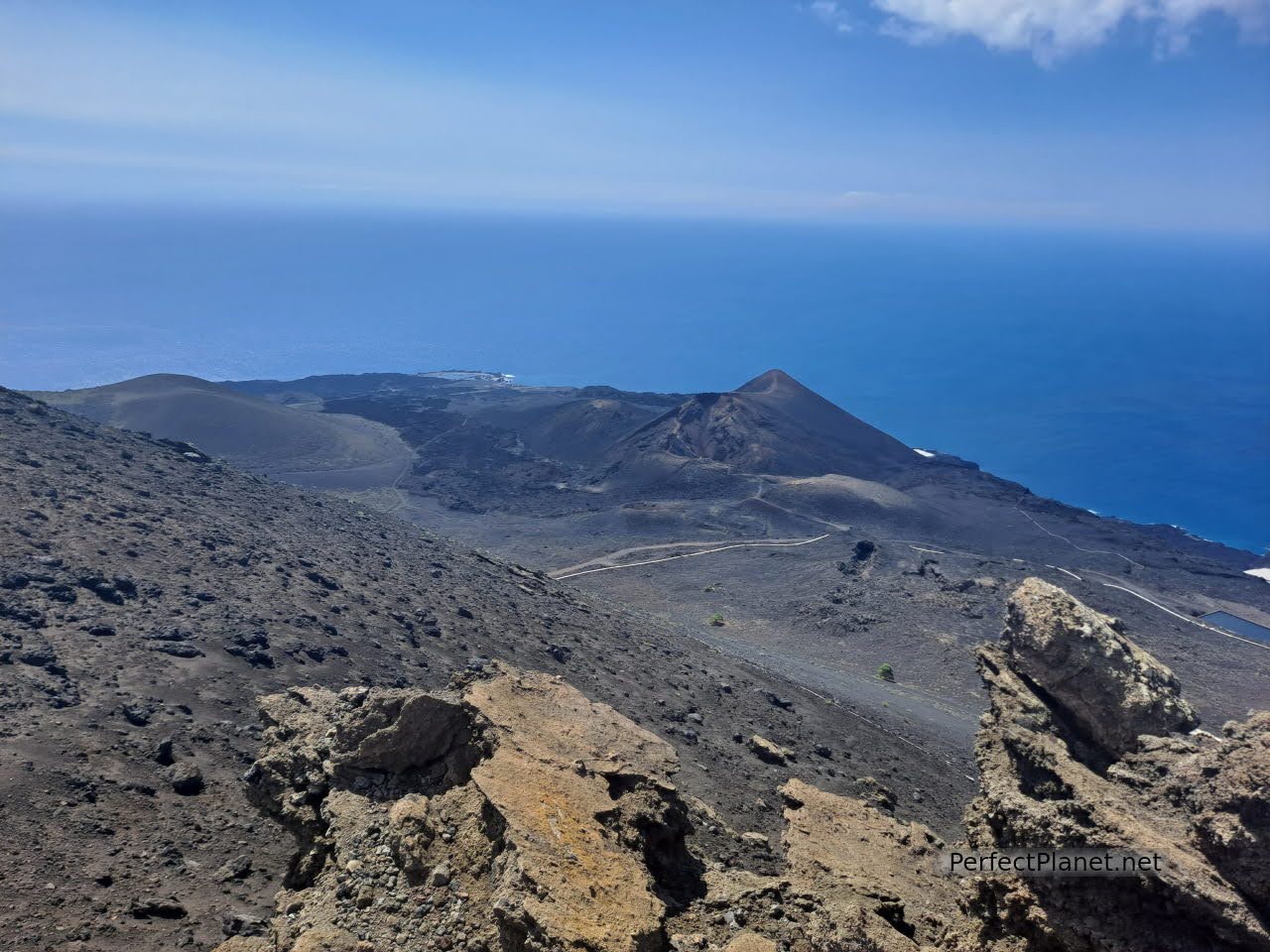
Views of Teneguía from San Antonio volcano
As in other places on La Palma there is a viewpoint for astronomical observation. A planisphere helps us to locate the constellations Ursa Major and Cassiopeia, and a trail post points towards Polaris; and a marker with trails indicates the changes in the seasons.
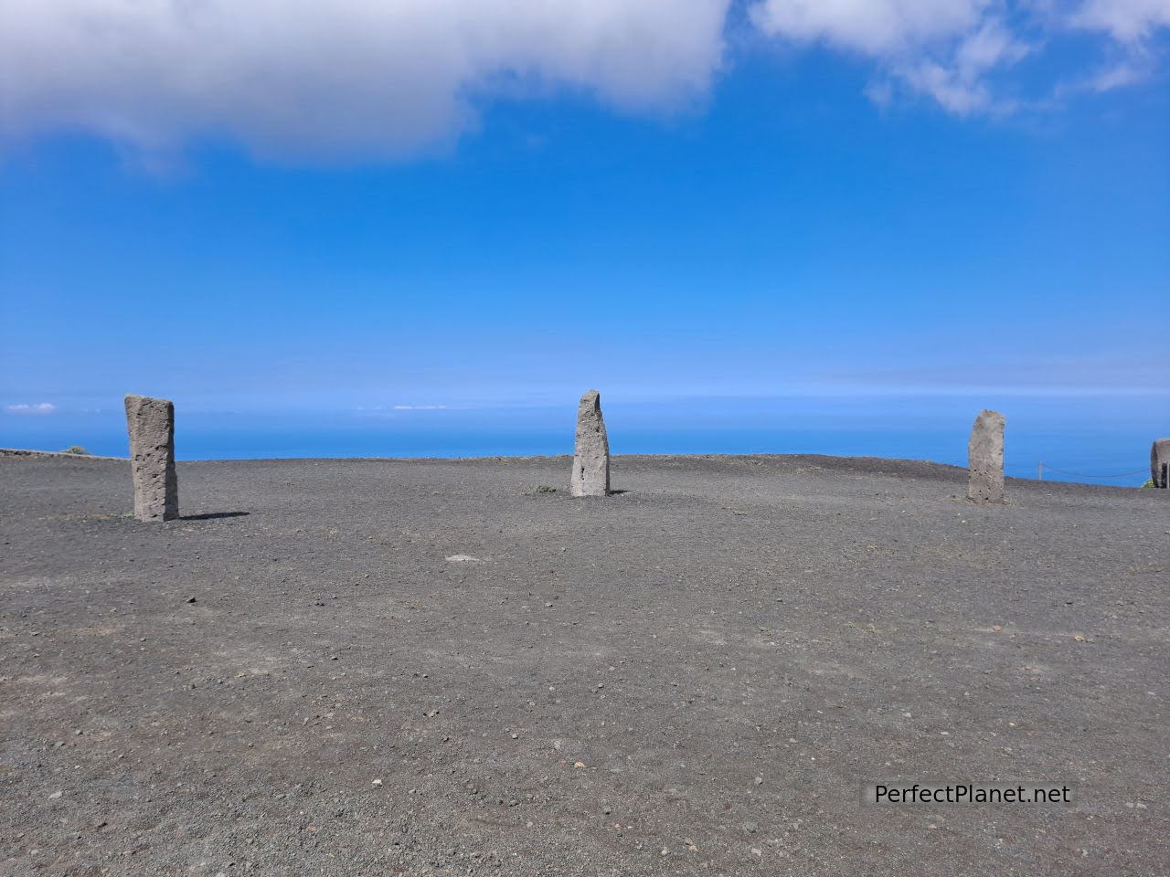
Astronomical viewpoint
Astronomical viewpoint
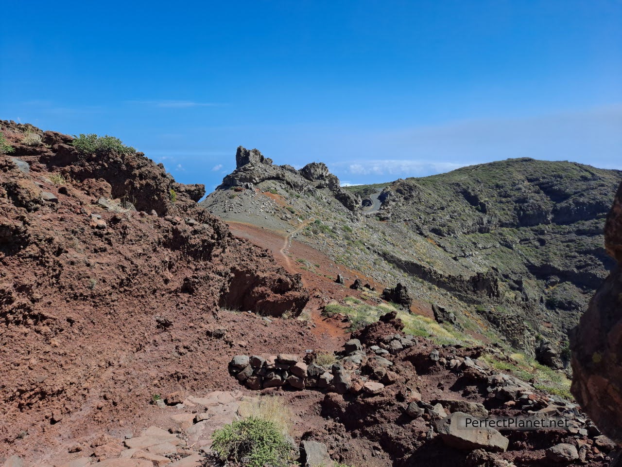
The GR131, the famous volcano route, passes by the San Antonio volcano in the direction of the lighthouse of Fuencaliente.
Road to Teneguía volcano Gr131
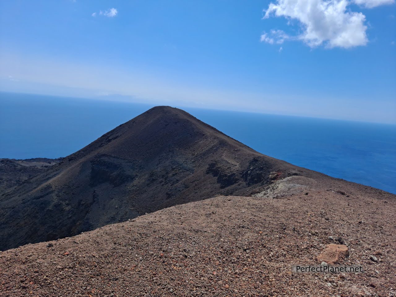
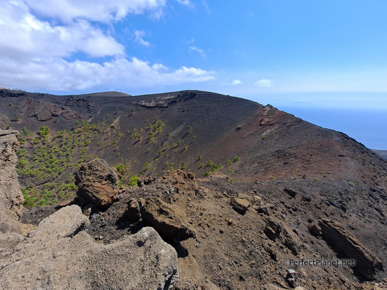
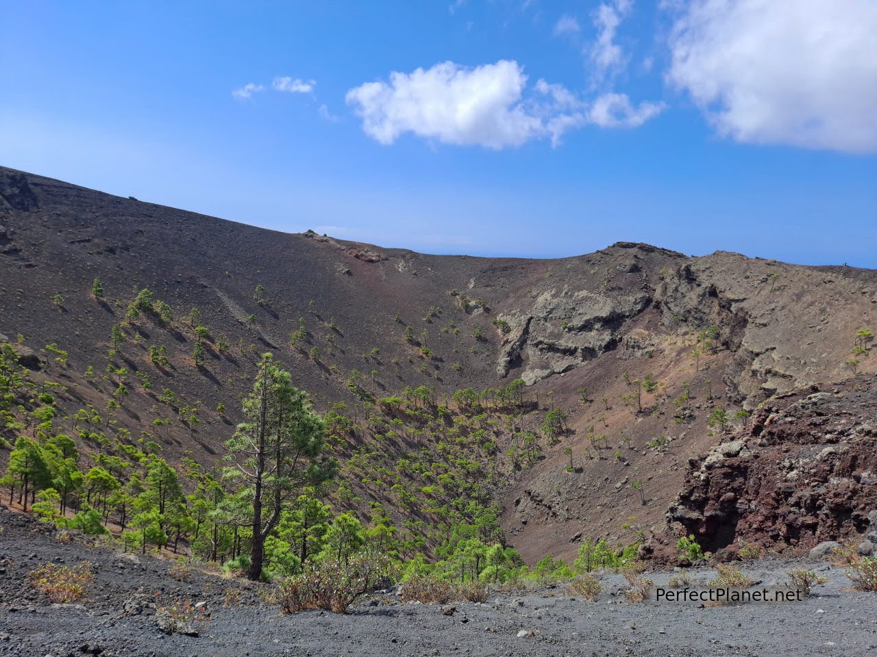
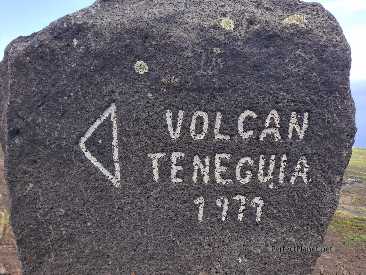
We take the marked path at the entrance to the car park and walk about three kilometres to reach the summit of one of the last volcanoes to erupt on the island, the Teneguía volcano. The path is wide and although there are some narrow passages to cross, it is easy to reach the summit. Be careful with the wind as the gusts can be strong at altitude.

Teneguía volcan
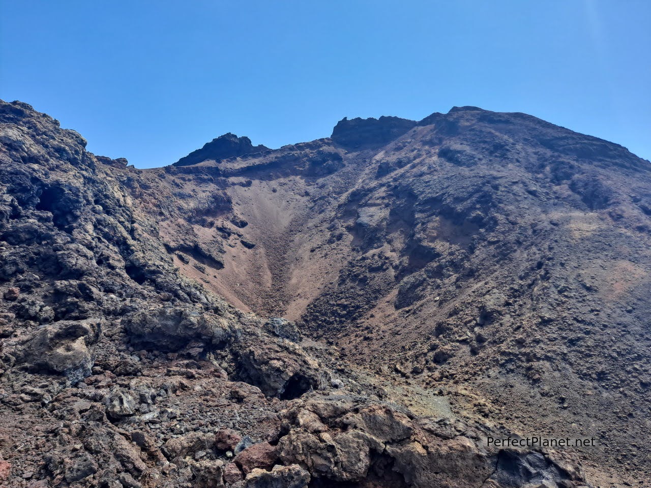
Teneguía volcan
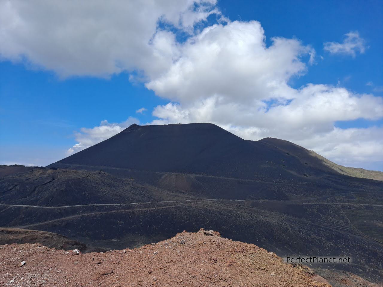
San Antonio volcano from Teneguía volcano
The GR131 continues through vineyards of the highly prized Malvasia grape until it reaches the Fuencaliente lighthouse and salt flats, where the Marine Interpretation Centre is located. The scenery is breathtaking, walking between volcanoes and vineyards to end up at the only salt flats in La Palma still in operation.
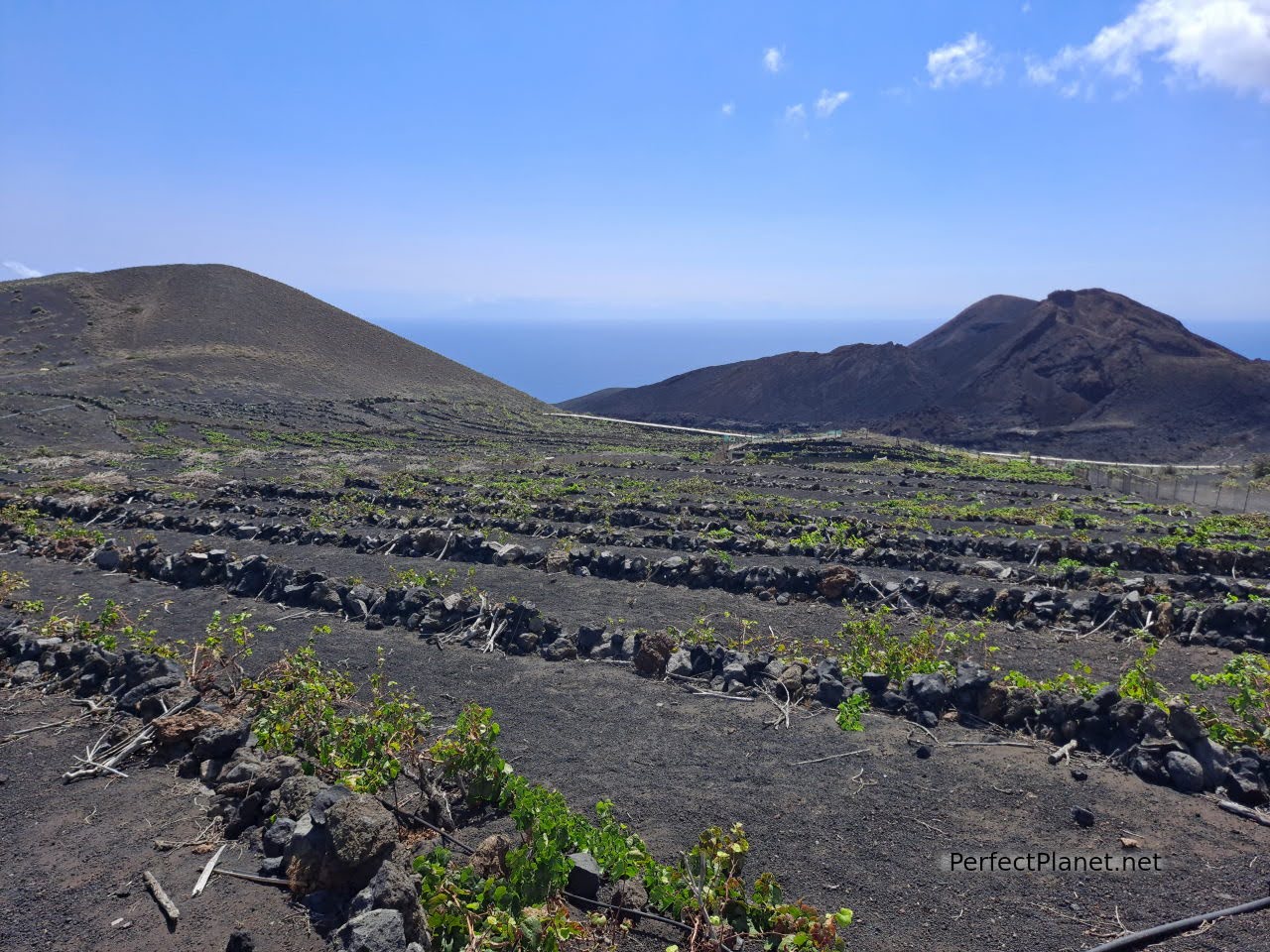
Vineyards
If you don't want to walk back, you can take a bus back to Los Canarios or to the Visitor Centre. The timetable ends around 17.30 in the afternoon, but it is better to ask beforehand in case they change.
Normally this section of the route is part of the famous Volcanoes Route that starts from the Refugio del Pilar, but due to the eruption of the Cumbre Vieja volcano all the GR131 trails belonging to Villa de Mazo and Fuencaliente are closed, so we have to make do with this short route. Even so, it is a marvellous walk.
Teneguía volcano
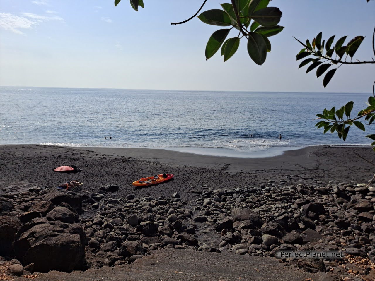
Nearby beaches. Echentive is an obligatory stop. This volcanic sand beach is known as Playa Nueva (New Beach) as it was formed by lava from the last eruption of the Teneguía volcano in 1971. Here you will find the Fuente Santa, which was buried by lava for years due to the action of another volcano in 1677, until it was rediscovered centuries later. It is currently closed.
Fuente Santa
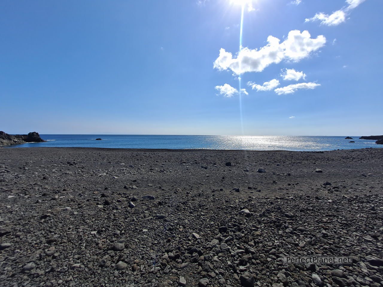
Echentive beach
Echentive natural pool
Next to it there are two natural pools where you can enjoy a quiet swim. Another option is to bathe directly on the beach, we recommend booties for both options.
Echentive natural pool
Echentive natural pool
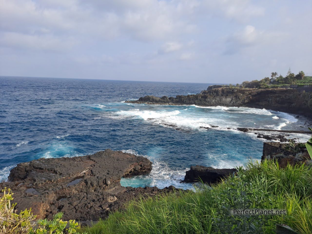
El Aljibe. Close to the beach of Echentive (approx. 2 kilometres) is this small cliff with spectacular views of the deep blue sea.
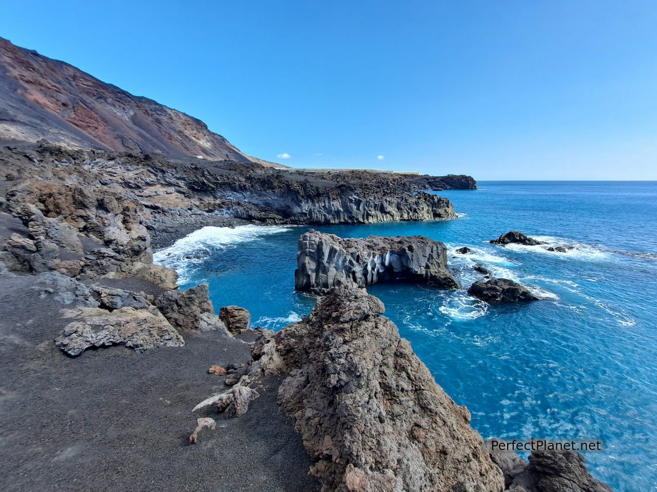
El Aljibe
Fuencaliente lighthouse. This is the end of the GR131 route on the volcanoes route. Situated on the southern tip of the island, it came into service in 1903. Next to the lighthouse is the Callaos beach, a privileged setting for an obligatory swim.
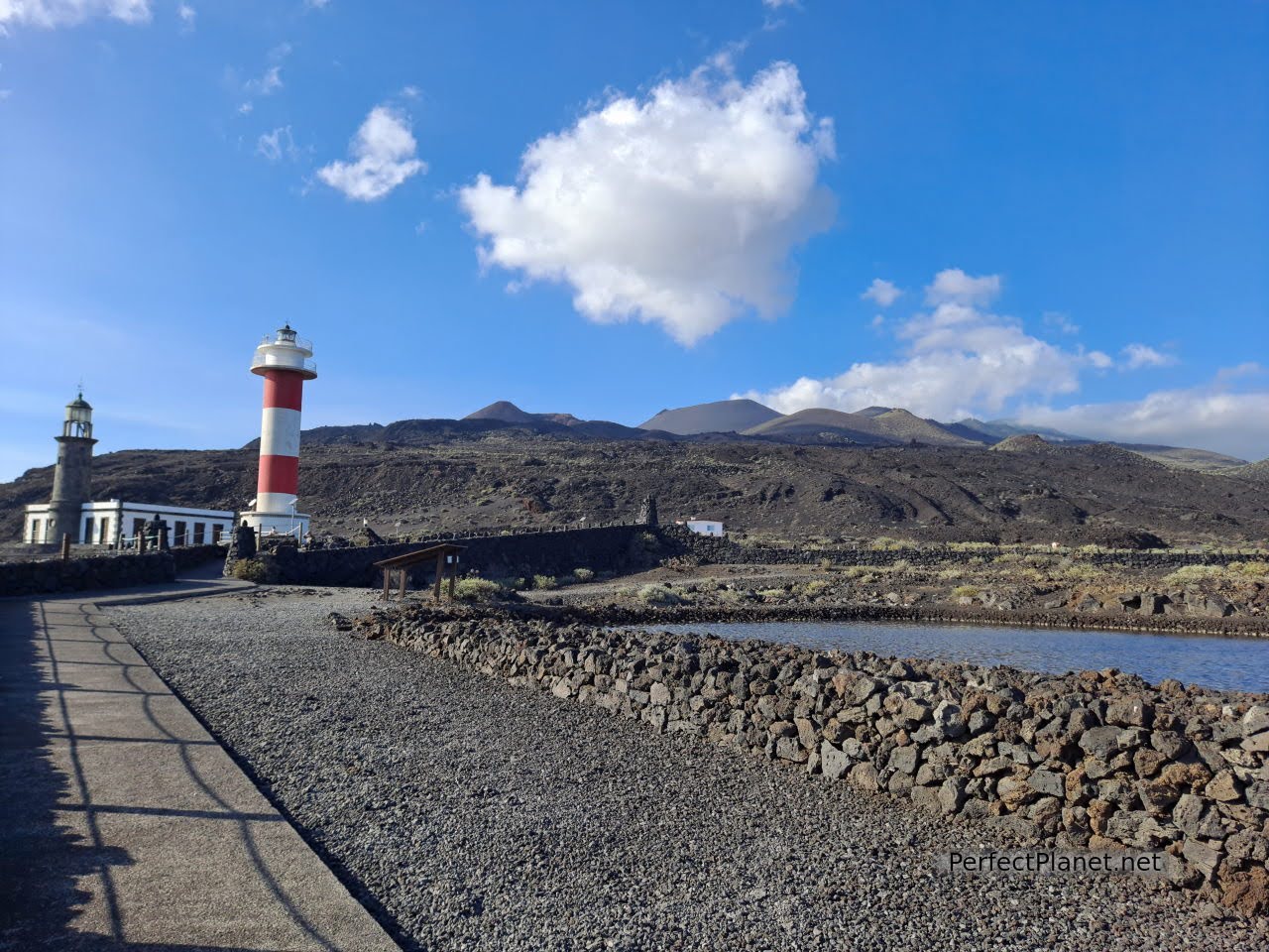
Fuencaliente lighthouse
Callaos beach
Callaos beach
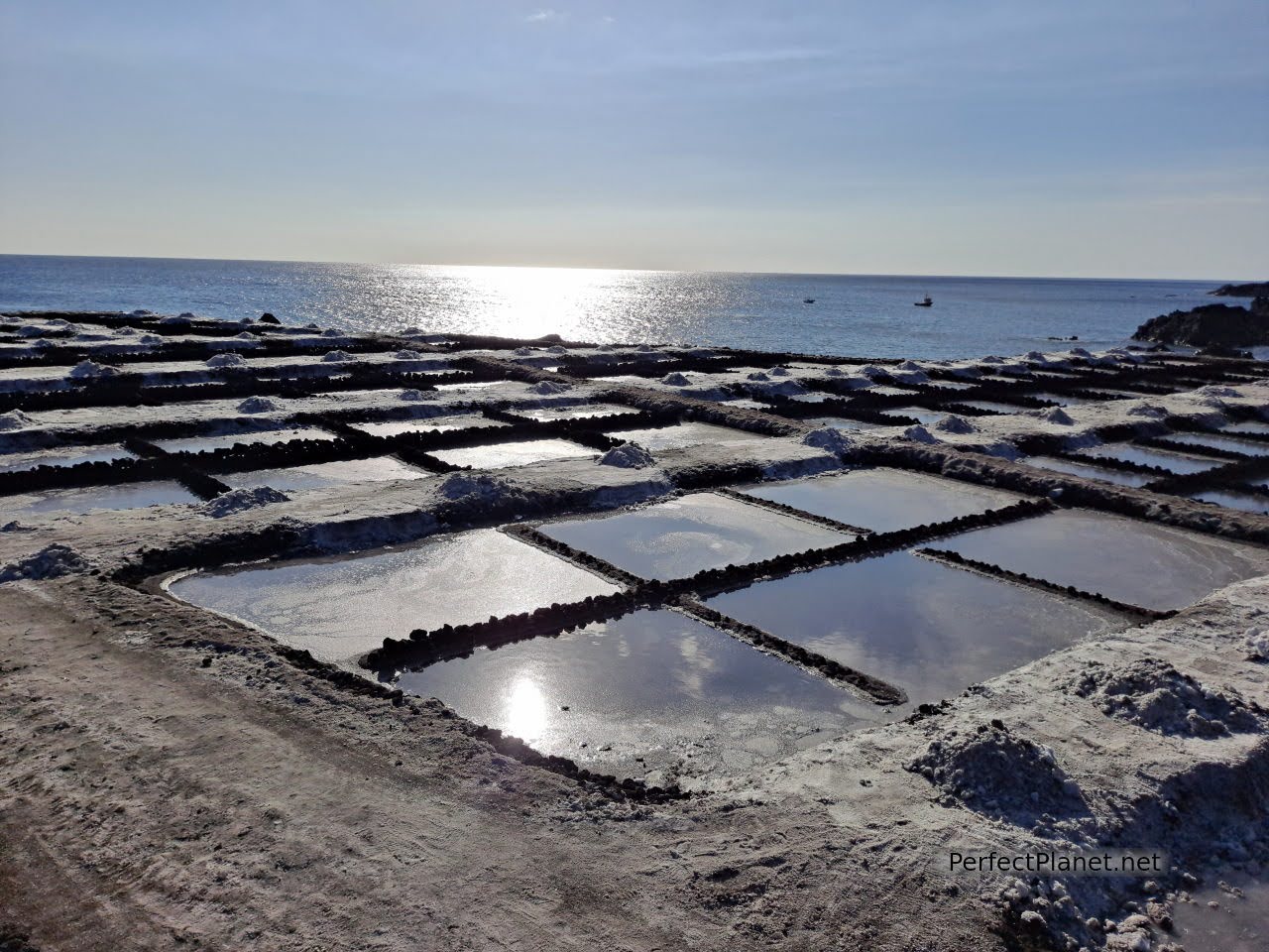
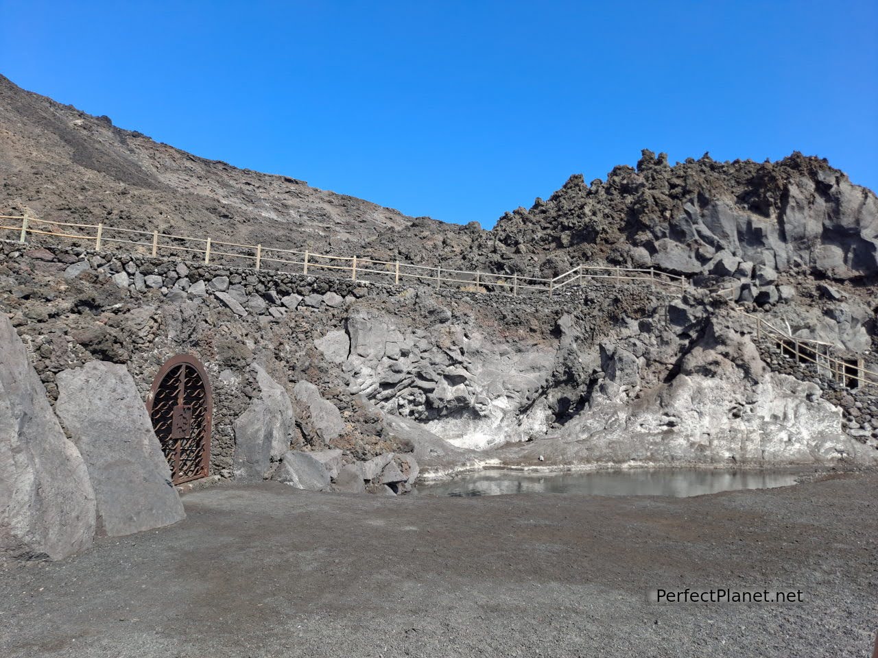
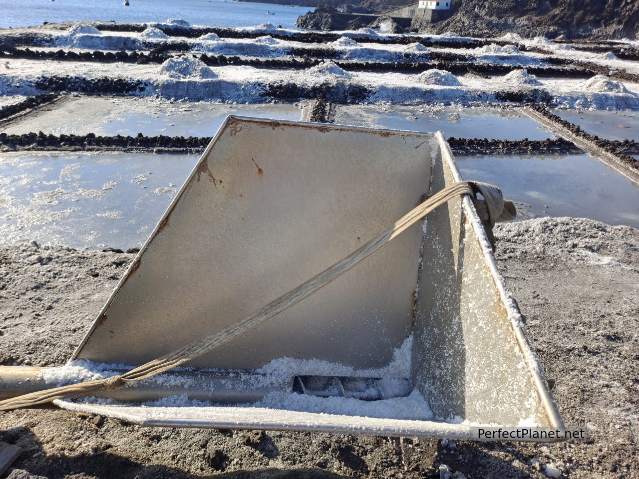
A few metres from the lighthouse are the famous salt flats of Fuencaliente. A complex dedicated to the extraction of salt that is still in operation. You can enjoy a walk among the different ponds with information panels.
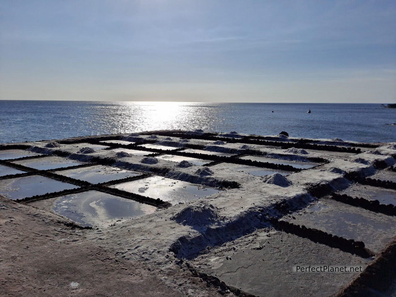
Salt flats of Fuencaliente
Unfortunately the salt flats were stained with ash and we could not enjoy them in all their splendour. The wind carries ash from the Cumbre Vieja volcano and deposits it on the salt flats. In the fifteen days since the eruption, thirty percent of the harvest has already been lost. What a pity. Even so, the place is worth a visit.
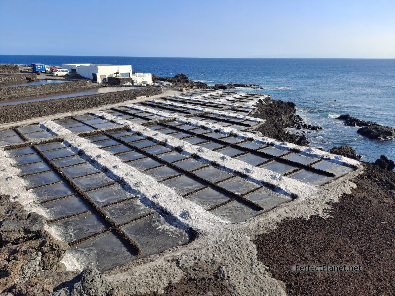
Fuencaliente salt flats

Fuencaliente salt flats
In the salt pans themselves there is a bar-restaurant where you can taste local wines at a good price, El Jardín de la Sal. Teneguía wine and a beer 4.50€.
This is also a good place to watch the stars and the sunset.
Fuencaliente salt flats
Day 2. Roque de los Muchachos, Dragos viewpoint, Veta beach, Porís de la Candelaria, Time viewpoint.
Roque de los Muchachos
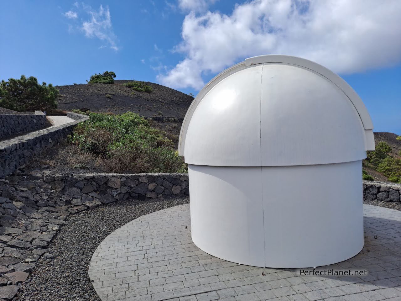
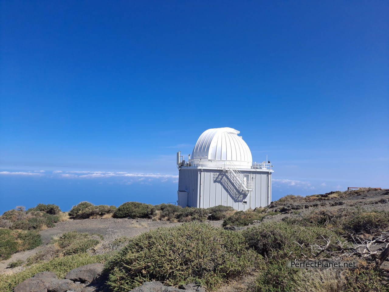
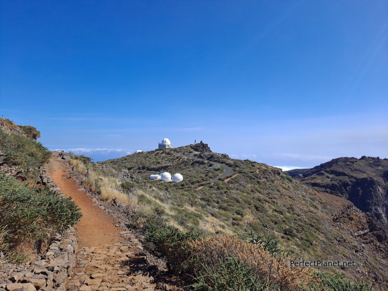
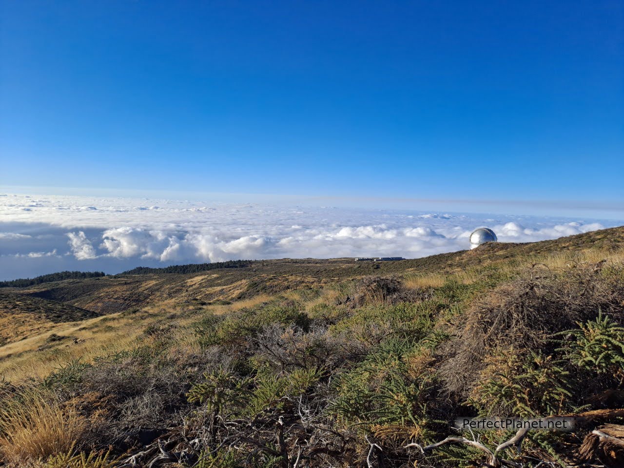
Our first stop is the Roque de los Muchachos and the Astrophysical Observatory. To get there we take the mountain road LP4, which is about 36 kilometres but it is slow.
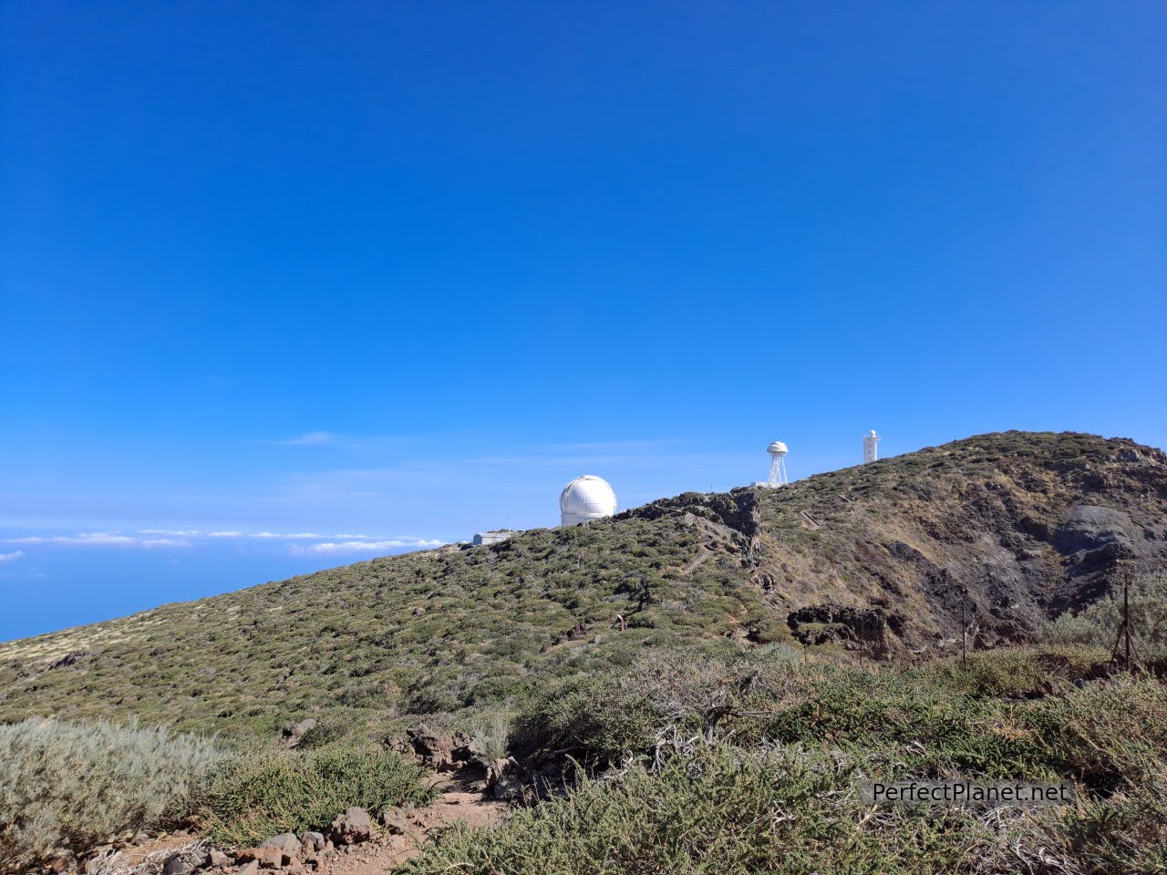
Astrophysical Observatory
Astrophysical Observatory
At the time of our visit, due to the eruption of the Cumbre Vieja volcano, the observatory was closed (although the Covid 19 protocol does not allow night visits, more information here).
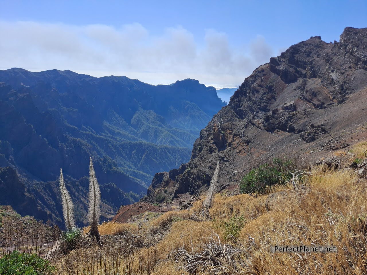
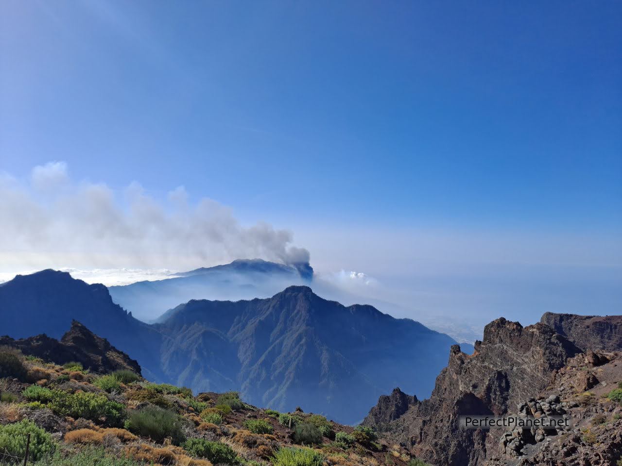
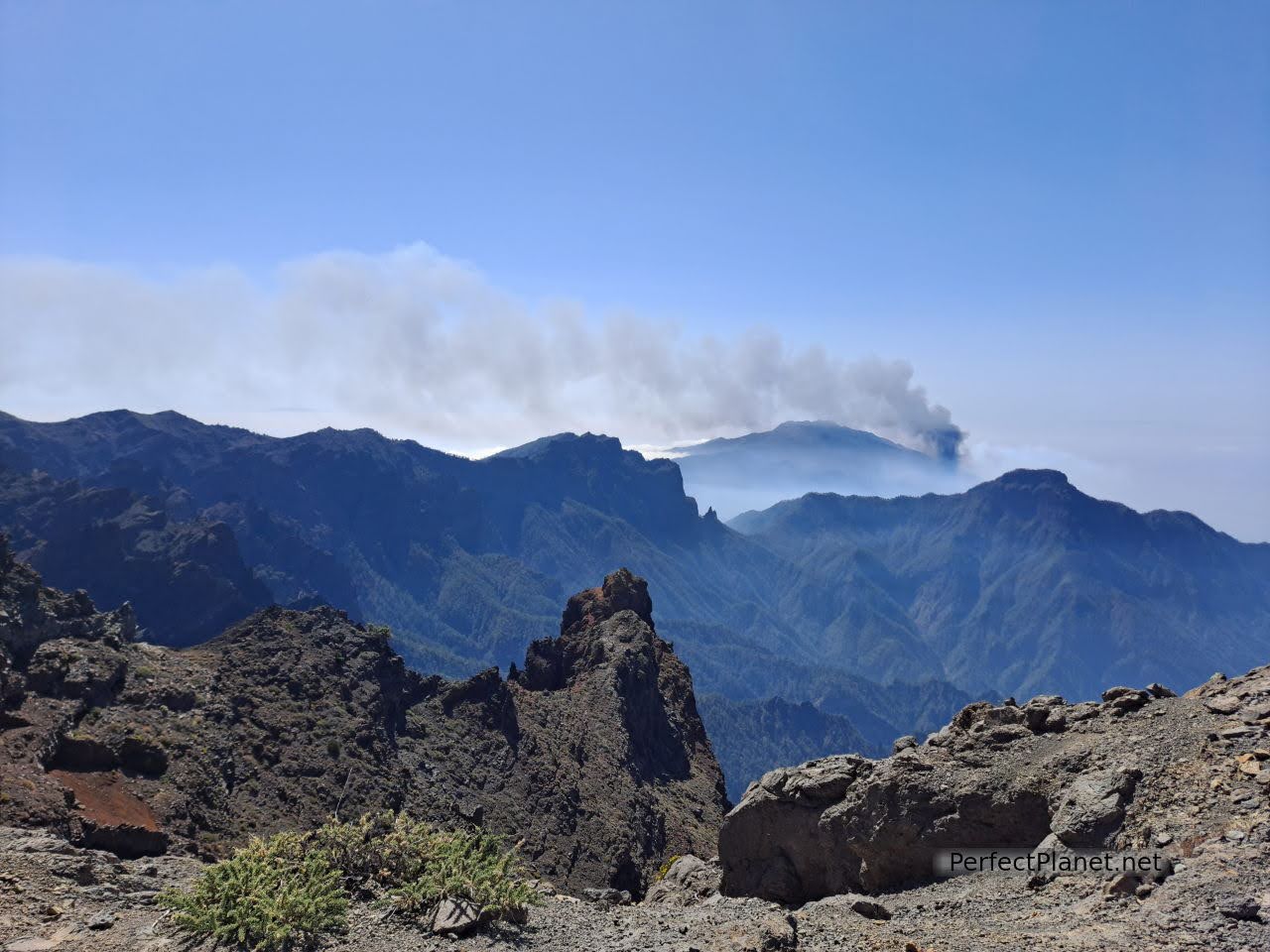
From the Roque de los Muchachos viewpoint you have spectacular views of the Caldera de Taburiente National Park and therefore of the active volcano. The car park is small, so it is advisable to get up early, and in high season you even have to book.
Views from the Roque de los Muchachos viewpoint
Roque de los Muchachos viewpoint
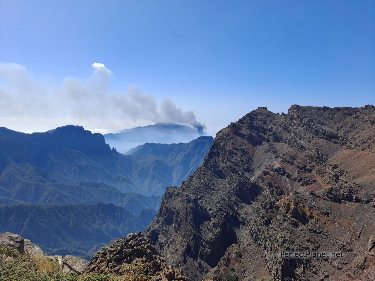
Views of the Cumbre Vieja volcano
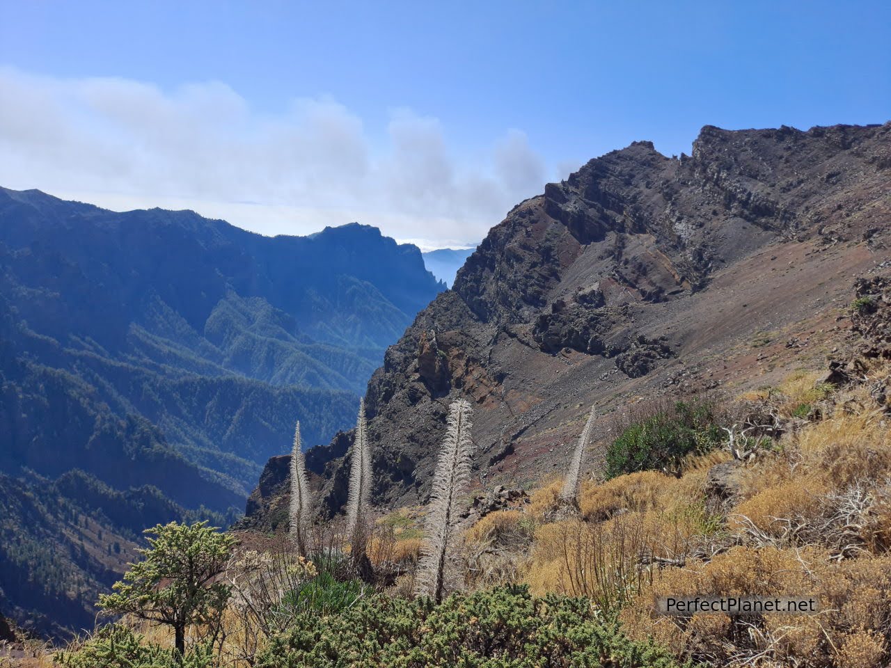
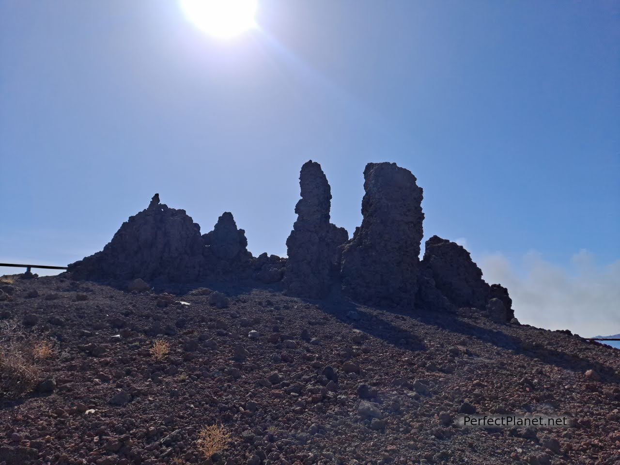
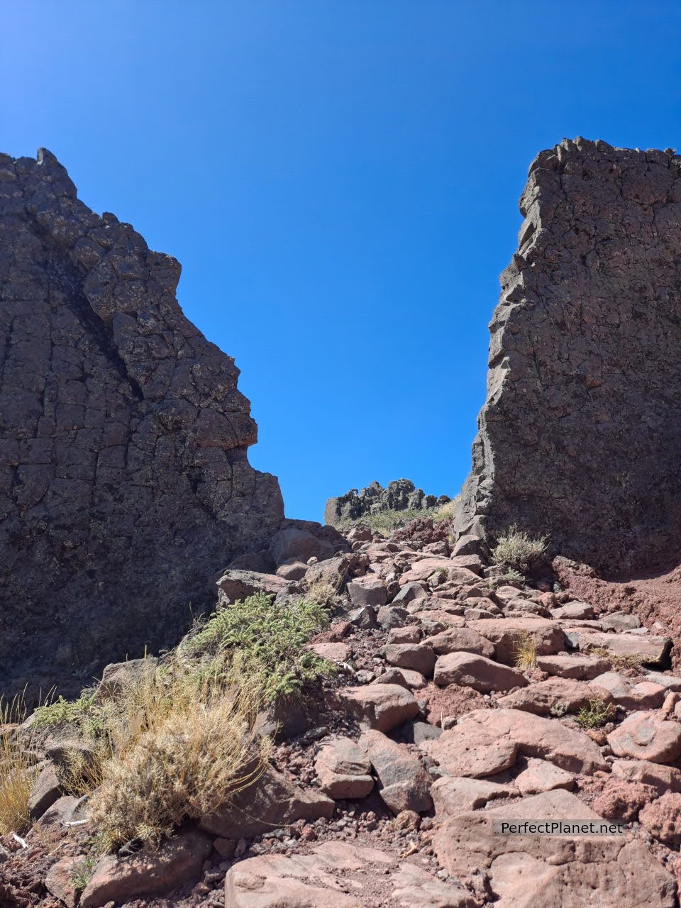
The viewpoint is the highest point on the island of La Palma and is crossed by the GR 131. We decided to walk along the section that goes from the Roque viewpoint to the peak of La Cruz (known as the Crestería route), passing by the Fuente Nueva peak, the Pared de Roberto and the Los Andenes viewpoint (another magnificent place for observing the active volcano). The route is easy and in good condition. About ten kilometres.
Crestería route
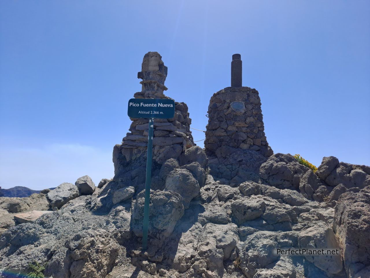
Fuente Nueva peak
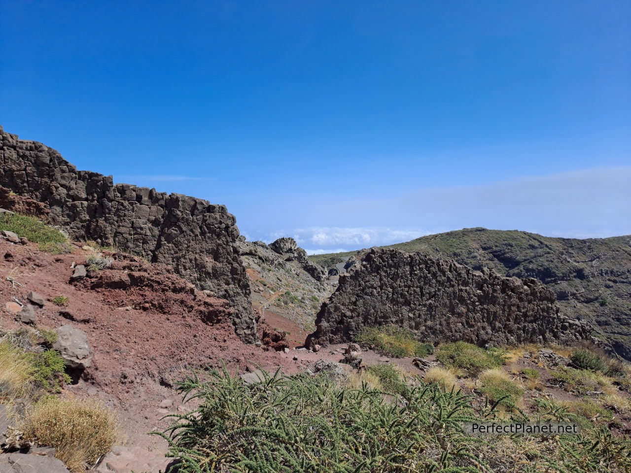
Crestería route
Roberto wall
Crestería route
You can also follow other very interesting routes that start from the viewpoint, or follow the GR131 towards Tazacorte or the PRLP11 trail towards Puntagorda or the PRLP12 towards Tijarafe, more info on the website of senderosdelapalma.
Crestería route
Views of the Caldera de Taburiente from the Los Andenes viewpoint
Apart from enjoying the magnificent views, you can see the different telescopes of the Observatory, the most striking of which are made up of mirrors, the Magic Telescopes.
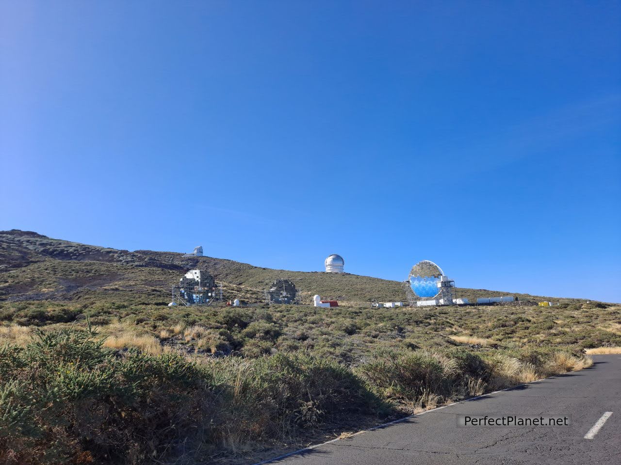
Magic Telescopes
When we finish the route some very friendly crows join us to see if they can catch something to eat.
From the viewpoint of Roque de los Muchachos we continue along the LP4 towards Puntagorda to the viewpoint of Los Dragos.
Dragos viewpoint
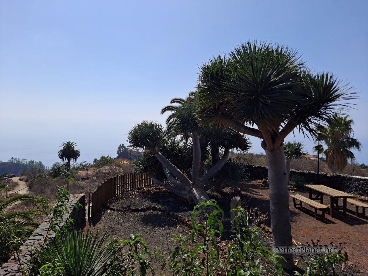
Dragos are a typical plant of the Macaronesia, particularly of the Canary Islands (region to which the Canary Islands, Azores, Cape Verde and Madeira belong).
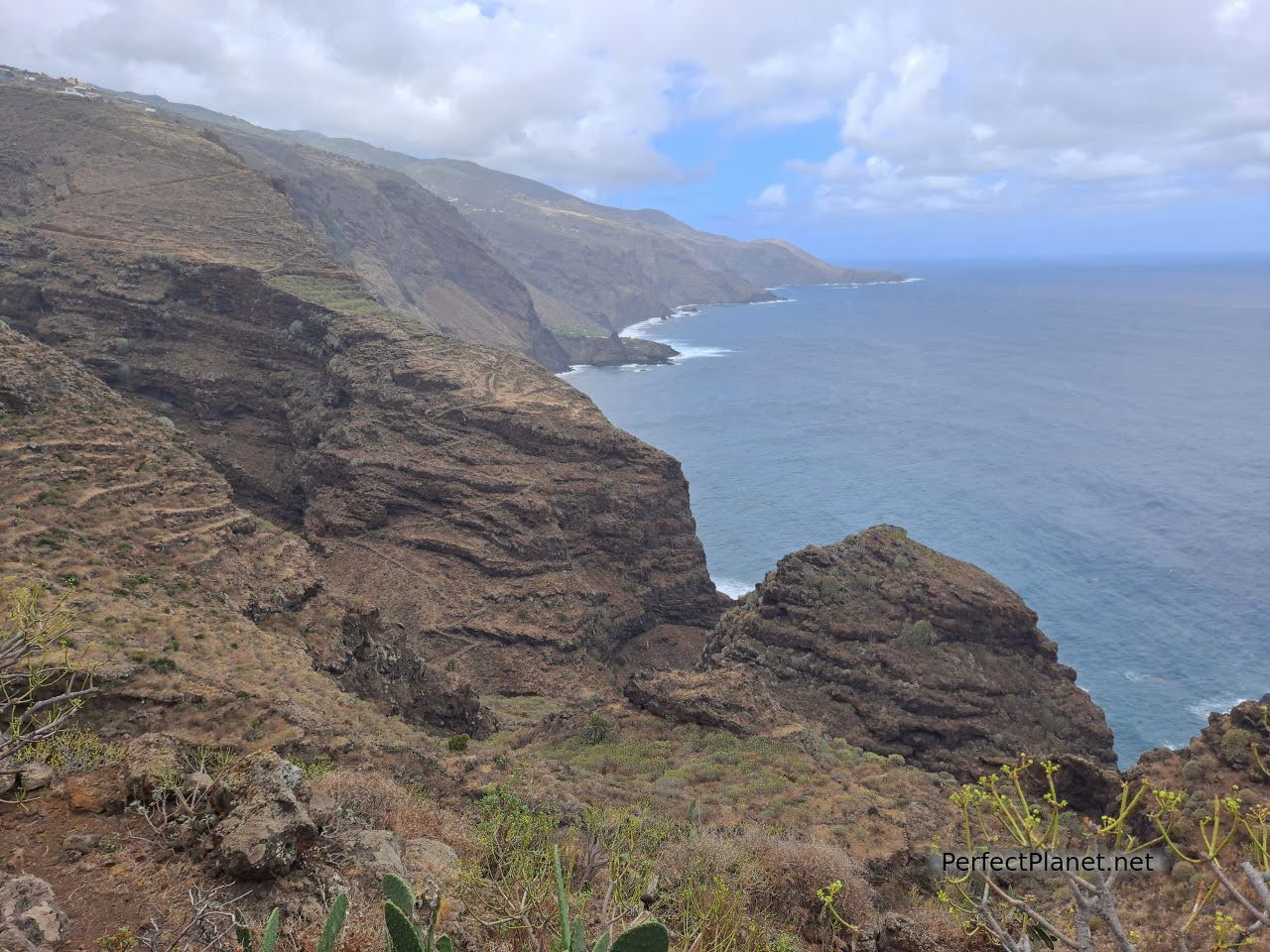
The viewpoint belongs to the district of El Roque and offers spectacular views of the Roque ravine.
Roque ravine
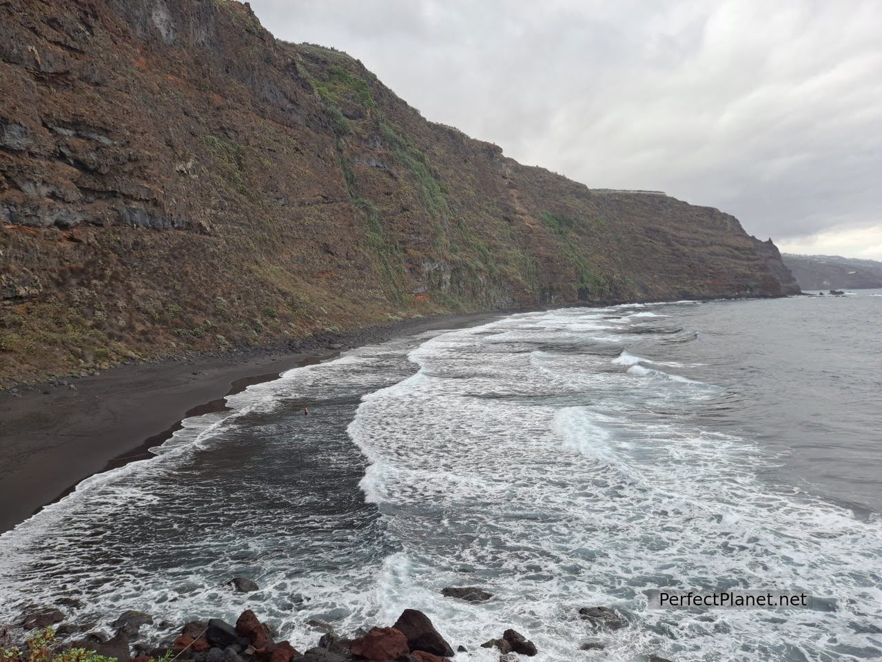
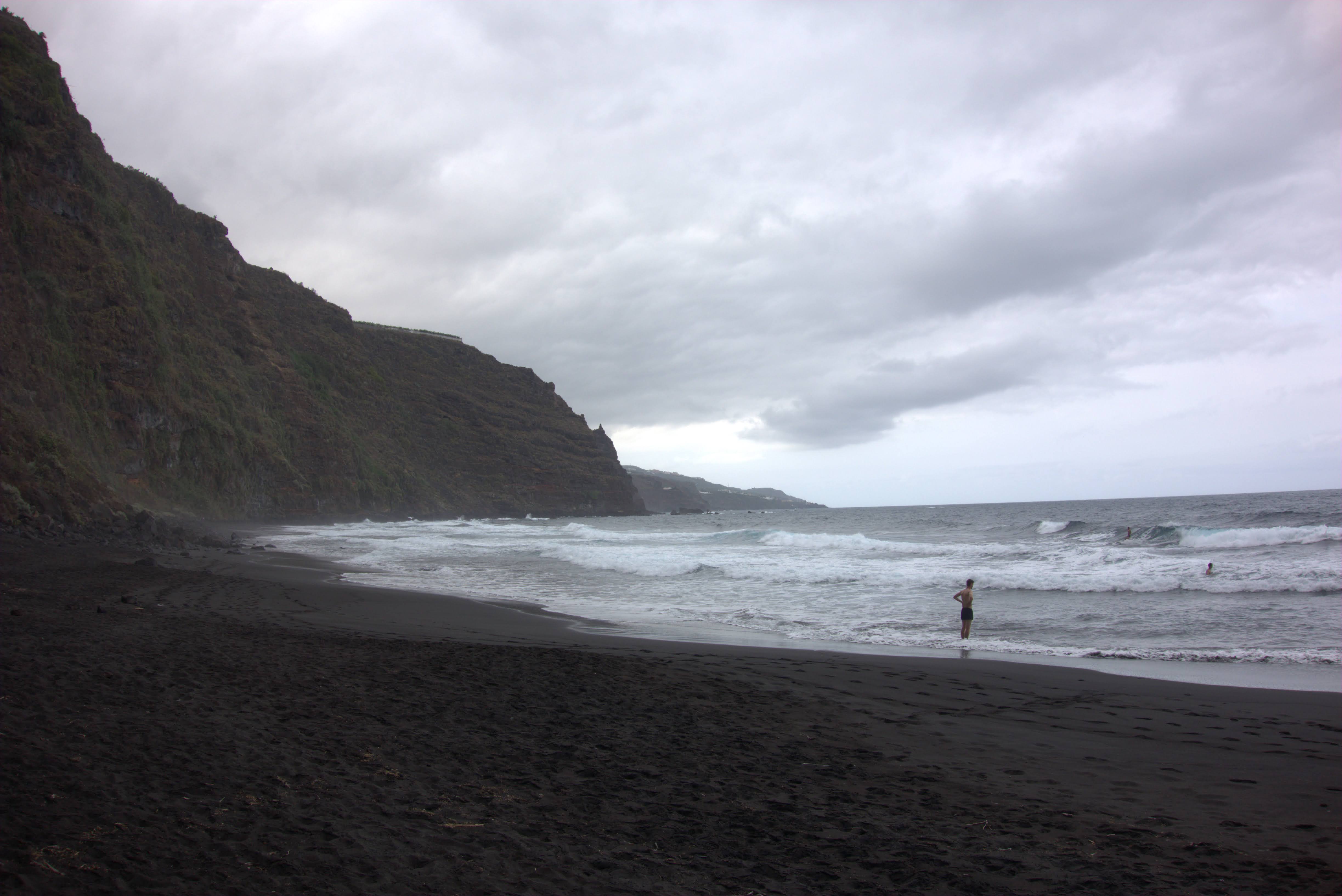
A few kilometres from Tijarafe in the district of Aguatavar is the turn-off to La Veta beach. The access is complicated, the road is narrow and winding and in some sections it seems to end. It is about four kilometres long, but fortunately the car park is quite large.

La Veta beach
La Veta beach
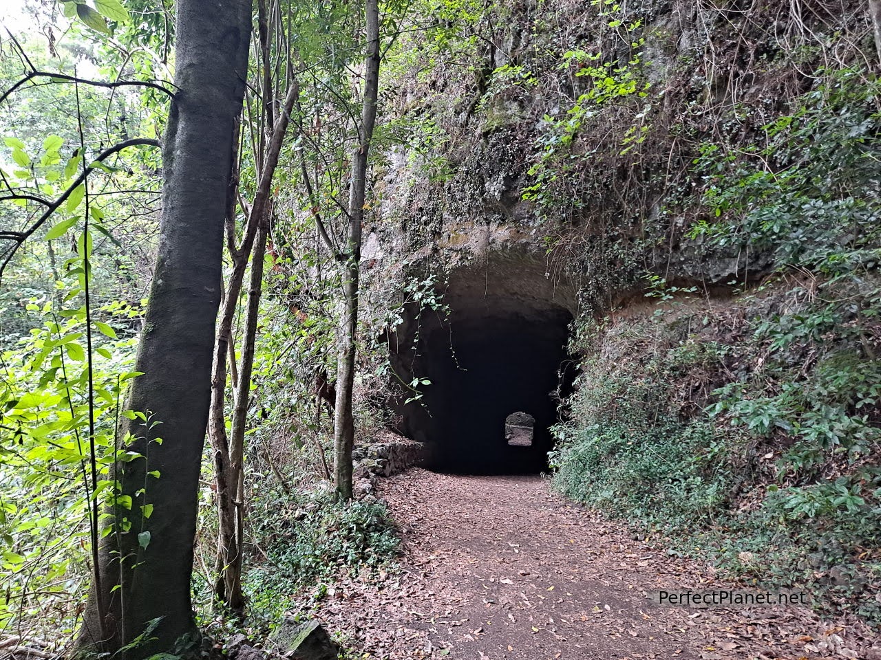
From here begins a spectacular path, through a tunnel (with light), which leads us after fifteen or twenty minutes of steep (but accessible) descent (about two hundred metres of difference in height) to the marvellous beach of La Veta.
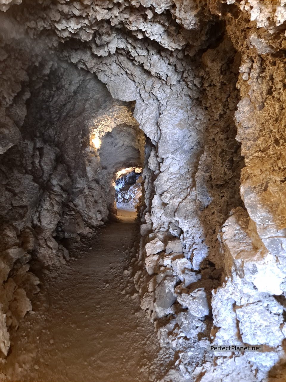
Tunnel
Surrounded by a small holiday village, this beach of fine black sand disappears in the autumn and winter months. Its waters are quite warm and calm. Swimming is a must. The village has a restaurant although we recommend you to bring down water as you will miss it on the way up in the sun.
La Veta beach
Access
We continue to Tijarafe and enter the beautiful church of Nuestra Señora de la Candelaria, whose interior is worth a visit, a baroque altarpiece from the 17th century.
Tijarafe church
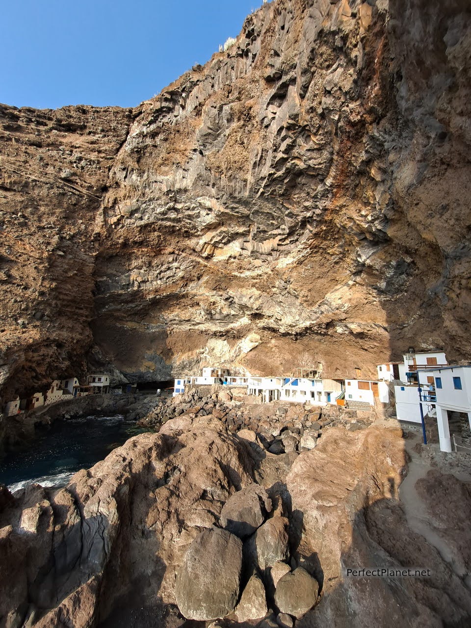
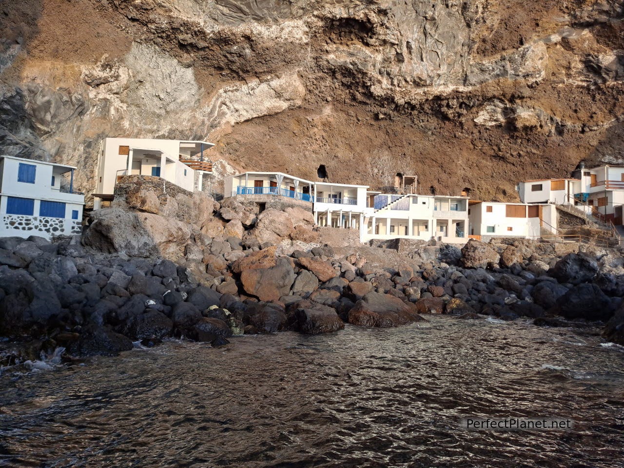
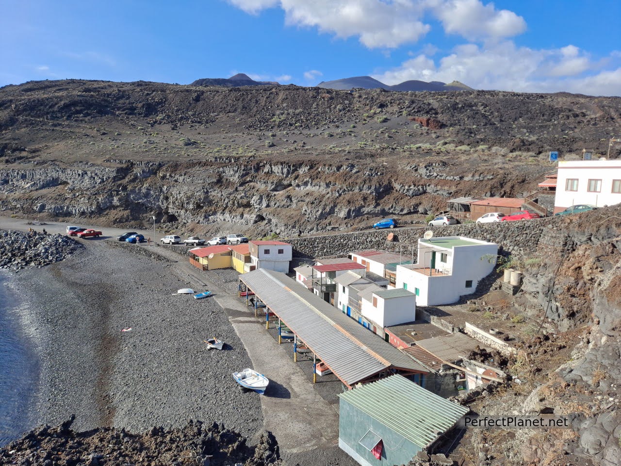
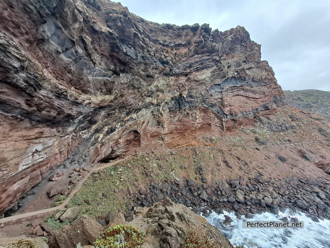
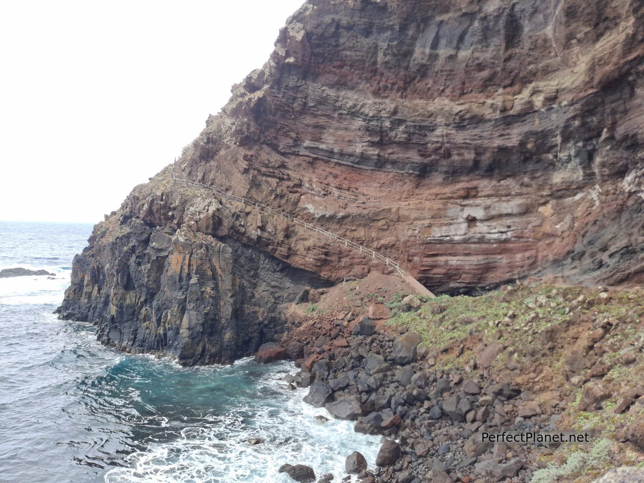
Poris de Candelaria
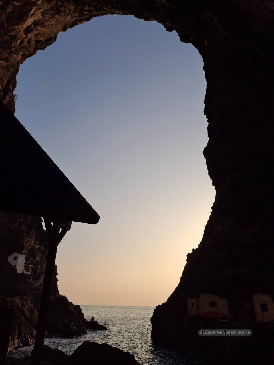
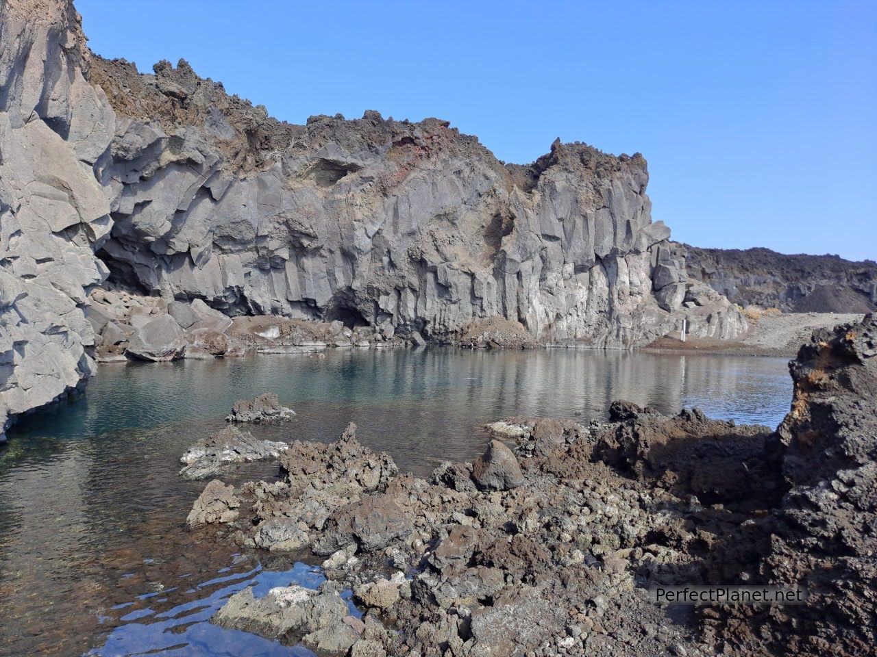
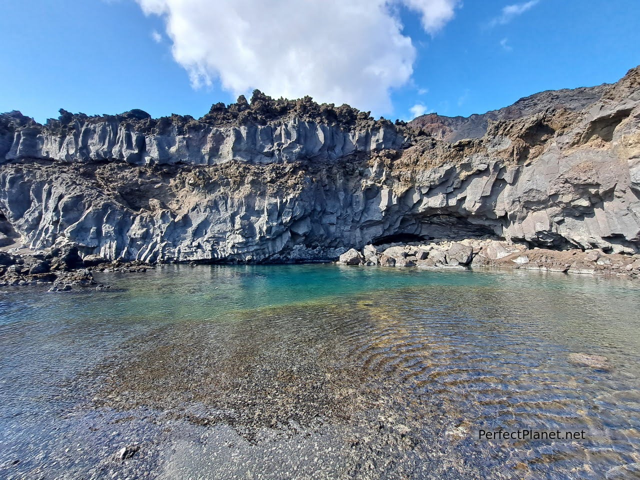
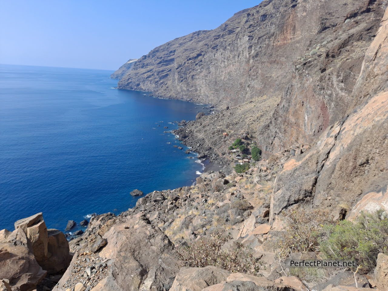
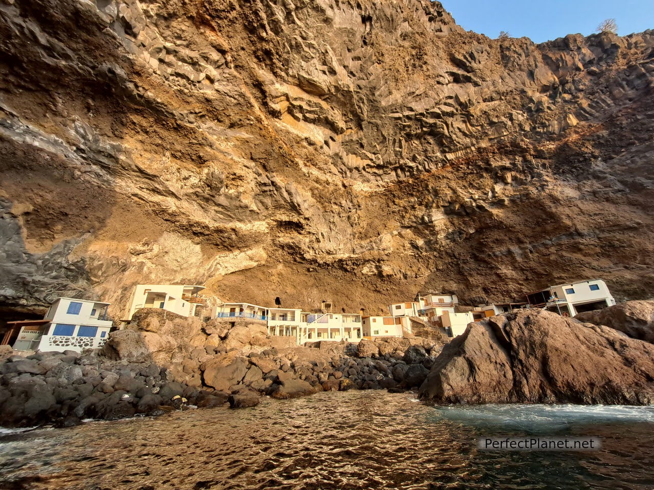
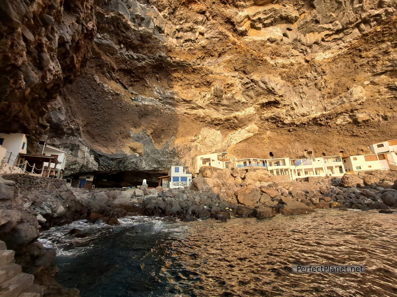
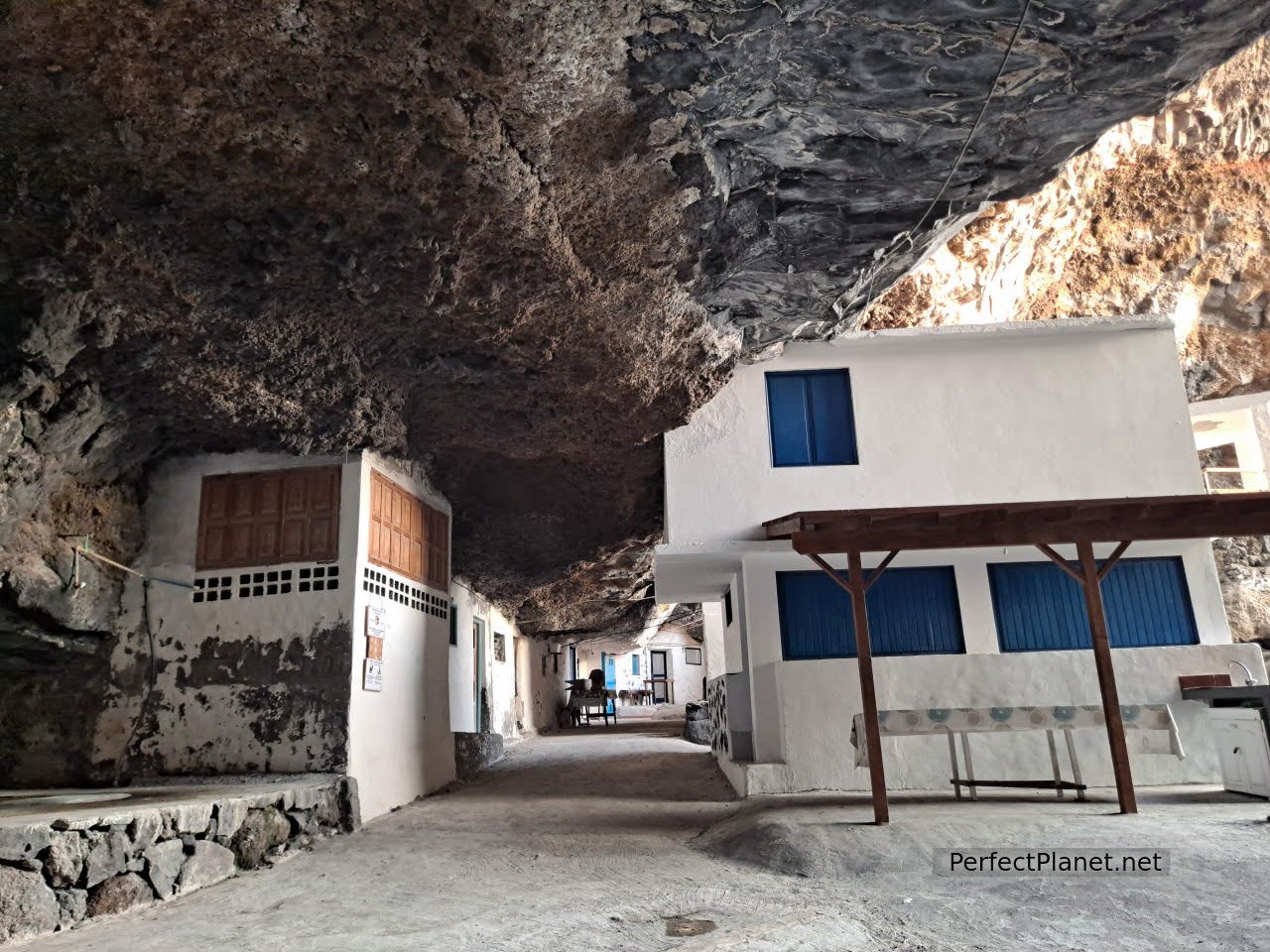
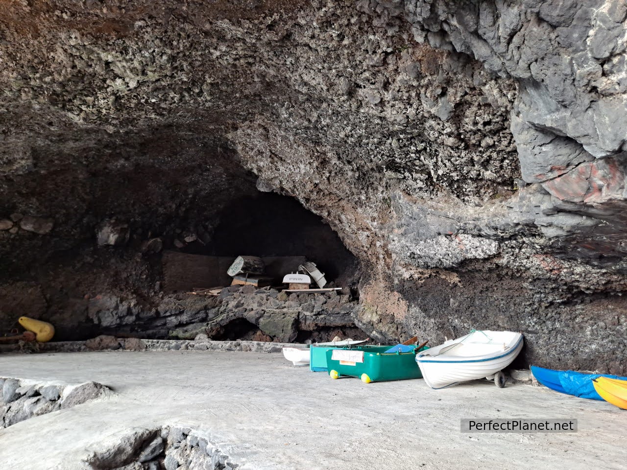
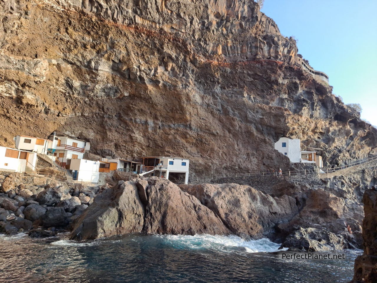
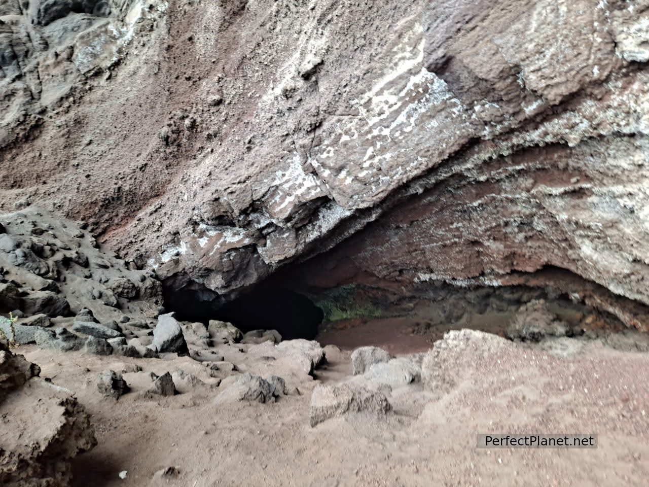
From Tijarafe on the LP1 you can reach one of the most amazing places on the island, the Poris de Candelaria. A small fishing village carved out of the rock in a cave. Here the access is also complicated. There are two car parks but they are small so don't go at rush hour.
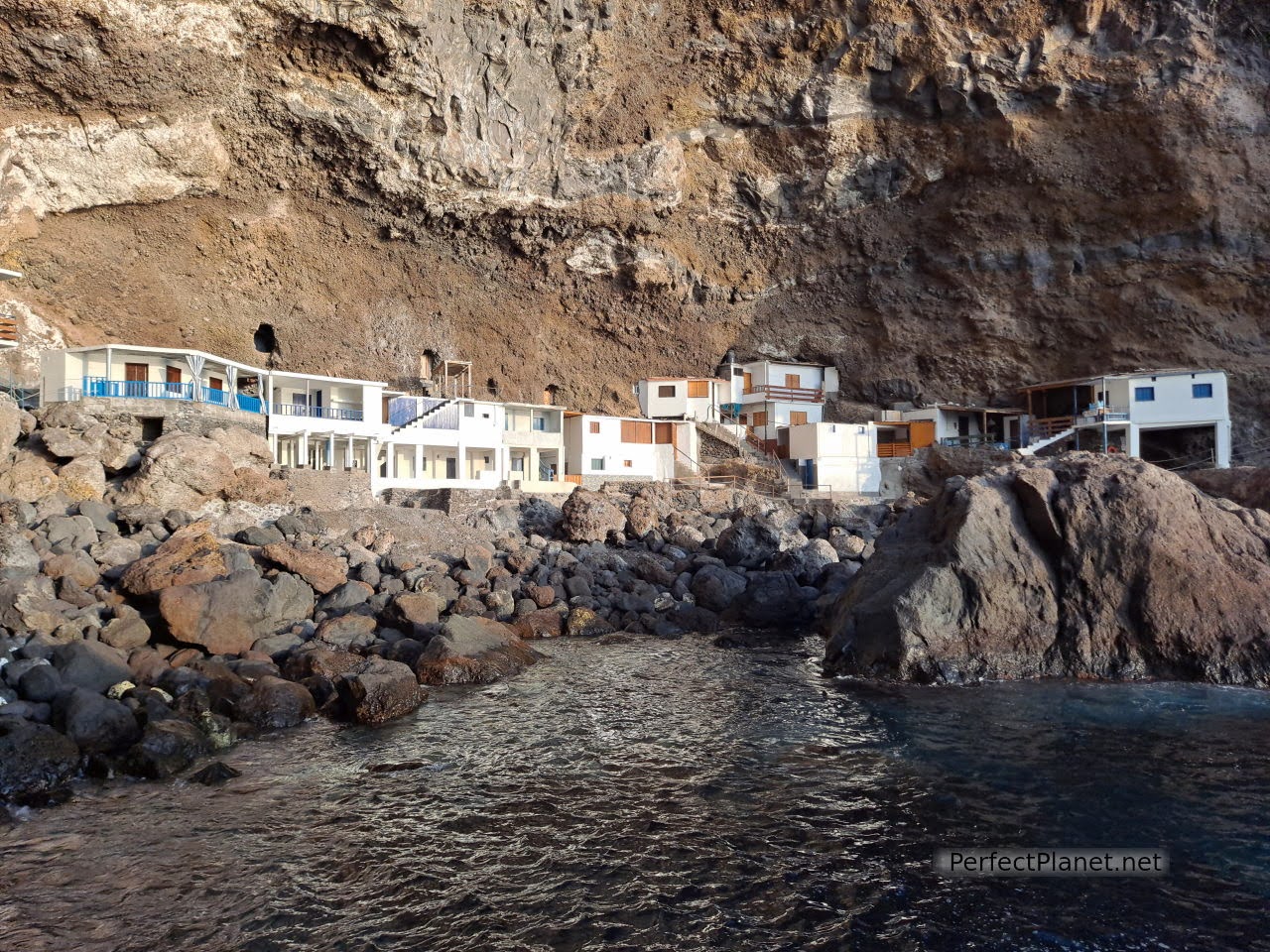
Poris de Candelaria
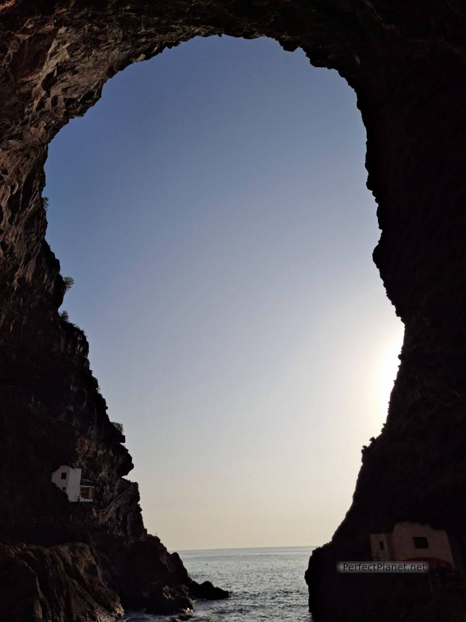
Poris de Candelaria
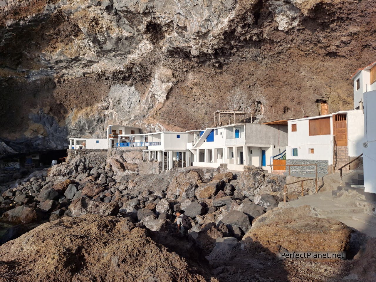
Poris de Candelaria
If you prefer to get there on foot, you can follow the PR LP12.2. Tijarafe (10.3km round trip). There are also boats that leave from Tazacorte to visit the area.
Poris de Candelaria
A small path of about two hundred metres separates the second car park from Poris de Candelaria. The blue waters, the layout of the houses built almost a century ago... leave you speechless.
Poris de Candelaria
Poris de Candelaria
Poris de Candelaria
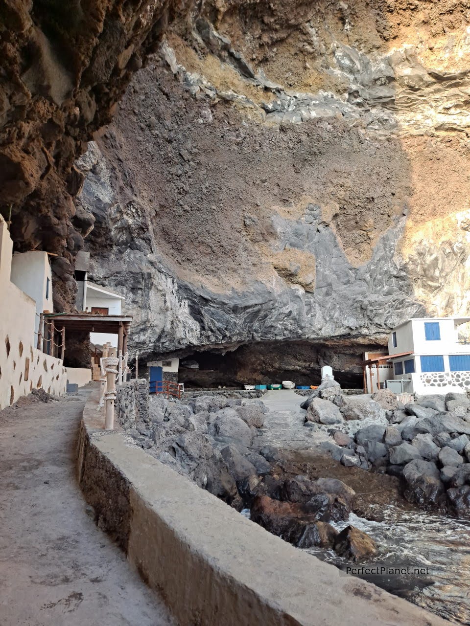
Poris de Candelaria
There are several access points for swimming so remember to bring your swimming costume and snorkelling goggles.
Poris de Candelaria
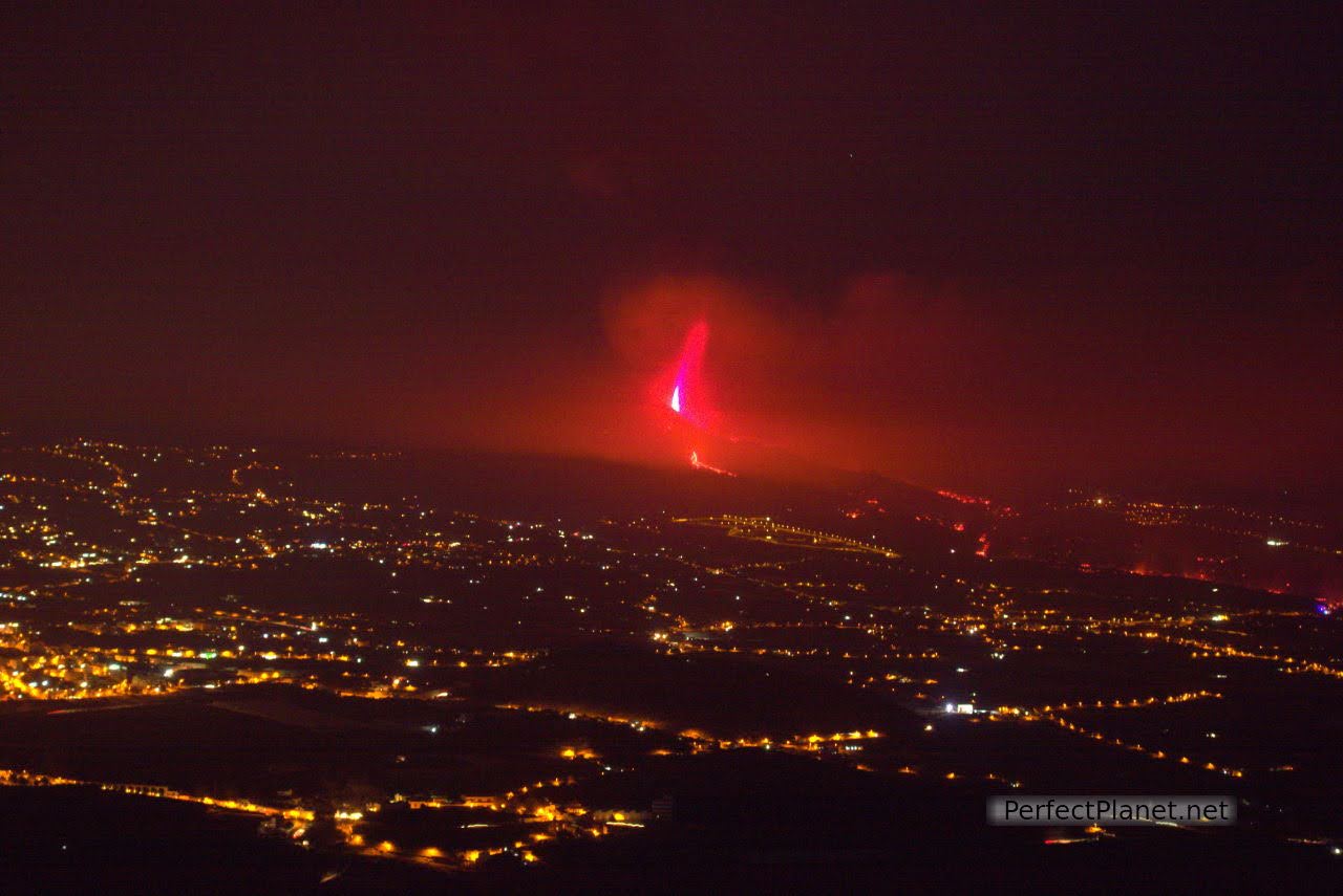
It gets dark and we have been recommended the Time viewpoint to see the eruption of the Cumbre Vieja volcano and the area of El Paso, Tazacorte and Los Llanos, as many of these areas have restricted access and we don't want to be a nuisance for the neighbours who are having a hard enough time.
Although there is a restaurant at the viewpoint, the car park is very small. There is a parking area on the left hand side a few metres away. Do not park on the road because the Guardia Civil have been issuing fines.
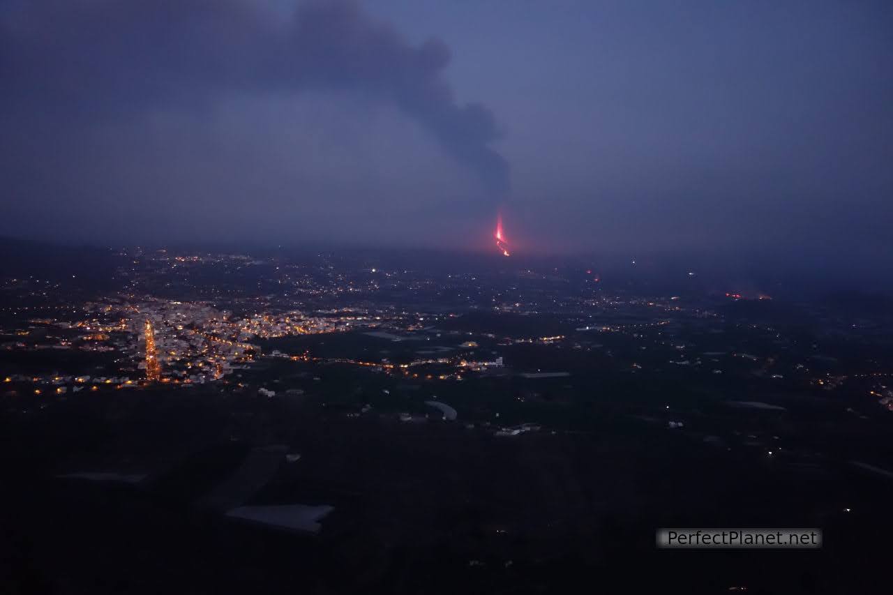
Views from the Time lookout point
The views of the area are breathtaking and the devastation caused by the volcano is shocking. We spoke to a woman who lived in El Paso and she told us that she was afraid, many days she slept in the car she had filled with her suitcases. She had left the area for a few days because she couldn't bear the thought of returning, the tremors, the noise... these people are suffering a lot and we have to do everything we can to help them. The Cabildo de La Palma has set up an account number for donations.
Views from the Time lookout point
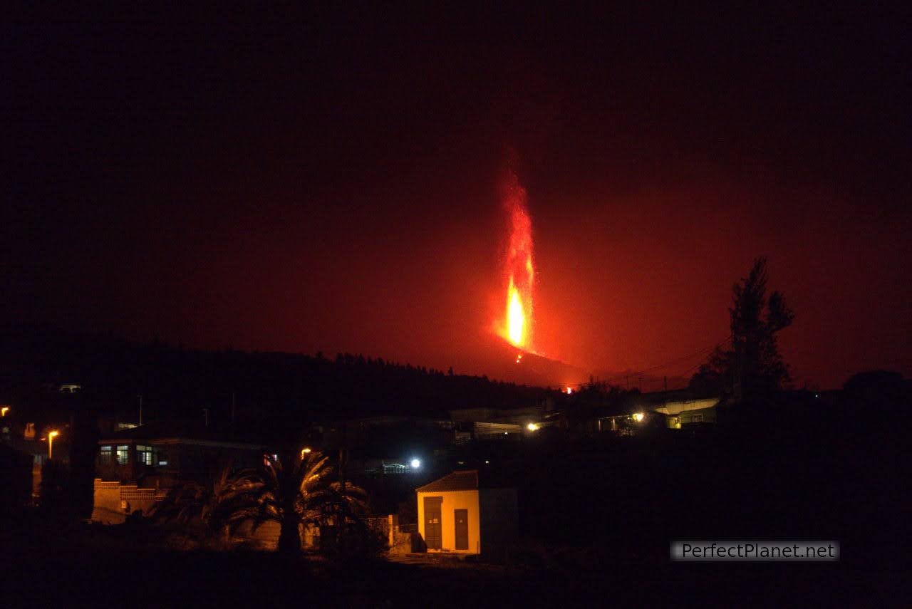
To continue back to our accommodation we continue on the LP2 in the direction of Santa Cruz de la Palma. We stop at the Giardino restaurant car park, very close to the Tajuya viewpoint, we are about 3 kilometres from the eruption and the noise is deafening. The volcano is spewing out lava at a height of almost five thousand metres. We have no idea what it is like to live constantly in this situation.
Views from the restaurant
On the way back through the tunnel on the Cumbre road we feel the ash rain. It is a very fine sand that sometimes turns to soot. Little by little we feel more and more like palmeros. A day of mixed feelings.
En el camino de vuelta al atravesar el túnel de la carretera de la Cumbre sentimos la lluvia de ceniza. Es una arena finísima que en ocasiones se convierte en hollín. Poco a poco nos sentimos cada vez más palmeros. Un día de sentimientos encontrados.
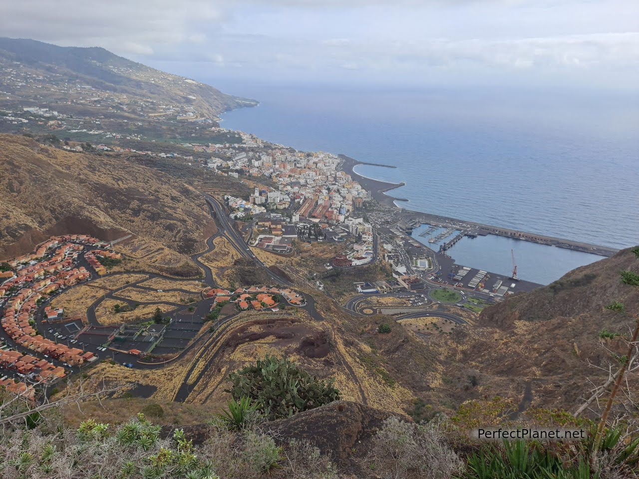
Day 3. Los Cancajos, Santa Cruz de la Palma, Concepción viewpoint, Nogales beach.
The day's proposal includes the east coast of the island of La Palma. Starting in Los Cancajos, a visit to the capital of the island and ending with a relaxing swim at the spectacular beach of Nogales.
Los Cancajos beach
Los Cancajos is a district of the municipality of Breña Baja, situated between the Airport and Santa Cruz de la Palma on the east coast of the island.
Los Cancajos beach
It has a volcanic sand beach protected by a breakwater so it is perfect for children. Ideal for snorkelling and cave diving. It has showers, umbrellas and sun loungers for rent. There are several parking areas but as it is quite a touristy area it is sometimes difficult to park.
Los Cancajos
The viewpoint of La Concepción offers incredible views of Santa Cruz de la Palma and the east coast of the island. It is accessed from the LP3 and you can walk up to the Concepción cliff so that nothing obscures the views.
Views from the viewpoint of La Concepción
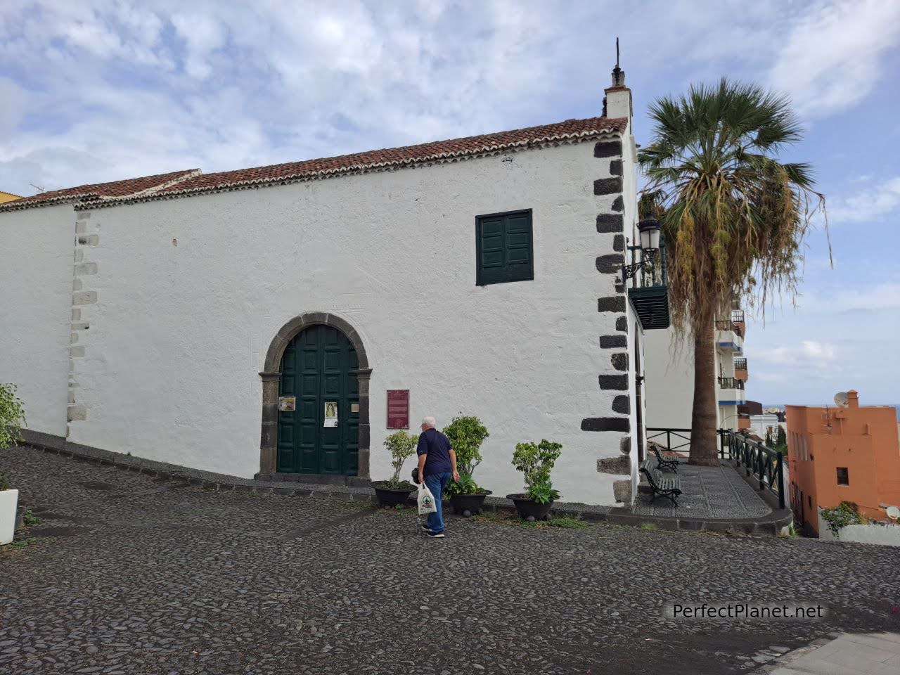
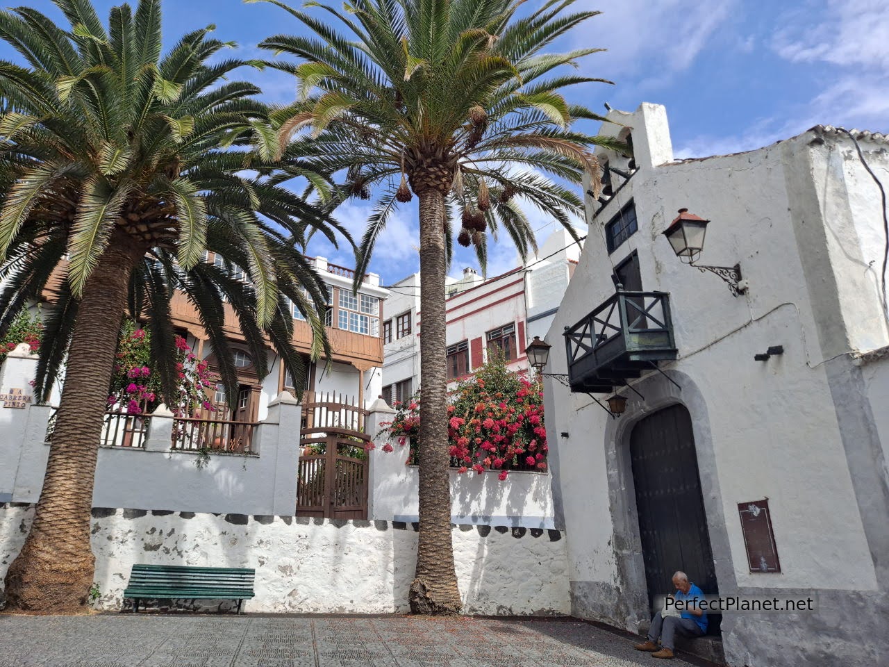
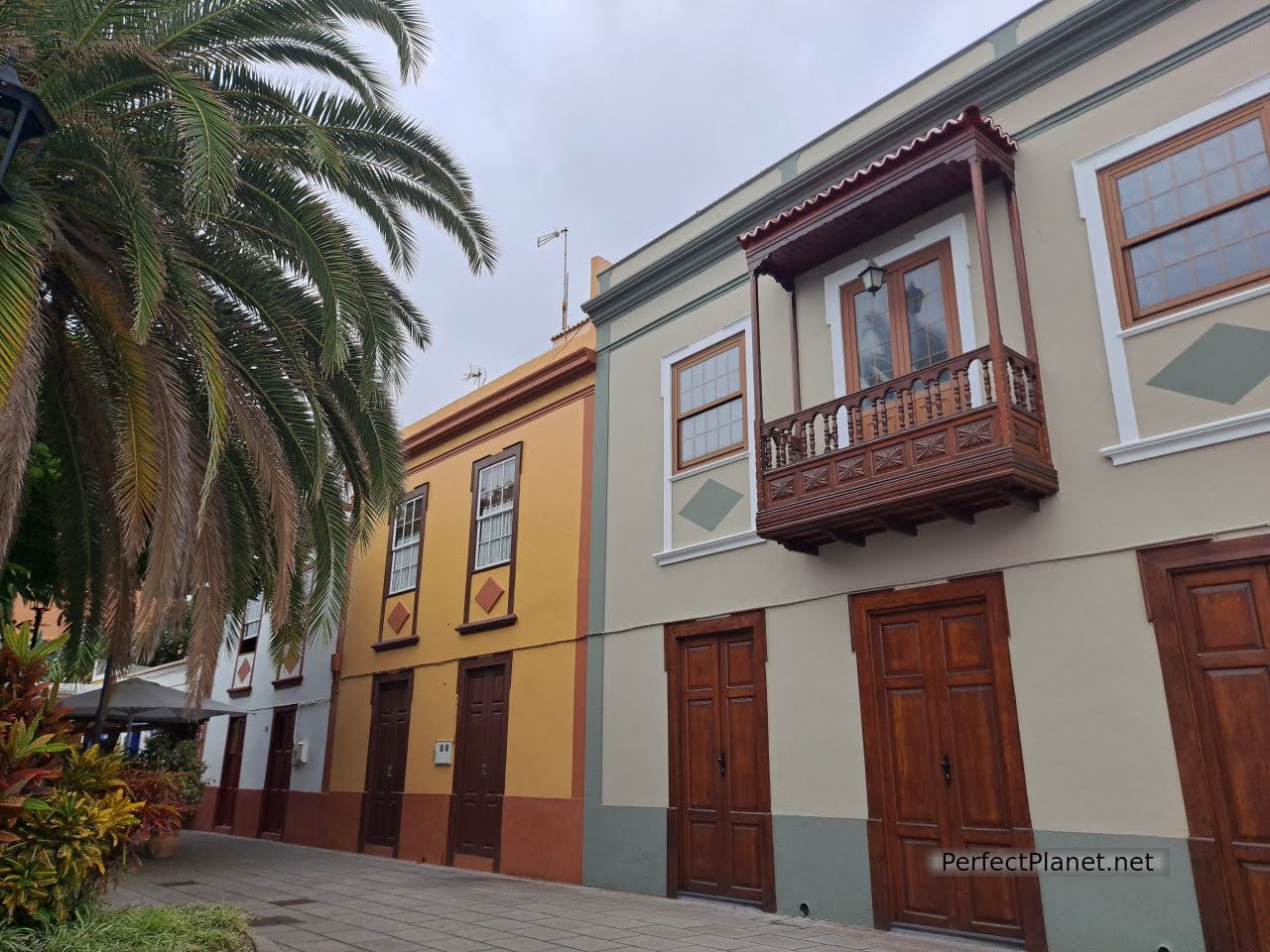
We continue to the capital of the island, Santa Cruz de la Palma. There are several parking options, in the harbour, on the maritime avenue or in the fishermen's neighbourhood, we finally parked in front of the Penitentiary Centre where the wonderful neighbourhood of San Telmo begins. Don't miss it.
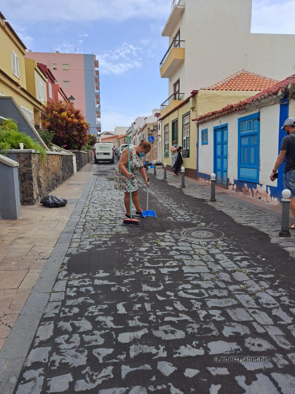
Neighbourhood of San Telmo
Hermitage of San Telmo
The San Telmo neighbourhood preserves the traditional architecture of the palm trees. On this occasion the women are busy cleaning the streets of the ash that has been falling over the last few days. Here you will find the island's first hermitage dedicated to San Telmo, located next to the Luz lift (free) which allows you to go directly down to the port, with spectacular views.
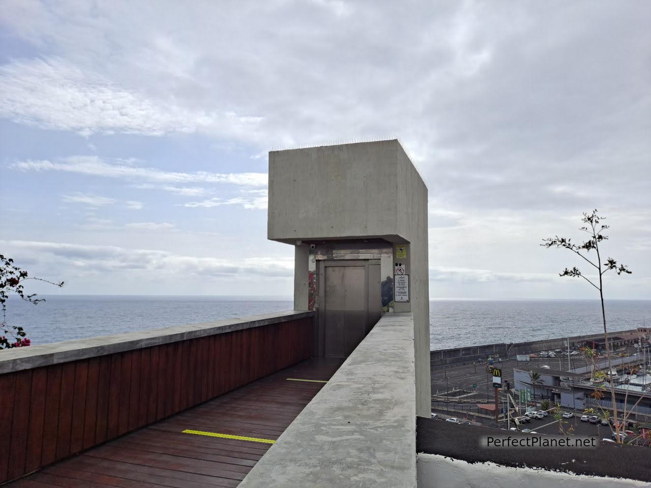
Luz lift
If you continue along San Telmo street towards Plaza Santo Domingo, there is a highly recommended restaurant, Rincón del Enano, where you can enjoy a delicious grilled octopus.
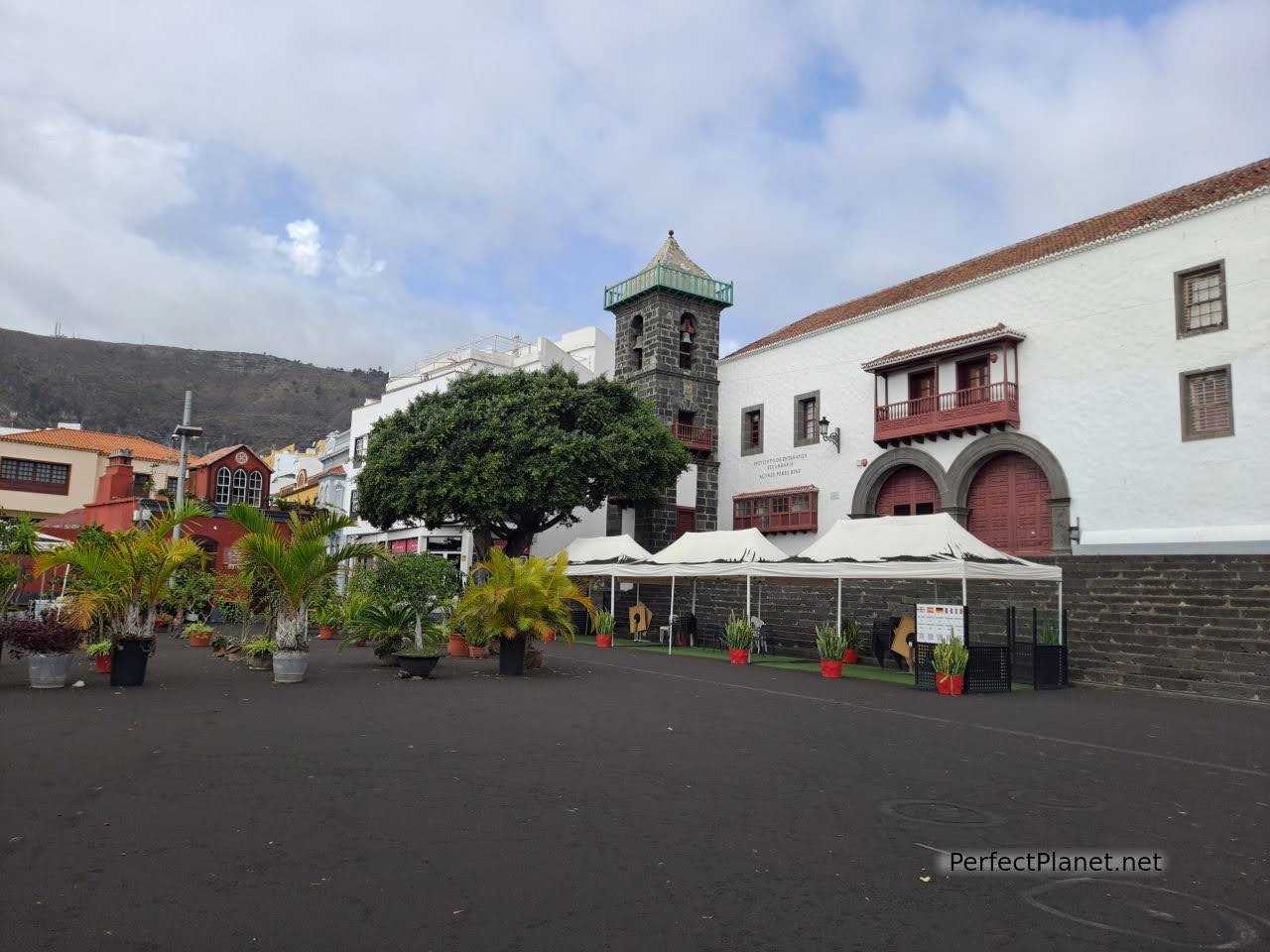
Santo Domingo square
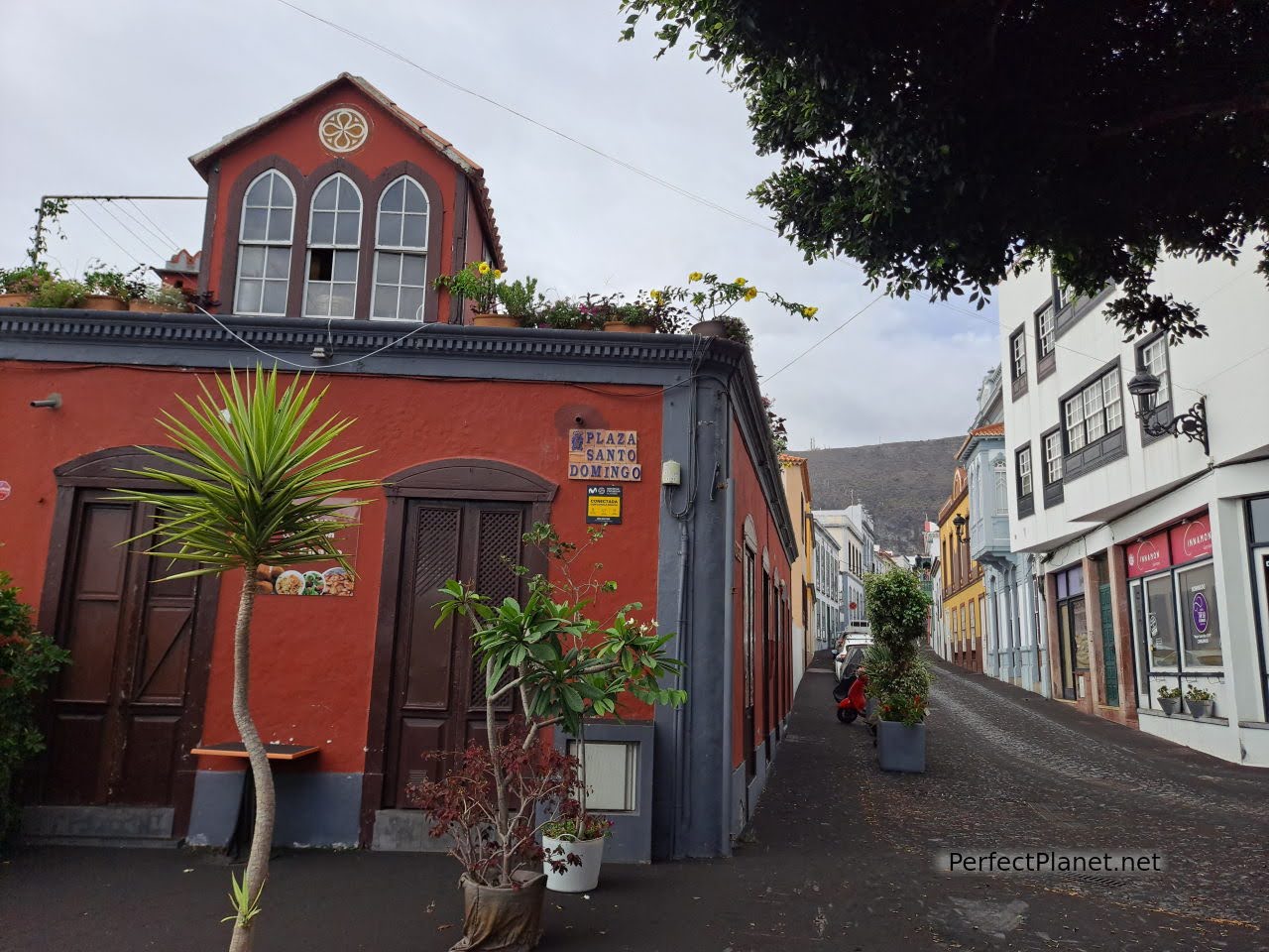
Santo Domingo square
From here you can go to the district of La Canela and see the old water tanks or alijbes where rainwater was collected for both private and communal domestic consumption, which were active until the middle of the 20th century.
Santa Cruz de la Palma
We walk down through the hermitage of San Sebastián to the Plaza de España, one of the symbols of the city, where the Matriz de El Salvador parish church with its spectacular coffered ceiling is located. From the porticoed gallery of the Town Hall you have a fantastic photograph of the square.
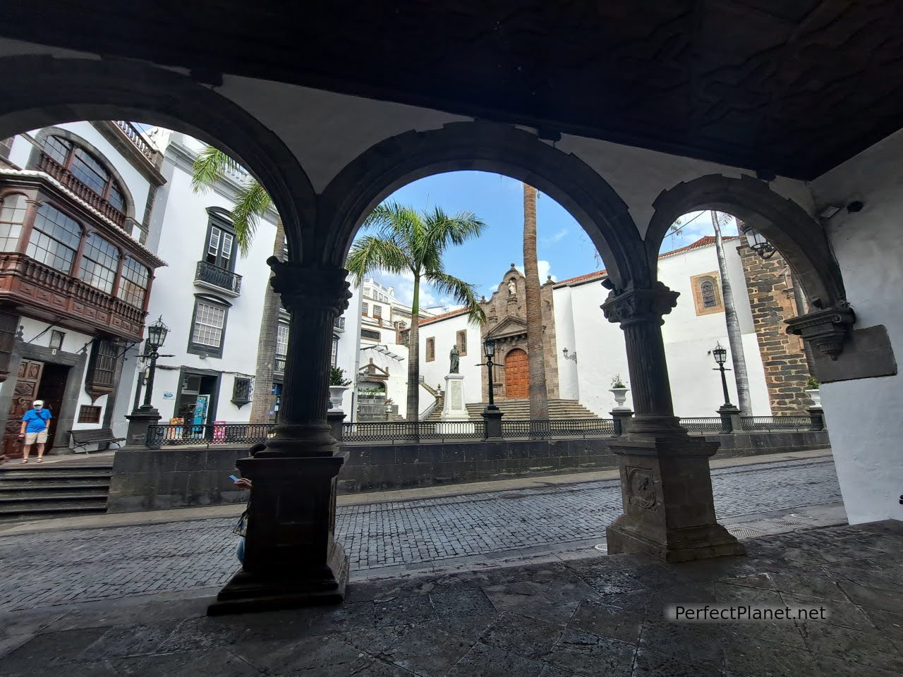
España square
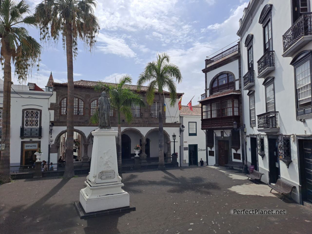
España square
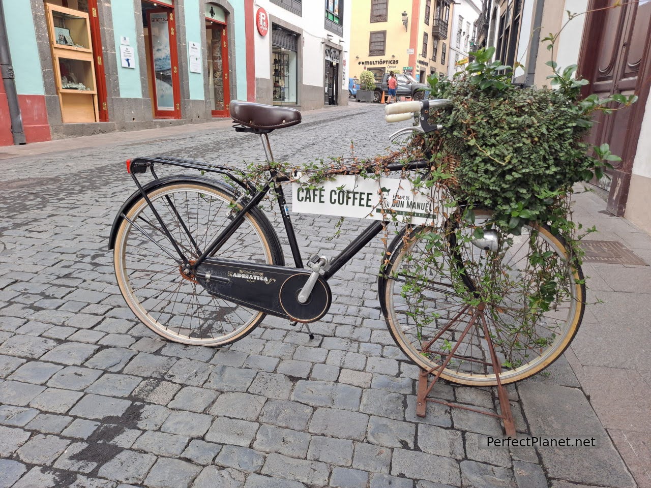
Cafe Don Manuel
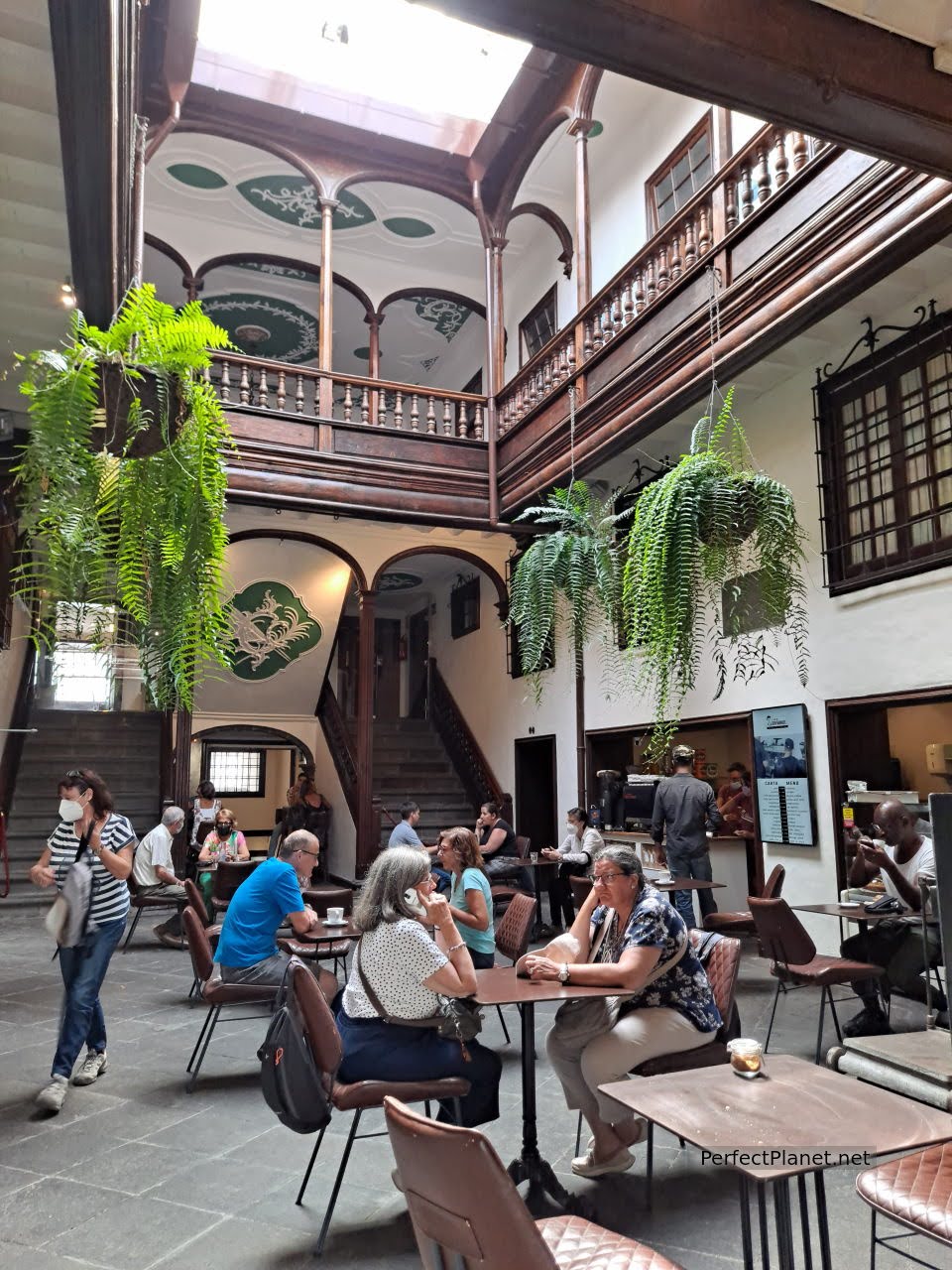
Cafe Don Manuel
The Don Manuel café with its beautiful interior patio is worth mentioning. To the north, following this same street, the Vandale square, and a few metres away in the Placeta de Borrero, Don Manuel has a small bar where we had an aperitif with a beer, all delicious (7.10€ for two beers and an avocado and mortadella bagel).
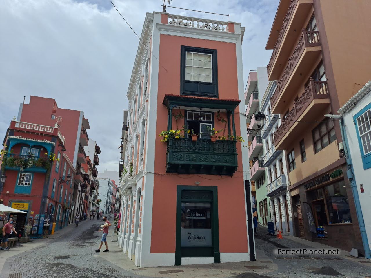
Cafe Don Manuel
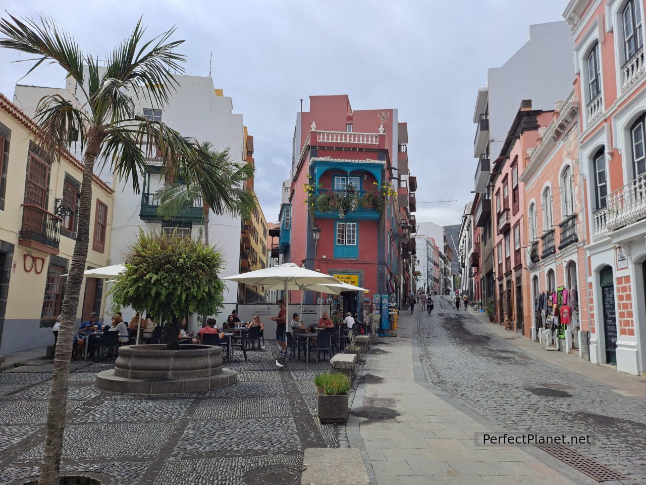
Placeta de Borrero
Behind the restaurant La Placeta is the Avenida Marítima and its beautiful balconies, typical architecture of its Portuguese ancestors. In the 16th century the construction of balconies was forbidden due to health concerns, but the Palmeros' rulers ignored this and they were not dismantled. The current ones date from the beginning of the 20th century.
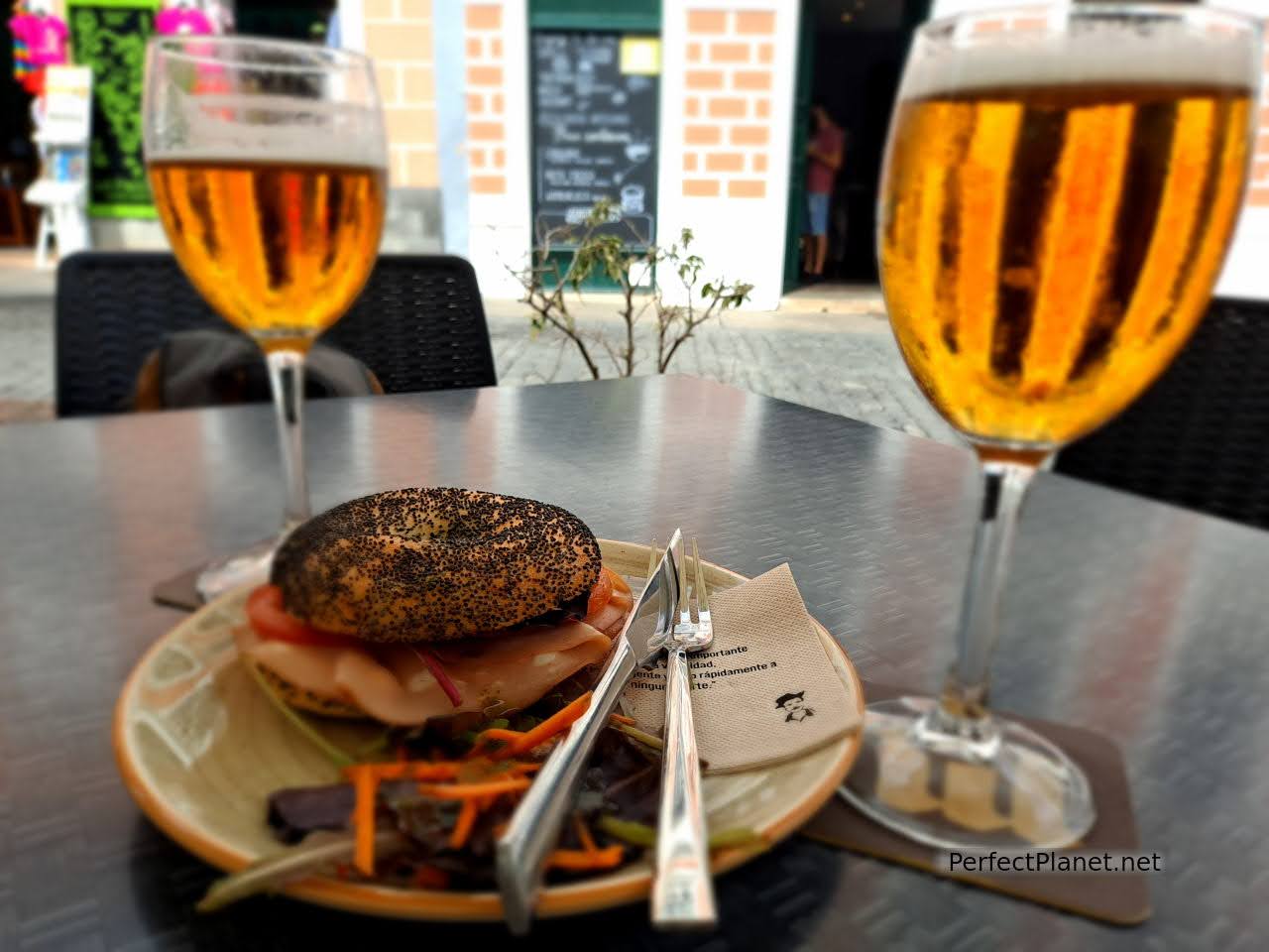
Appetizer
Continue along Avenida Marítima to the Royal Castle of Santa Catalina. Free entrance. You can enter its parade ground and enjoy the views. Close by is the Museum Naval del Barco de la Vírgen (Naval Museum of the Virgin Ship) in the shape of a run aground galleon. Admission 4,50€.
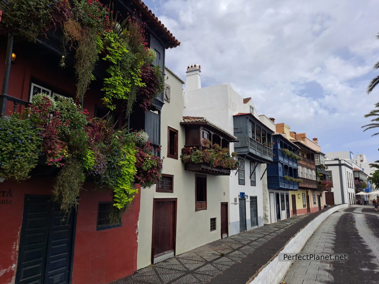
Balconies of Avenida Marítima
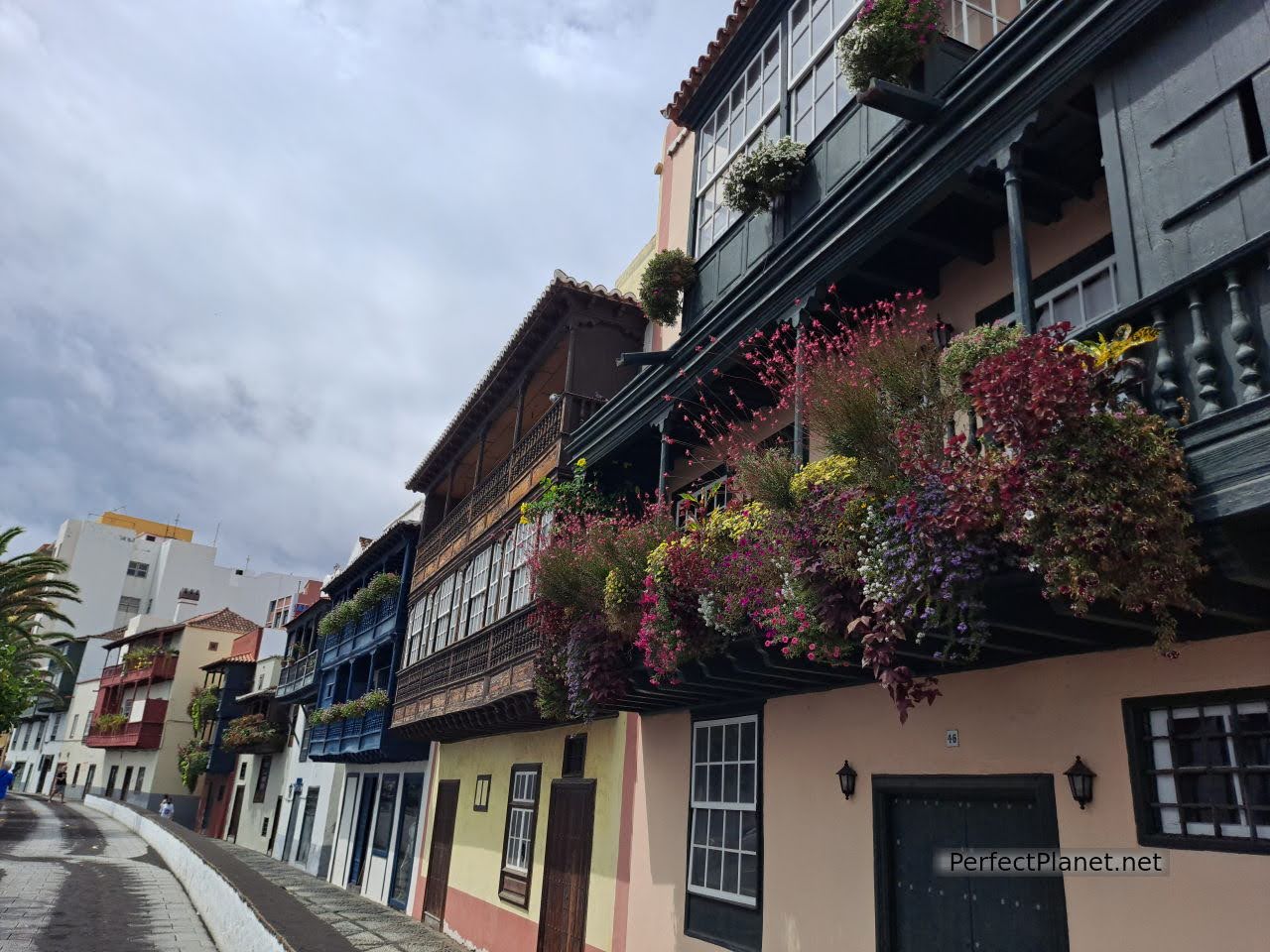
Balconies of Avenida Marítima
We retrace our steps and return to the port along O'Daly steet, one of the most commercial streets of the city. For tapas we recommend Tasca la 4, which closes at 2 p.m., and if you want a tasty and inexpensive menu del día, Estipalma restarutant, with a starter, main course, dessert, bread and drink for 9€/pax.
The beach of Nogales in the municipality of Puntallana is about fifteen kilometres north of the capital. It has a large car park with views of the cliffs along the LP102.
Access to Nogales beach
From the car park you have to walk along a path along the cliff for about fifteen minutes. The views are incredible.
Access to Nogales beach
Access to Nogales beach
The beach of Nogales is beautiful, in spite of being famous for its strong currents, it invites you to swim. Fine black sand under a spectacular cliff. It has a small shower. Surf lovers will enjoy this jewel.
Nogales beach
Nogales beach
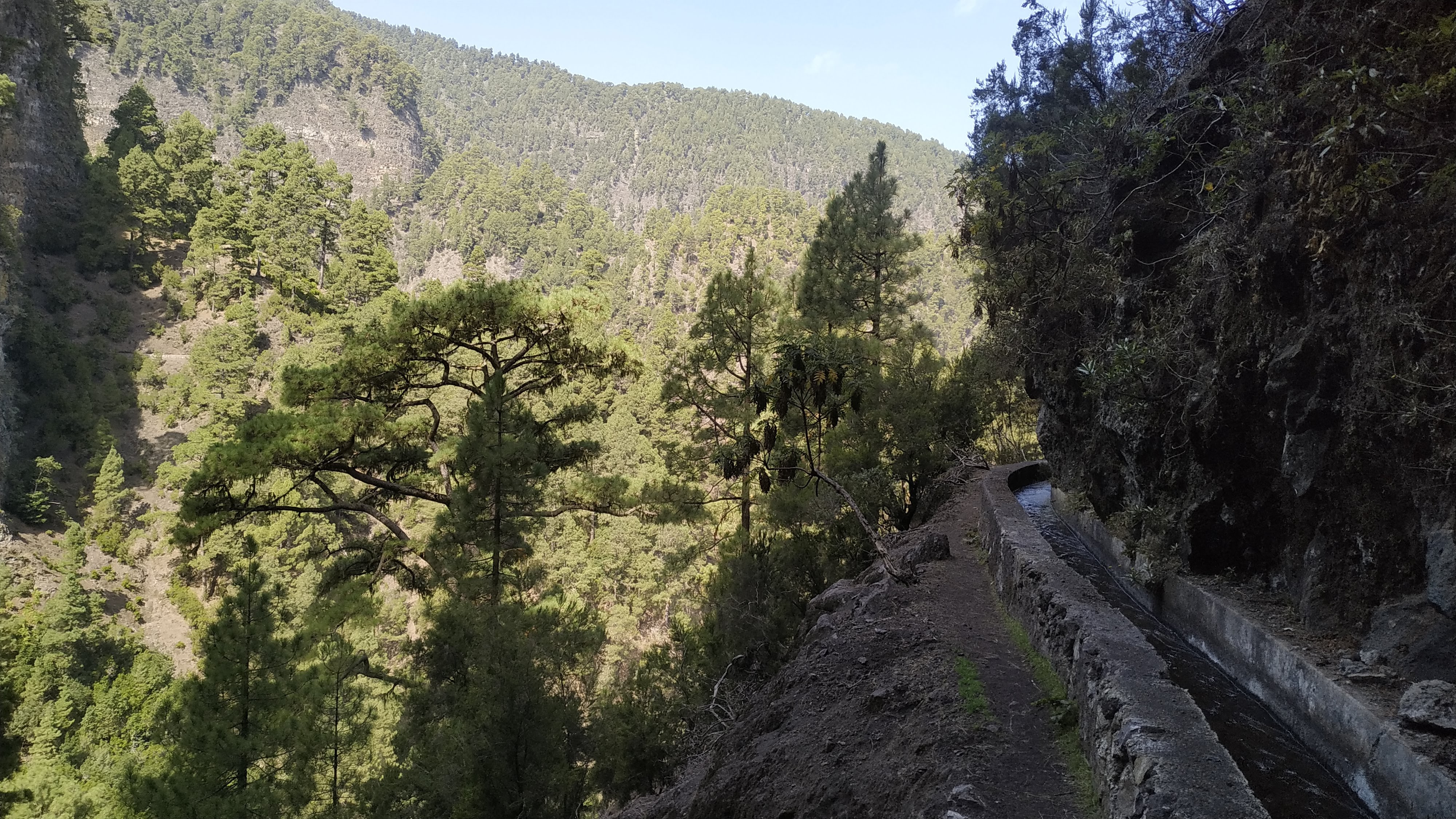
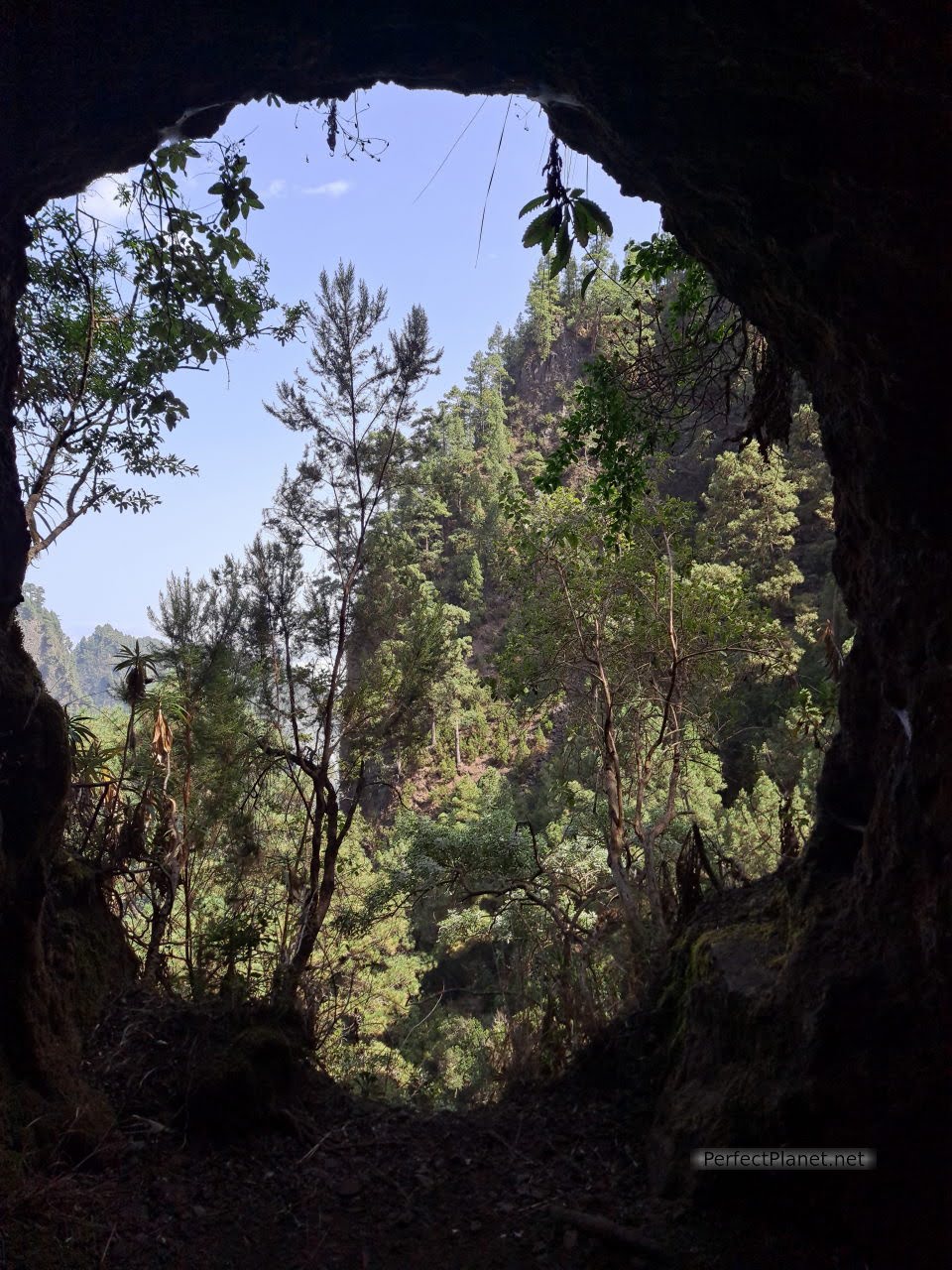
Day 4. Route of Tilos by springs of Marcos and Cordero, San Andrés, el Charco Azul.
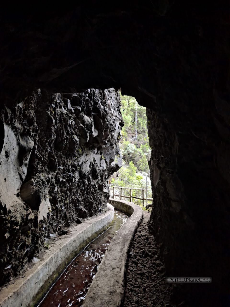
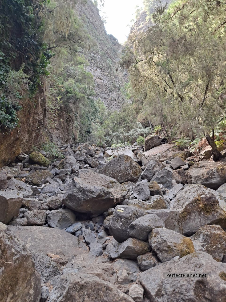
Today we propose one of the most curious and fun routes on the island, the route of the Tilos through the Nacientes de Marcos y Cordero.
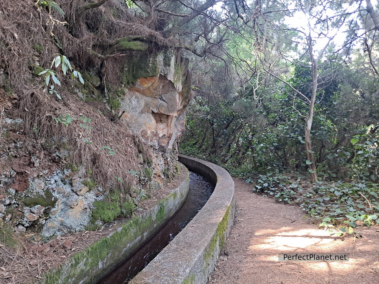
Water canal
The complete route on foot is about 25 kilometres and has a difference in altitude of about 1,000 metres, as long as you start and return from the Tilos forest. The other option is to share a 4x4 taxi (15 kilometres). For this you can book individual seats or the whole vehicle (obligatory if you go in high season).
Tunnel
The full taxi fare is 140 €/trip. If the van is full with the eight available seats it is 17,50 €/pax. Although there are more companies, we went with the taxi service Luis Alberto Batista Pérez 616418847. You can pay in cash, with bizum or by card.
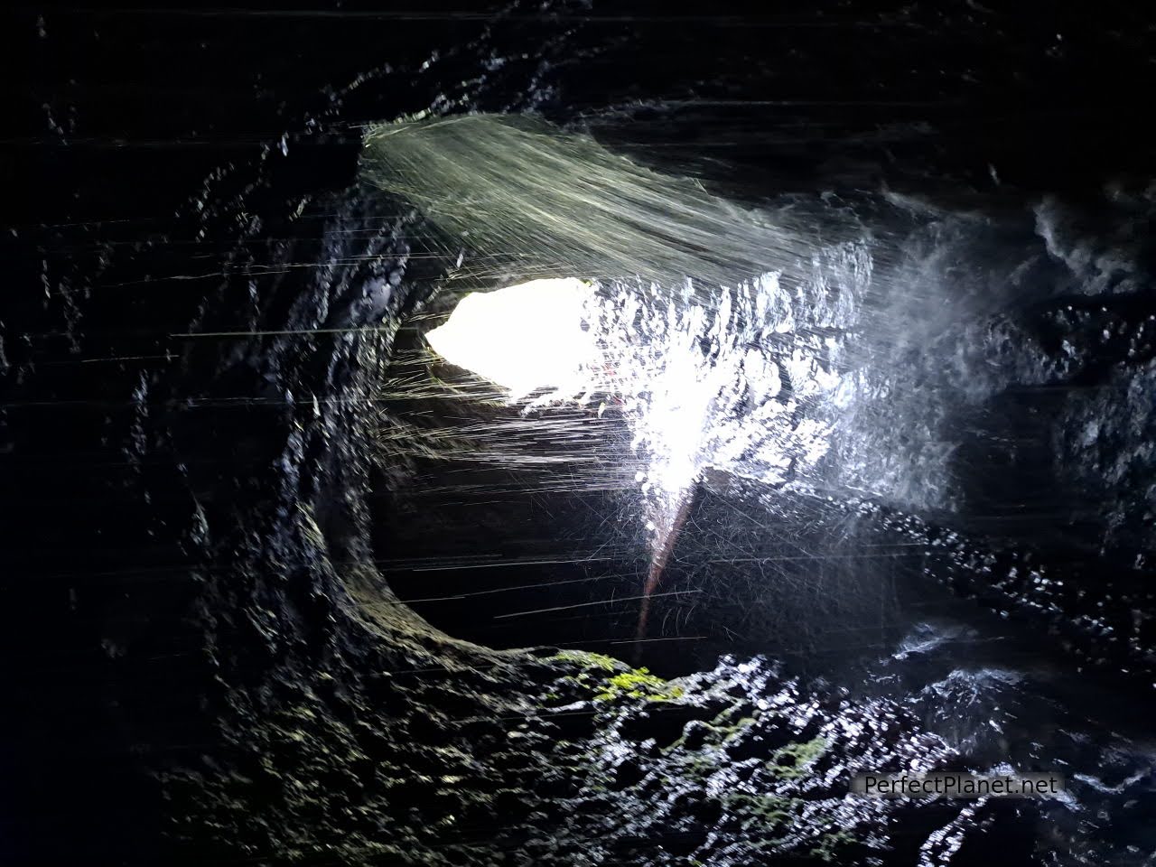
Don't forget to take a torch or headlamp and a mackintosh, you have to go through twelve tunnels, one of which is almost four hundred metres long! However, the driver always carries torches for sale, which cost about €12.
Tunnel
Part of the route is done by 4x4, so to get the taxi you have to go to the Los Tilos Visitor Centre, almost five kilometres from the village of Los Sauces on the LP105.
Springs of Marcos and Cordero
Springs of Marcos and Cordero
The journey in the 4x4 van takes almost an hour on a spectacular and wild road. The driver makes the trip more enjoyable by telling us stories about the area. Actually if you have a 4x4 you can drive up on your own but we don't recommend it, the road is quite bad and narrow, and if you are going to do the circular route you would have to come back for it somehow.
Springs of Marcos and Cordero
Springs of Marcos and Cordero
Springs of Marcos and Cordero
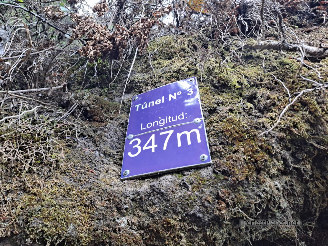
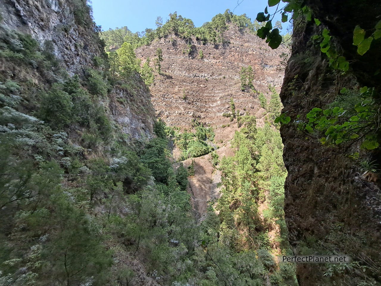
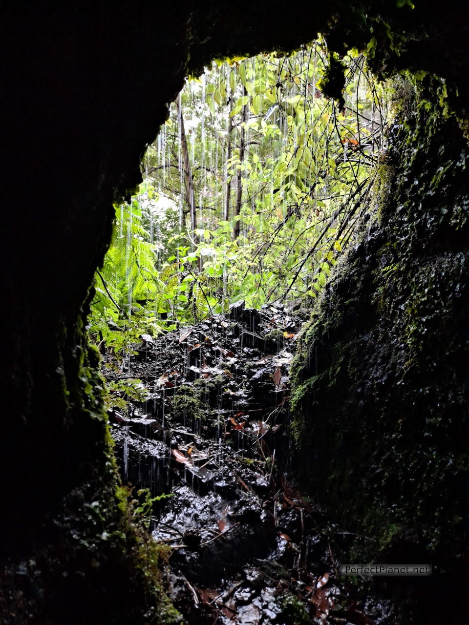
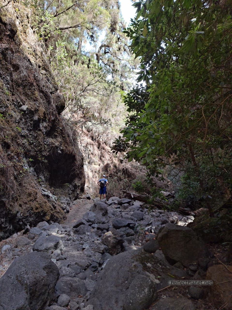
The taxi drops us off at the Casa del Monte. We start our route by following the path parallel to a water channel that is still in use. We will have to cross up to thirteen tunnels, one of which is 347 metres long.
Springs of Marcos and Cordero
The tunnels are in perfect condition. Excavated in stone, they are amazing and the views of the ravines leave you speechless. It is a very exciting and fun route and even if you go in the dry season you are sure to get wet.
Springs of Marcos and Cordero
The Springs of Marcos and Cordero route belongs to the Natural Park of Las Nieves, of great scenic and environmental value, and is part of the Biosphere Reserve, as is the rest of the island.
Springs of Marcos and Cordero
Laurel forest
The vegetation changes as you ascend, first fayal heathland and then Canary Island pine. The tunnels end at the headwaters. Up to this point, the path is flat and shady, with good views...
From the Naciente de Cordero (the last one) the descent begins through a spectacular ravine and little by little we enter the laurel forest.
Descent
Descent
Springs of Marcos and Cordero
Laurel forest
Laurel forest
Arriving at the Espejo viewpoint, the forest thickens and becomes a magical place.
Espejo viewpoint
We continue to the Espigón Atravesado viewpoint, which offers a 360-degree panoramic view and the possibility of seeing numerous birds such as the chaffinch.
Espigón Atravesado viewpoint
There are only a few kilometres to go before the end of the route and the Tilos Forest is opening up. They can grow up to 30 metres high! Along with the lime trees, fayales, laurels, heaths... a marvel for the senses.
Tilos Forest
Tilos Forest
In the car park we meet again a couple who had taken another taxi and they tell us that they have the car at the beginning of the 4x4 road. There is no reception here and they can't call a taxi, so we offer to take them to Los Sauces but in the end we take them to the car. It turns out that they are from Burgos! What a coincidence! They insist that they have to invite us for a drink even though it wasn't necessary, we did them a favour. Finally we met up for dinner.
Tilos Forest
Type of route: circular.
Distance: 14 kilometres.
Difference in altitude: 1,200 metres.
Markings: good.
Difficulty: moderate.
Essential: mackintosh, torch or headlamp, hiking boots or shoes, plenty of water, cap and sun cream.
If you don't want to do the whole route you can enjoy the Bosque de los Tilos up to the Mirador del Espigón and enjoy this jewel of the island.
50 metres from the Visitor Centre is the famous Tilos Waterfall. Don't miss it. Today it is closed due to landslides.
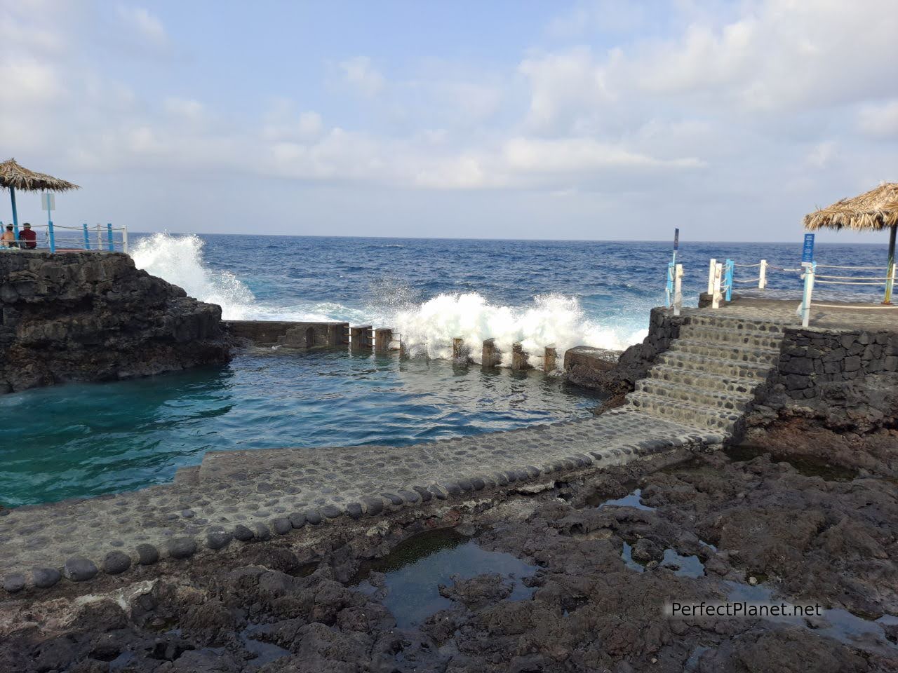
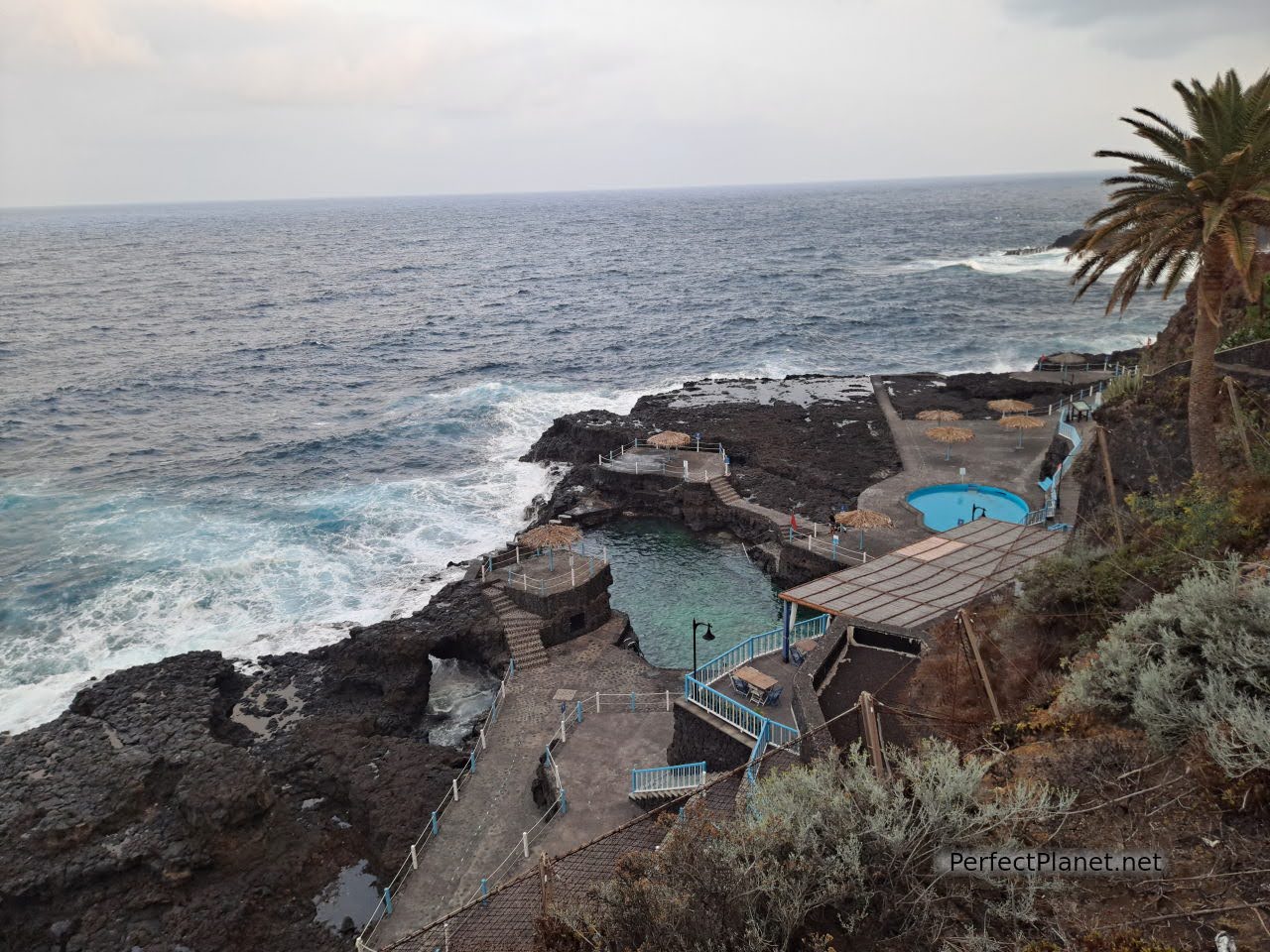
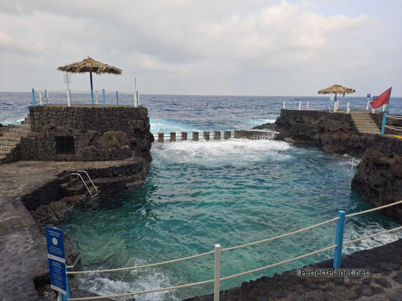
After the route we decided to visit the village of San Andrés and take a dip in the natural pools of Charco Azul.
Charco Azul
San Andrés is a beautiful place with traditional colourful palm houses surrounded by banana trees. It is worth a stroll and a drink in the Miami bar or in the restaurant La Placita Food and Coffee.
San Andrés
San Andrés
San Andrés
San Andrés
About two kilometres from San Andrés are the Charco Azul natural swimming pools. Free of charge, with toilets, lifeguard, bar and shower (50 cents). It has several pools for bathing but today the tide is very strong and we can only bathe in one of them. Ideal to end the day.
Charco Azul
We dined at the Rompecabos restaurant with Felipe and Yoli. 8 beers, a portion of grilled cheese, prawns and squid 50€ approx.
Charco Azul
Charco Azul
Day 5. GR130 Barlovento to Franceses, Fajana natural pools, el Tablado, sunset and stargazing in Roque de los Muchachos.
Today we propose a route along the rugged north coast of the island of La Palma.
La Fajana
First stop at the natural pools of La Fajana. This wonderful bathing area is located just six kilometres from Barlovento. It has several pools, tables, lifeguards, umbrellas, toilets and a beach bar. There is a large car park and they are free of charge.
La Fajana
La Fajana
We are in the north of the island and the change in temperature is noticeable, windier, cloudy and with some very light rain.
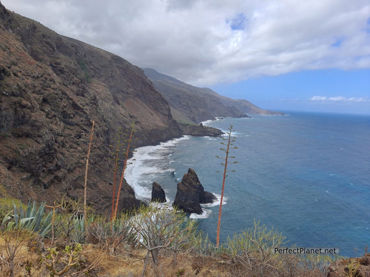
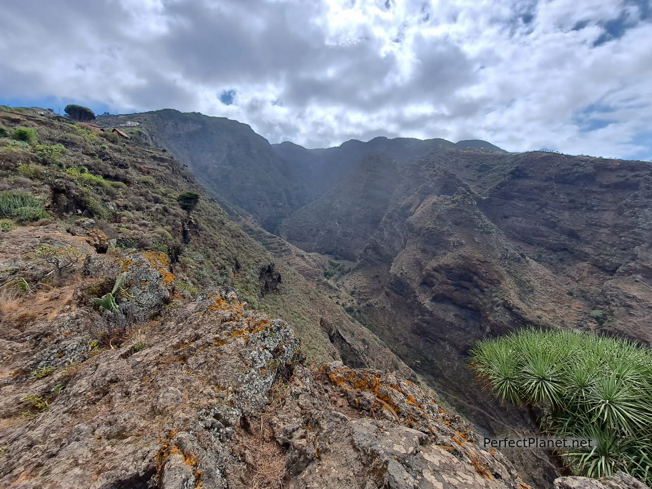
The GR130 goes around the island of La Palma along the coastal area. The most beautiful stretch, which we recommend, is from La Palmita to El Tablado, passing through Gallegos and Franceses.
Gallegos
You can start the route at any of its points, the longest route is from Barlovento to Franceses, as from the latter you can take a bus to return to the starting point. It is about 10 linear kilometres of medium difficulty. If you decide to continue to El Tablado, it is another 10 kilometres, +/- 6 hours, high difficulty.
Gr130
Gr130
For us the most beautiful stretch from Gallegos to Franceses enjoying the Guelguén Reserve. The views along the cliffs are spectacular. Remember to take water and something to eat, also sun cream because although it rained a little, you are very protected from the wind. Wonderful.
Gr130
Gr130
Gr130
If you don't want to continue walking to El Tablado (the bus doesn't enter the village) you can get there by private car along the LP1 for 15 kilometres. The road near El Tablado is in bad condition, narrow and winding. It is best to park outside the village as the roads are very narrow.
Gr130
Gr130

Guelguén Reserve
Franceses
Gr130
Dragos
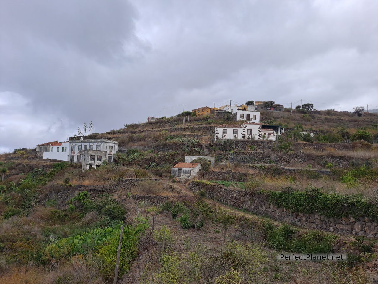
The enclave in which El Tablado is situated is a protected natural environment, and no wonder. Situated between the Hombres ravines and Facundo ravines, the village preserves traditional palm tree architecture.
El Tablado

El Tablado
El Tablado
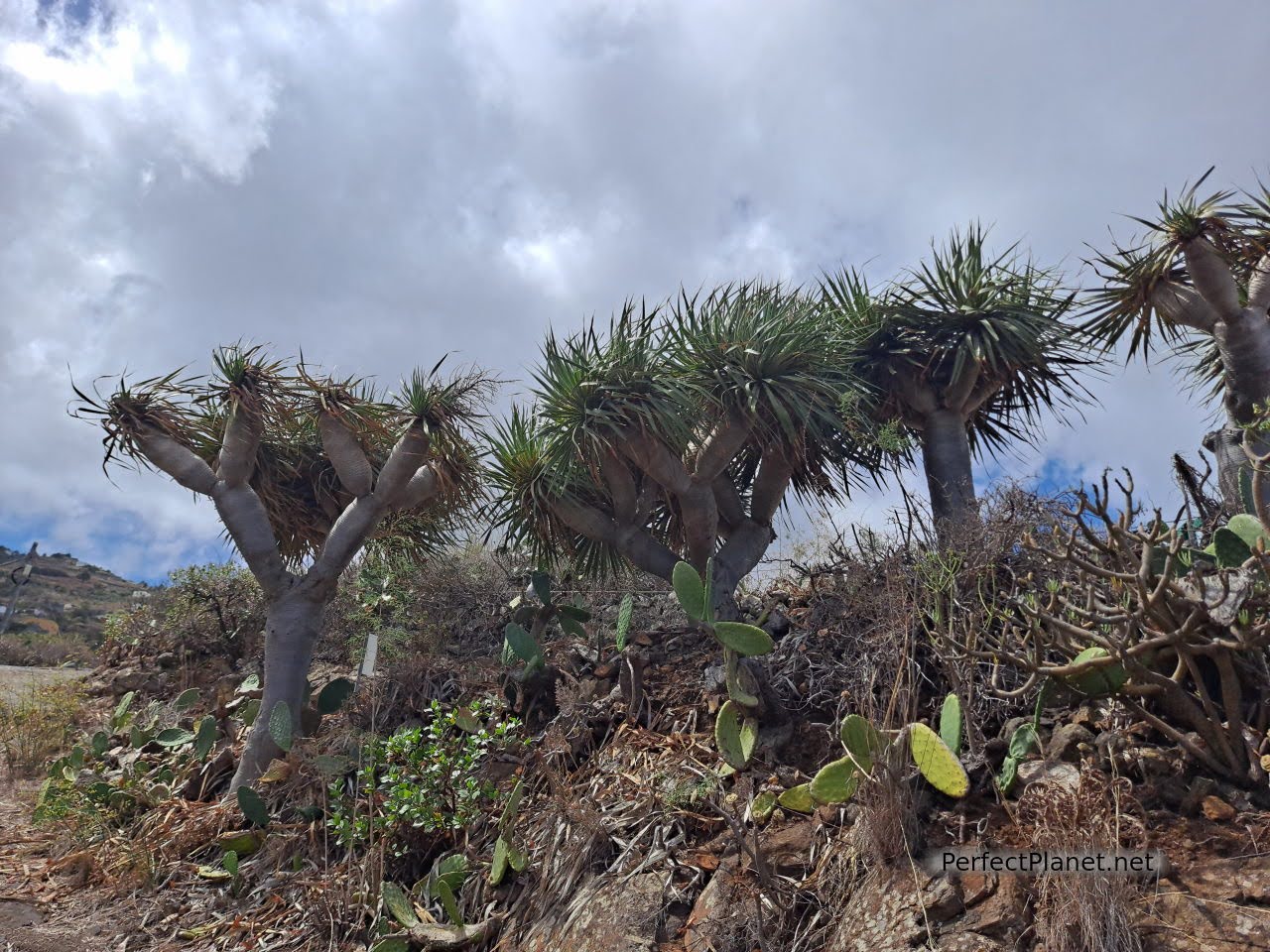
The dragon trees, prickly pear cactus, cactus and steep cliffs with blue waters do not disappoint. Don't miss it.
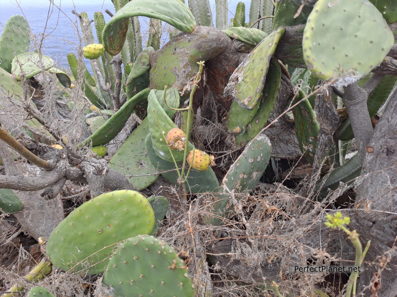
El Tablado
El Tablado
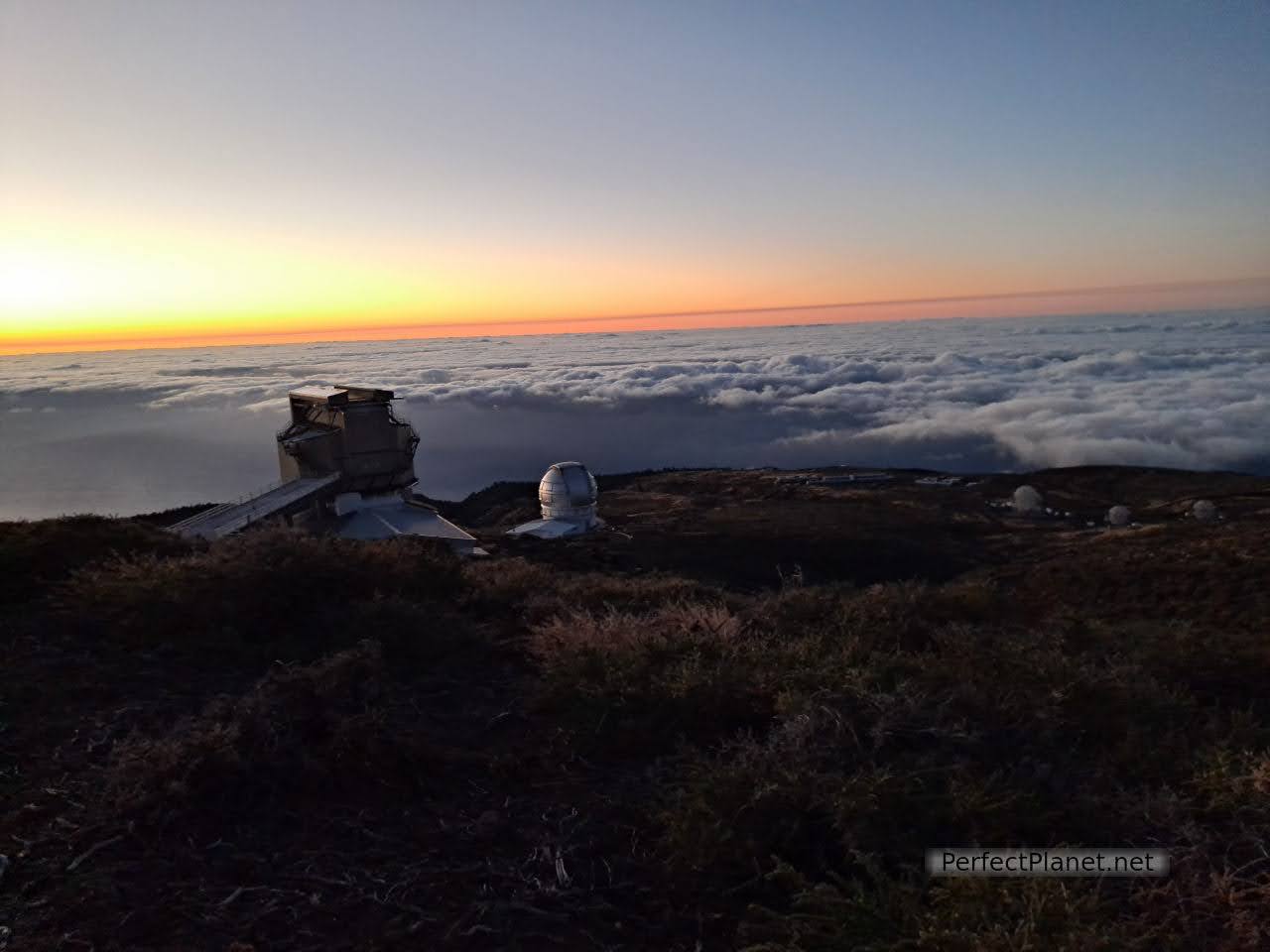
We decided to end the day by returning to the Roque de los Muchachos viewpoint to watch the sunset and observe the spectacular sky over the island. A starlight destination, any point on the island is good for stargazing, but this place near the Astrophysical Observatory is promising. We return via the LP4.
Caldera de Taburiente
Observatory
Gr131
The sunset is spectacular despite the cold and windy weather. We walk along the GR131 towards Tazacorte. The views of the Cumbre Vieja volcano and the Caldera de Taburiente are breathtaking.
It gets dark and we start to see the stars and constellations, we are alone although I am not surprised because it is so cold.
Cumbre Vieja volcano
Sunset
At around 21.30 we decide to go back and to our surprise the barrier is closed! We are a bit shocked, we see lights in an adjoining building and we knock on the door, nobody comes out. We start to whistle and after ten minutes the guard comes out and tells us that the barrier closes at 20.00 hours so as not to disturb the astrophysicists, that he has seen our car but as he didn't see us he thought they would come and look for me.
What a scare, we thanked him and apologised for the inconvenience.
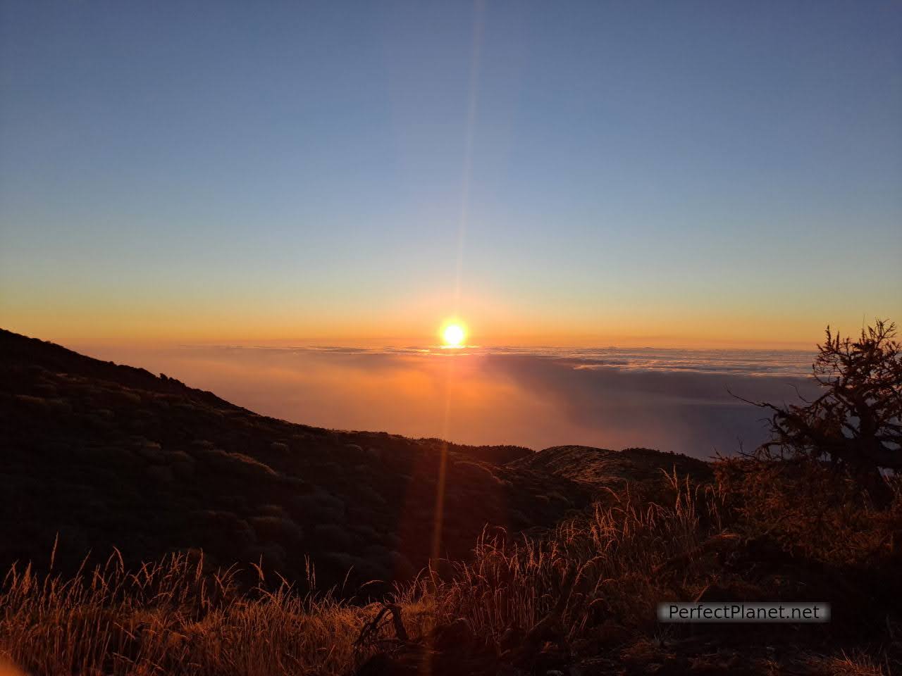
Sunset
Indeed, near the viewpoint of the Andenes there were a lot of groups of people to see the stars, it seems that the rest of the people knew about it.
Sunset
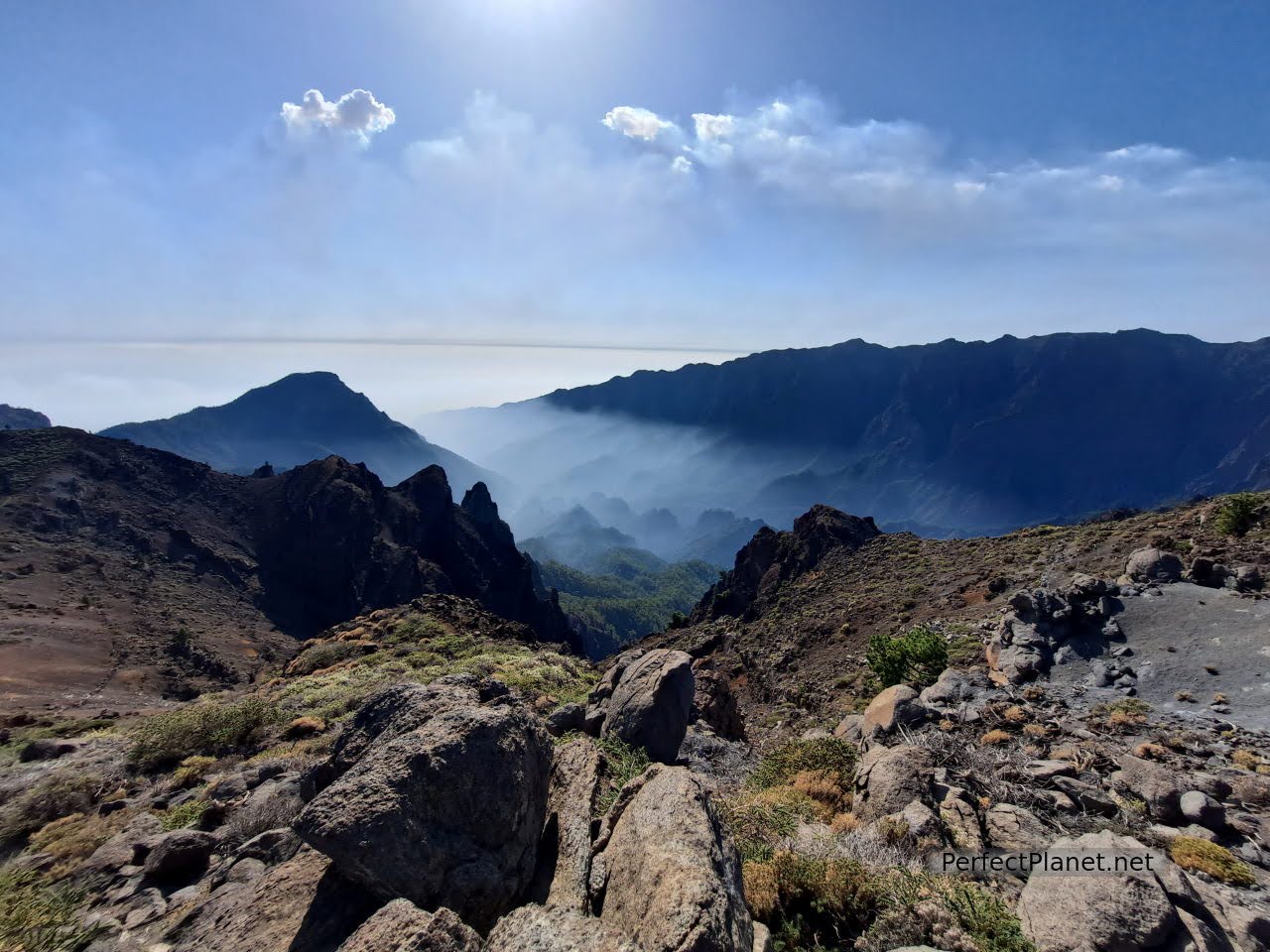
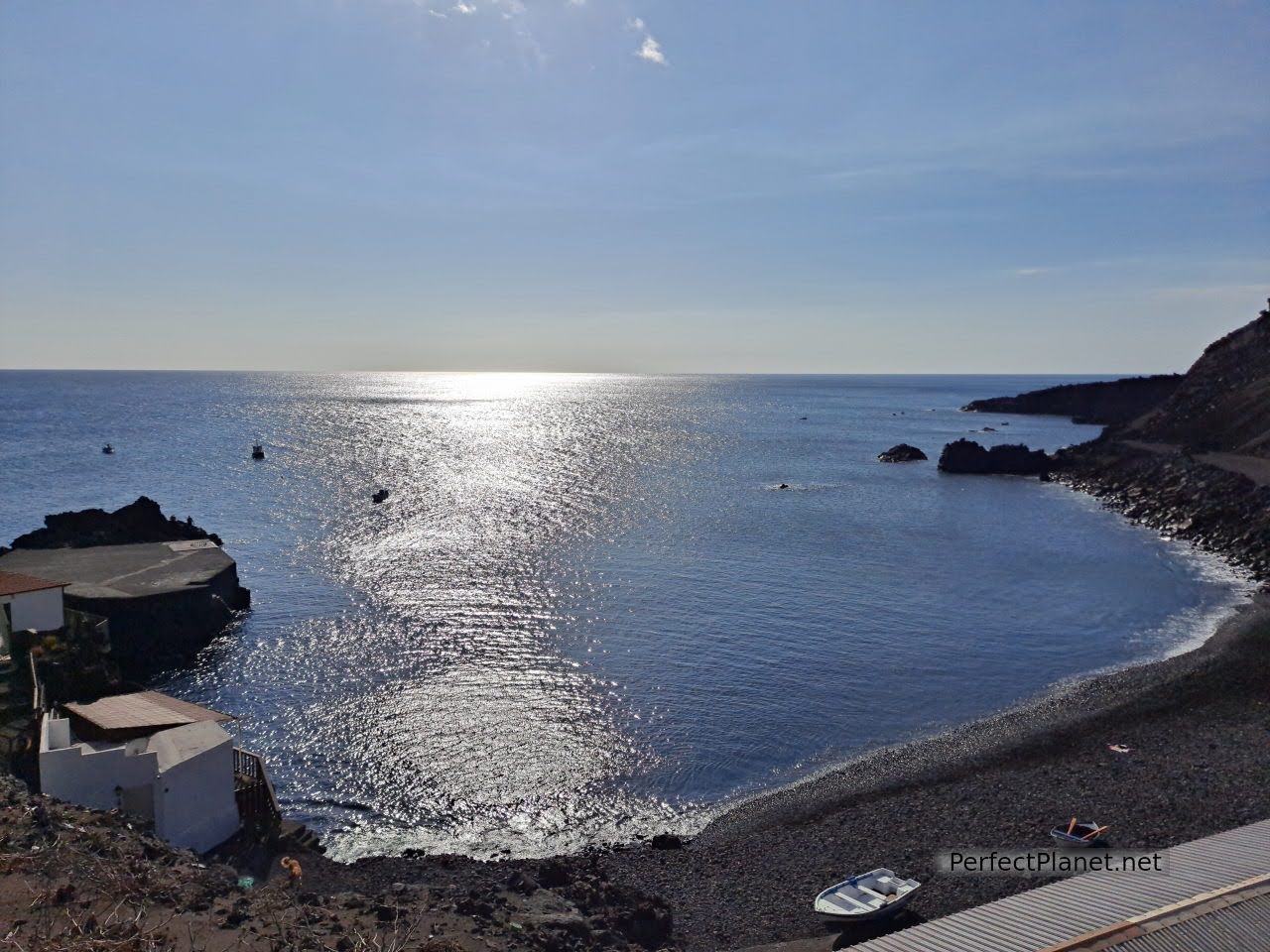
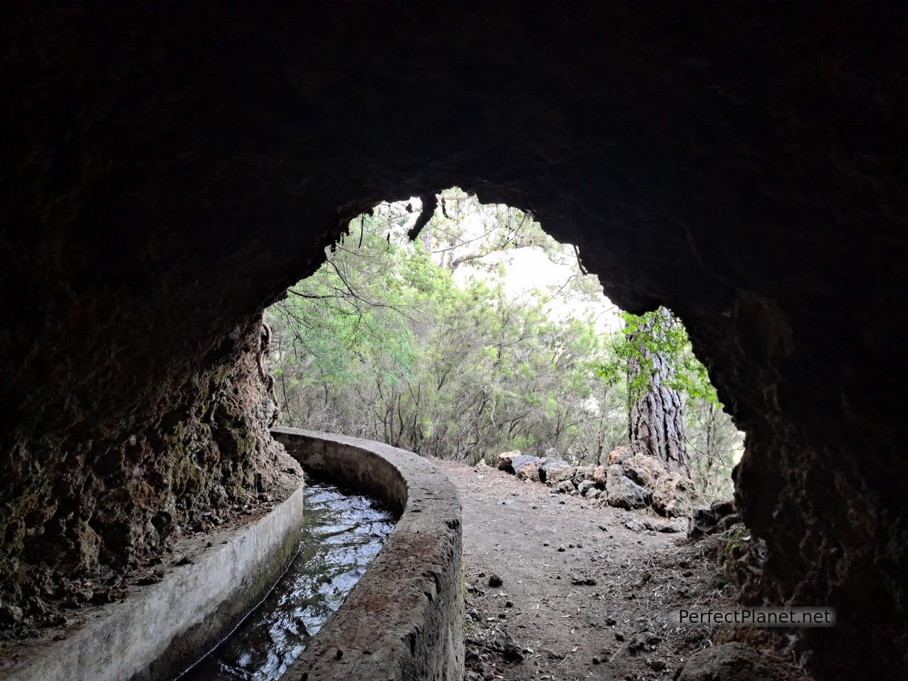
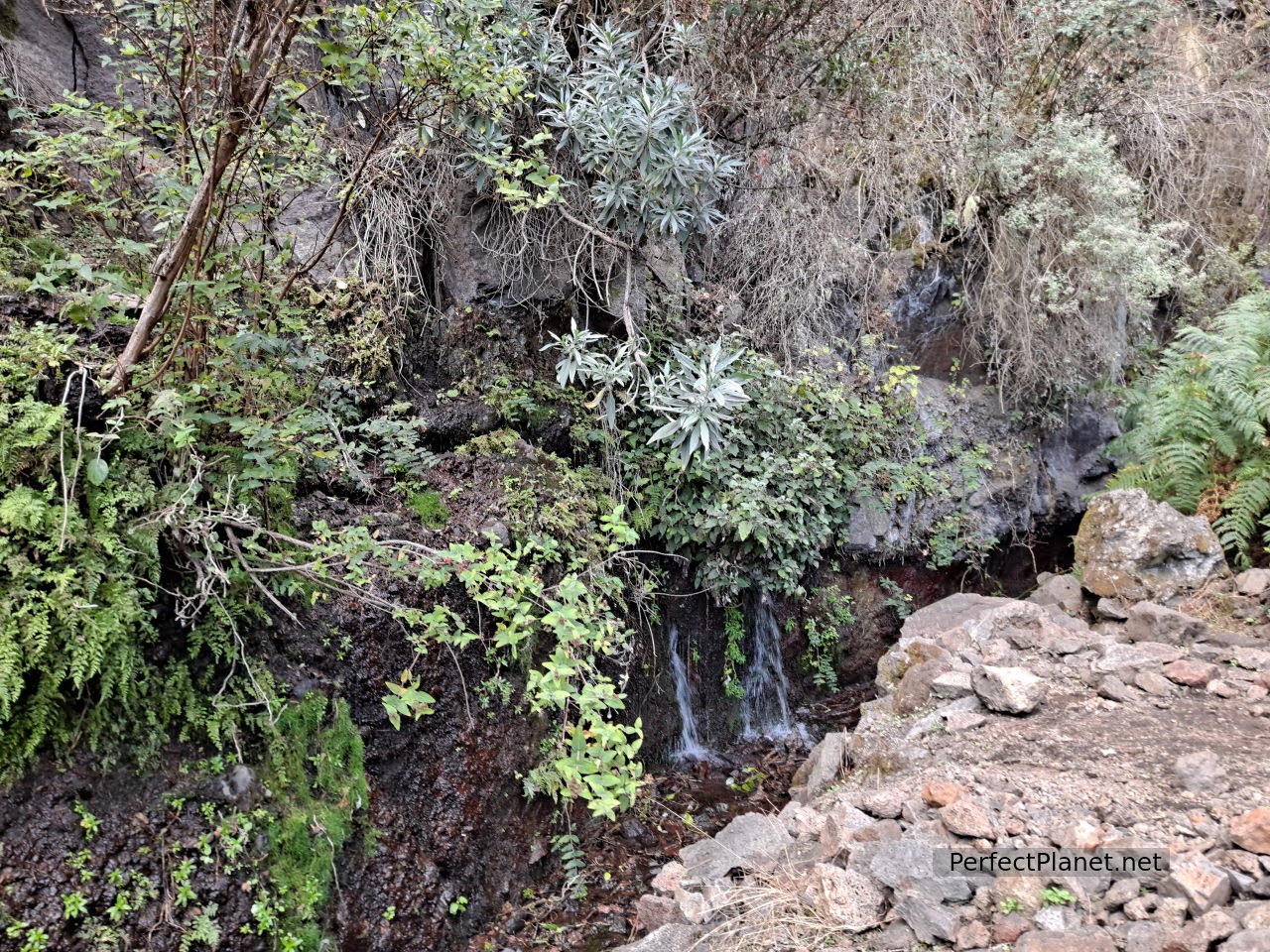
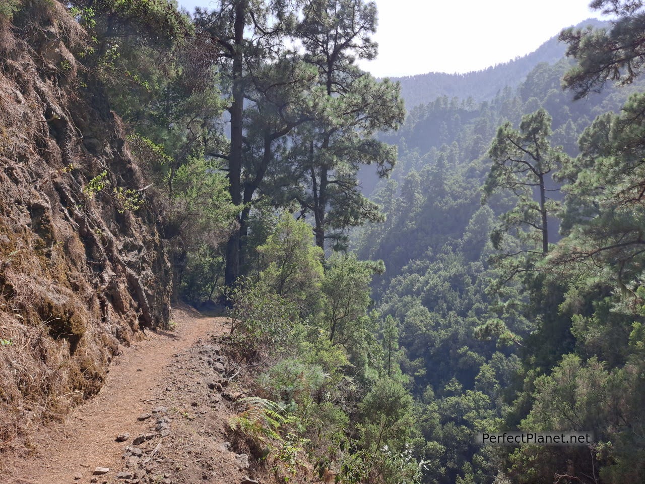
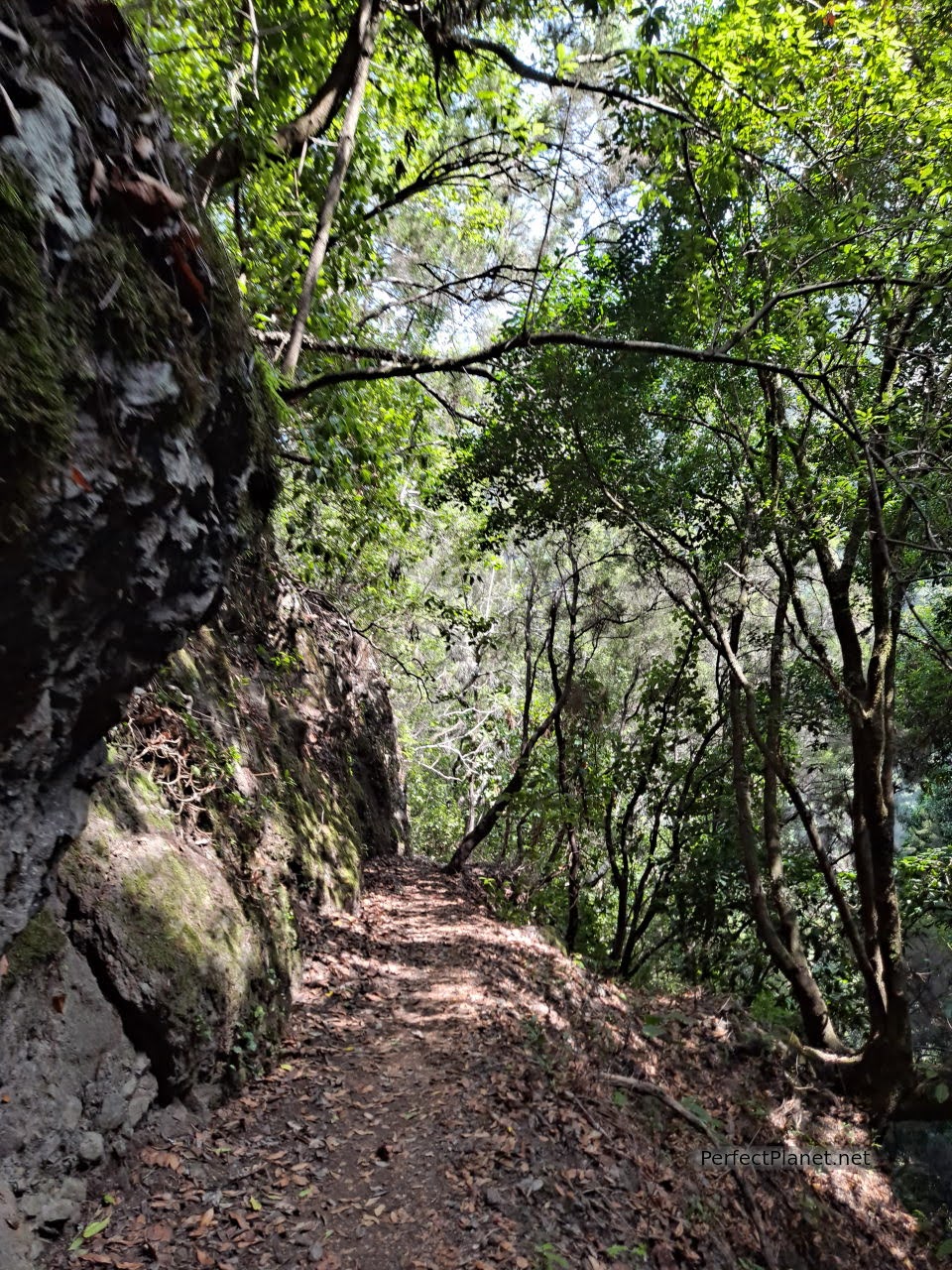
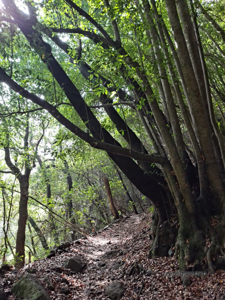
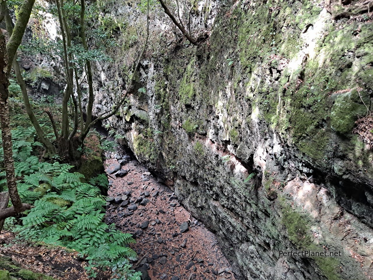
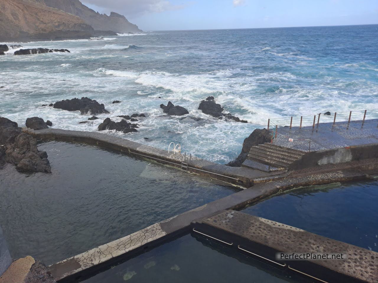
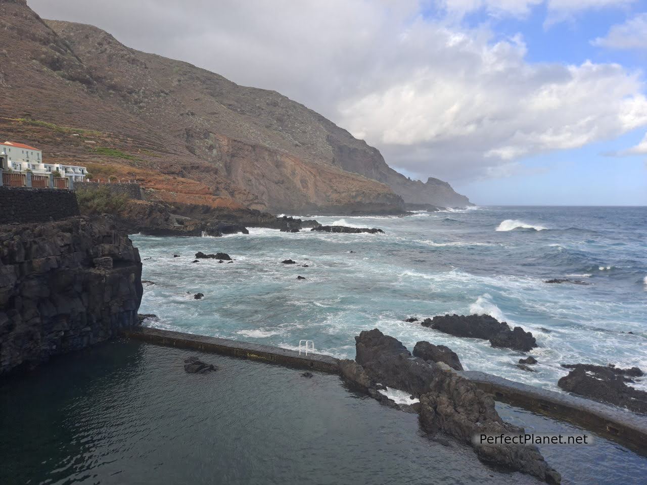
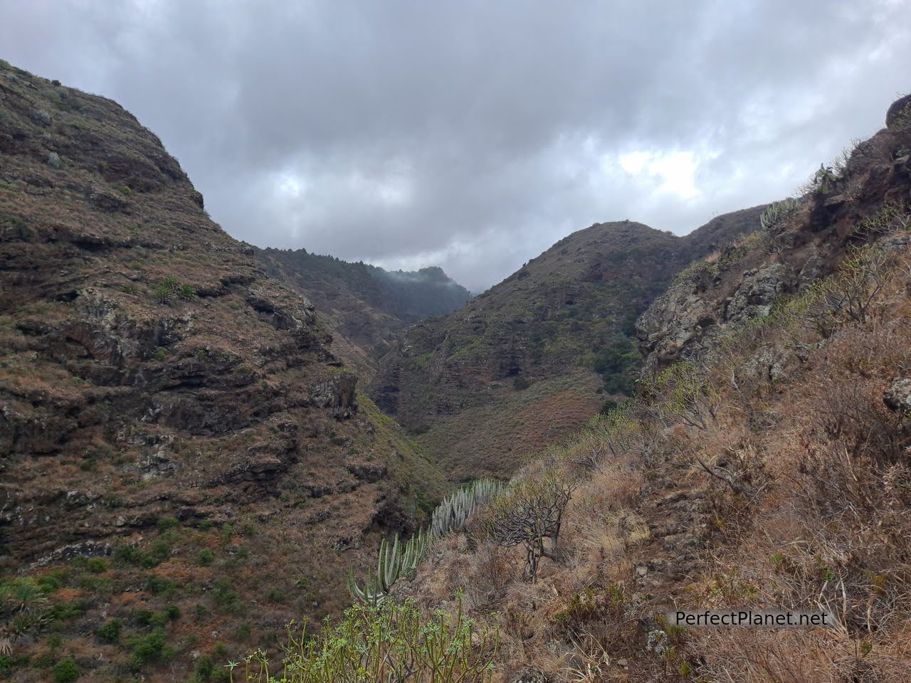
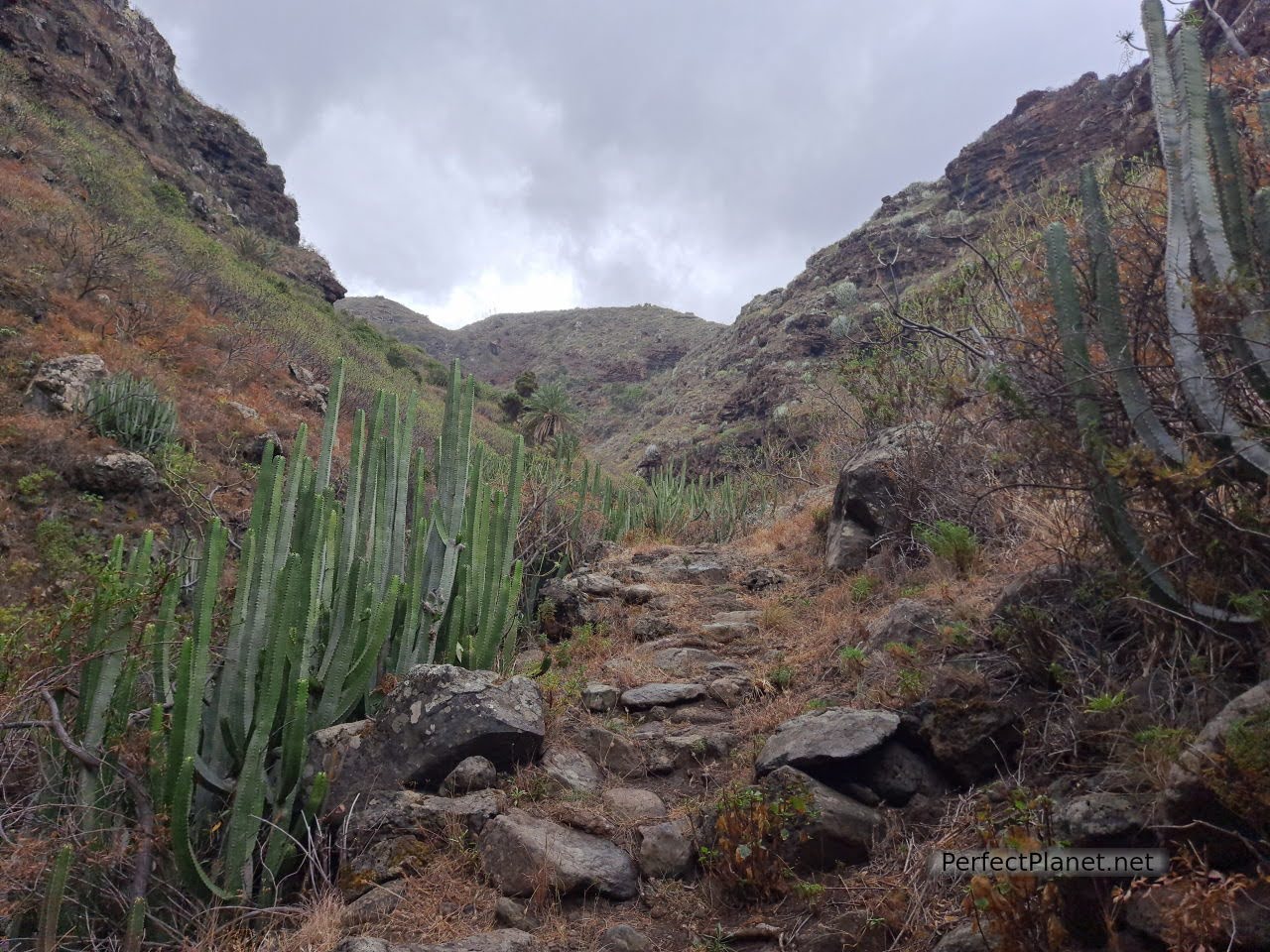
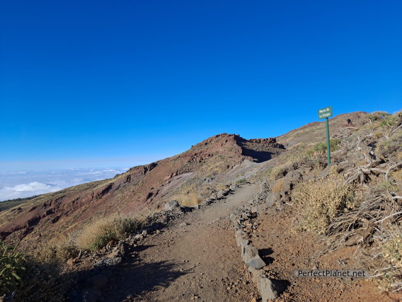
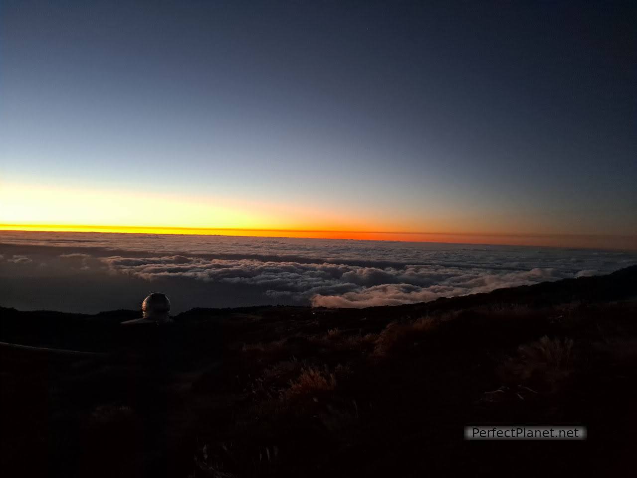
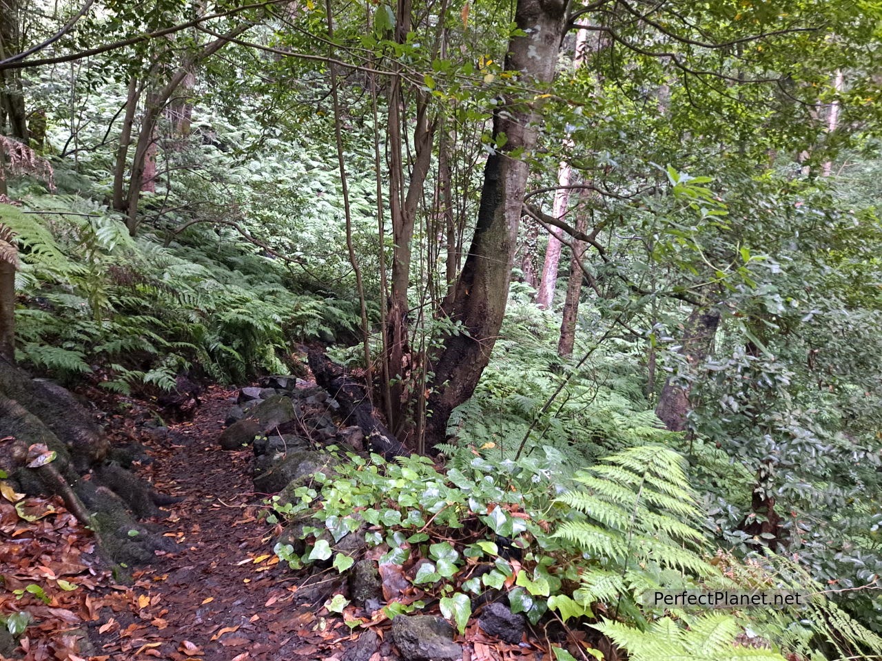
Day 6. Cubo de la Galga, San Bartolo viewpoint, La Nieve peak.
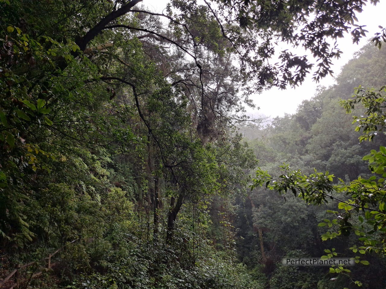
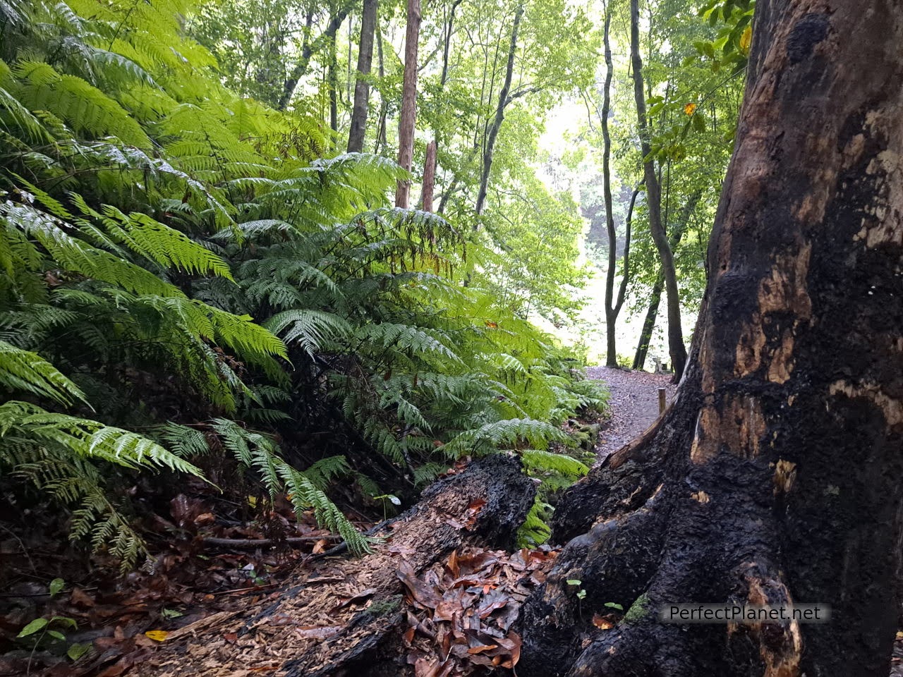
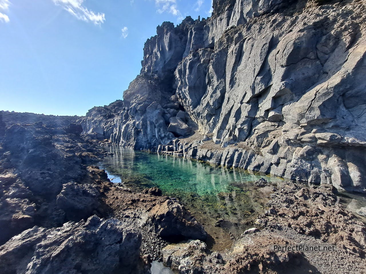
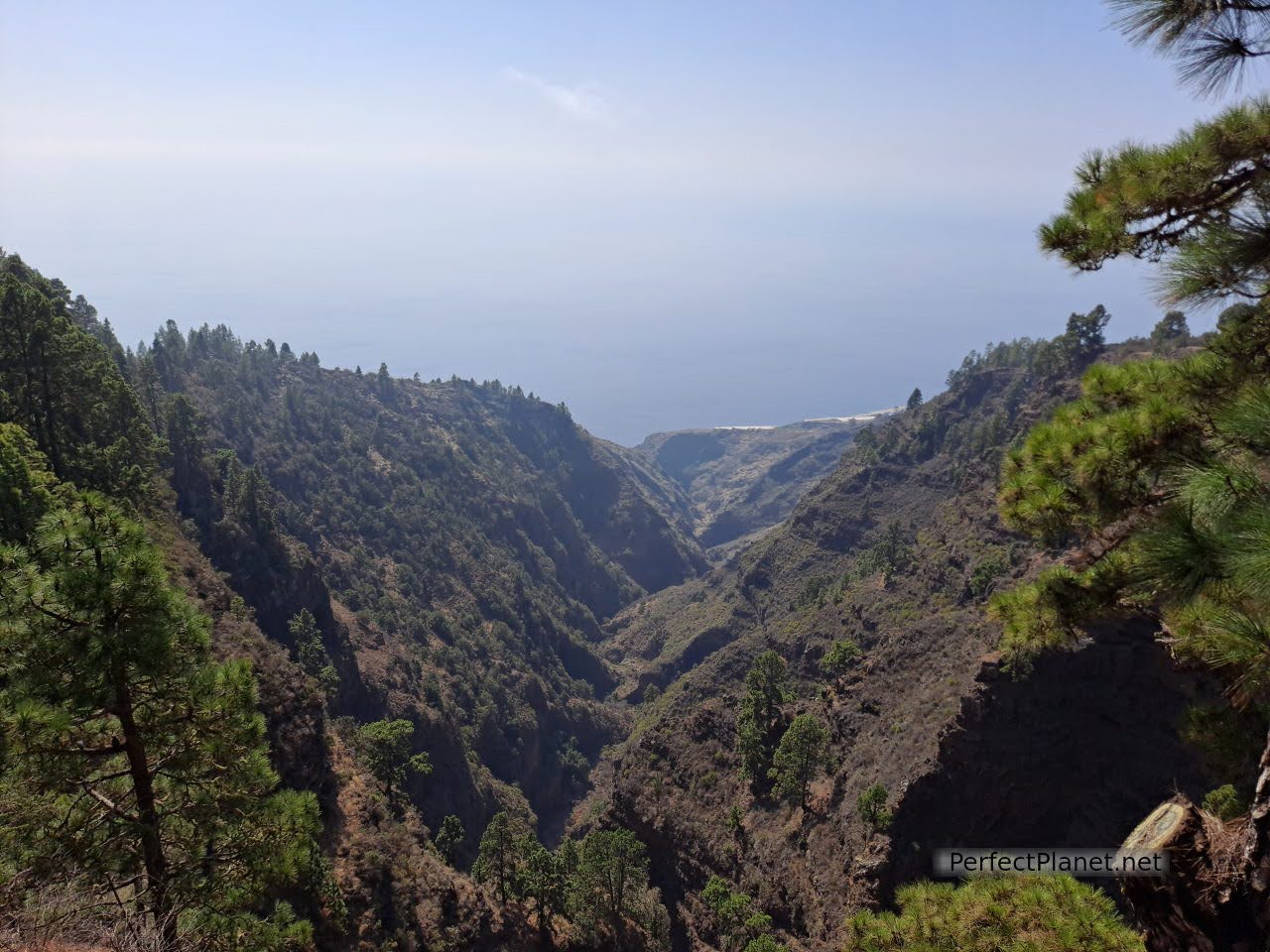
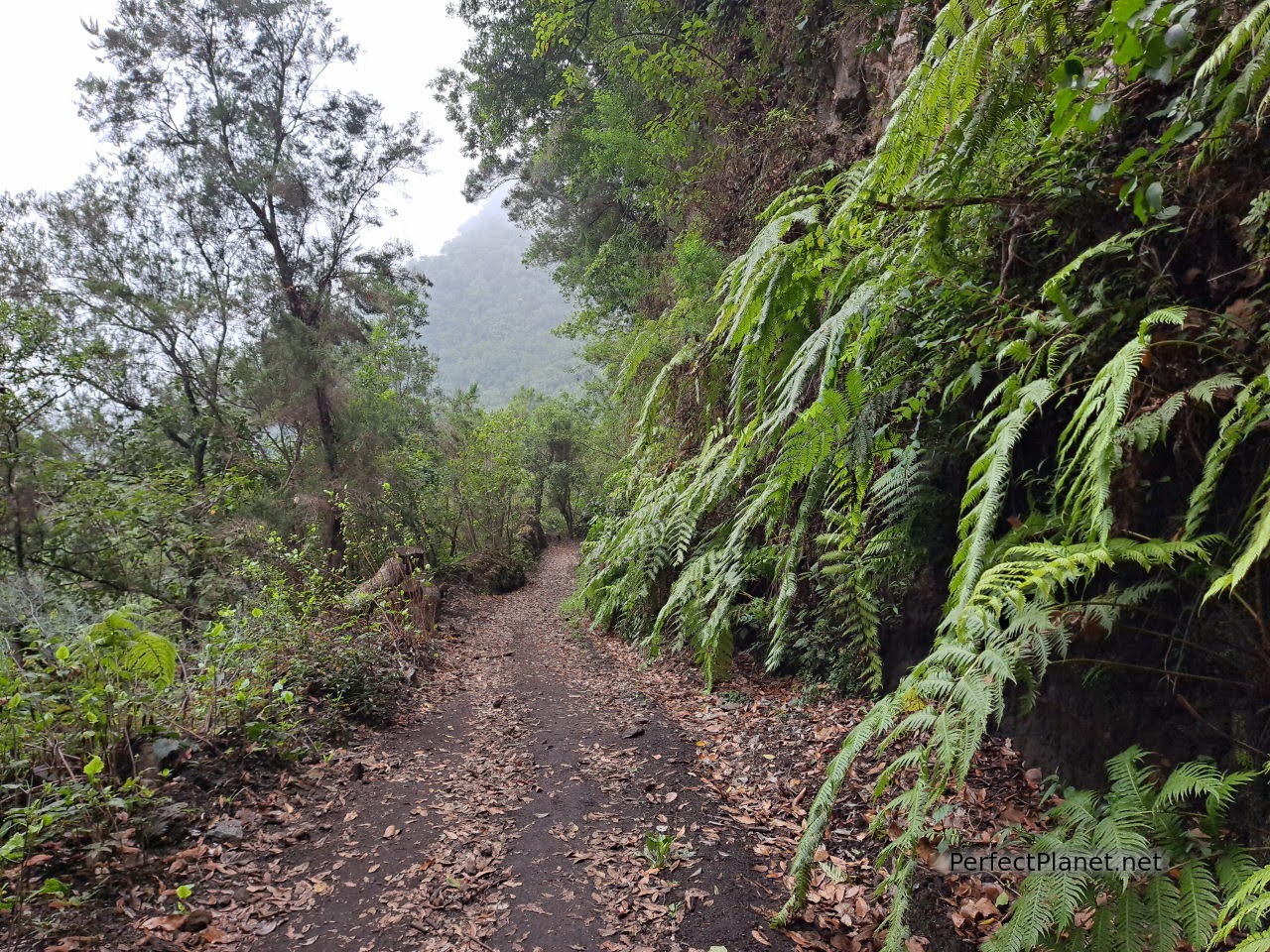
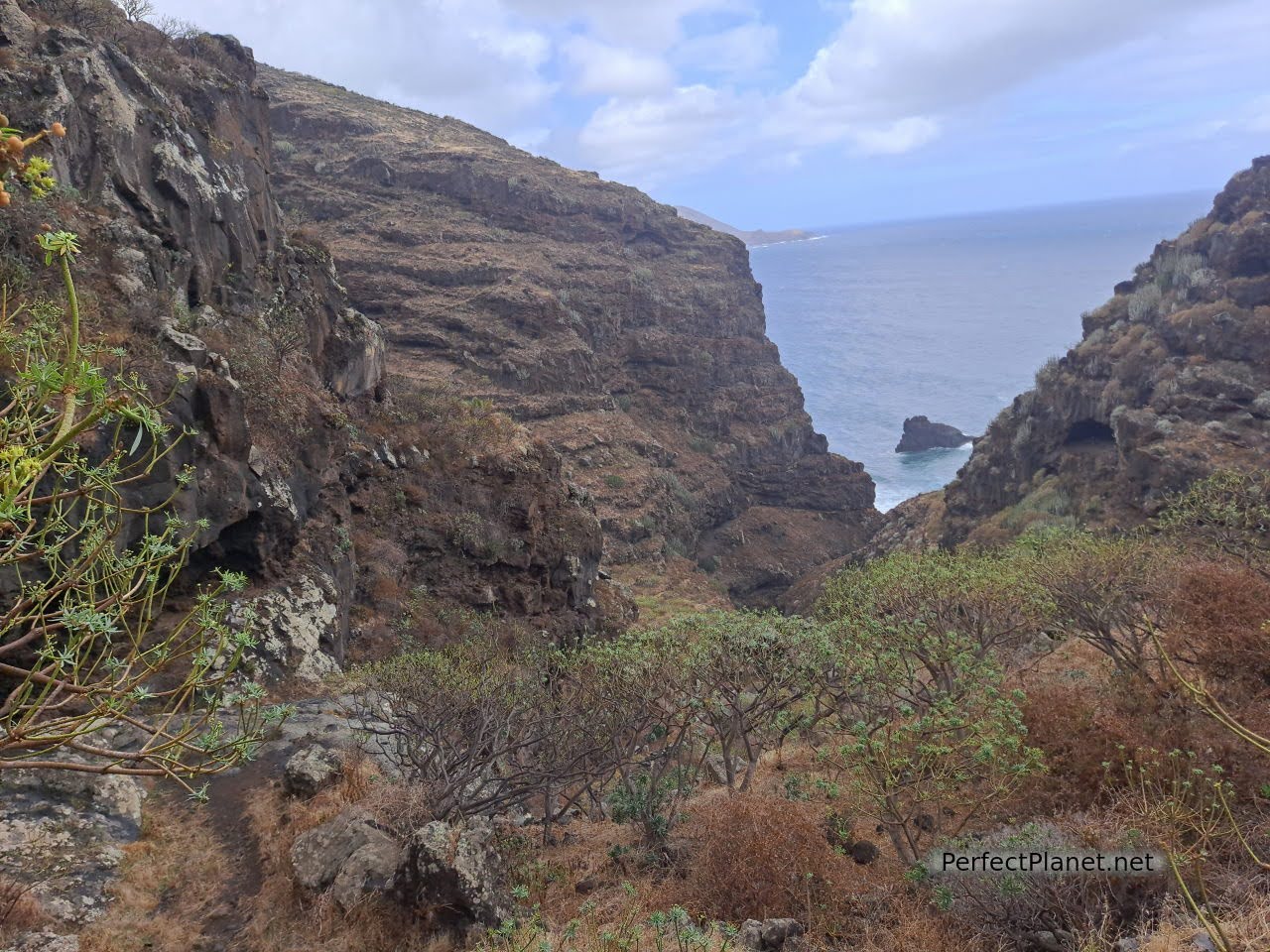
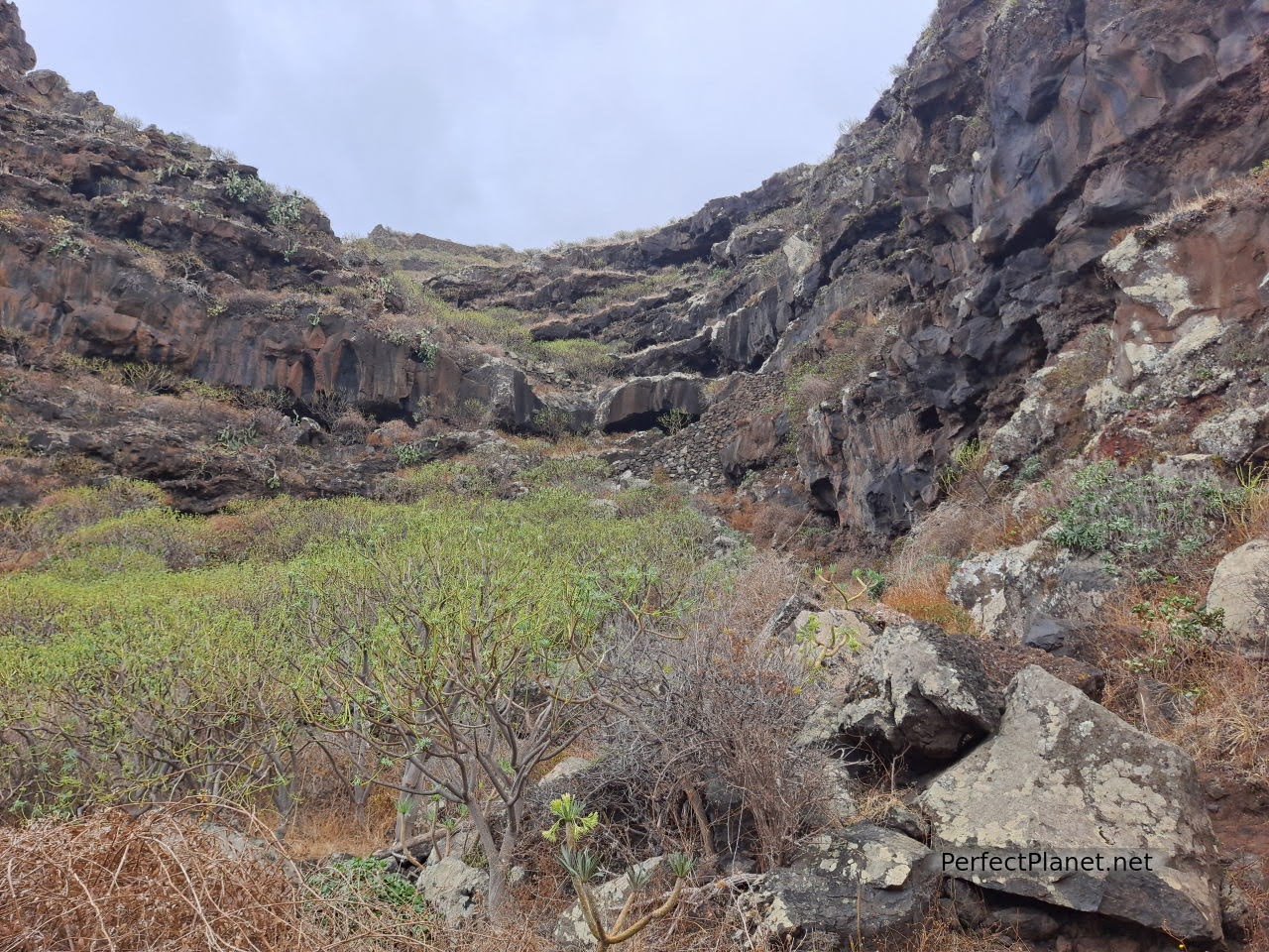
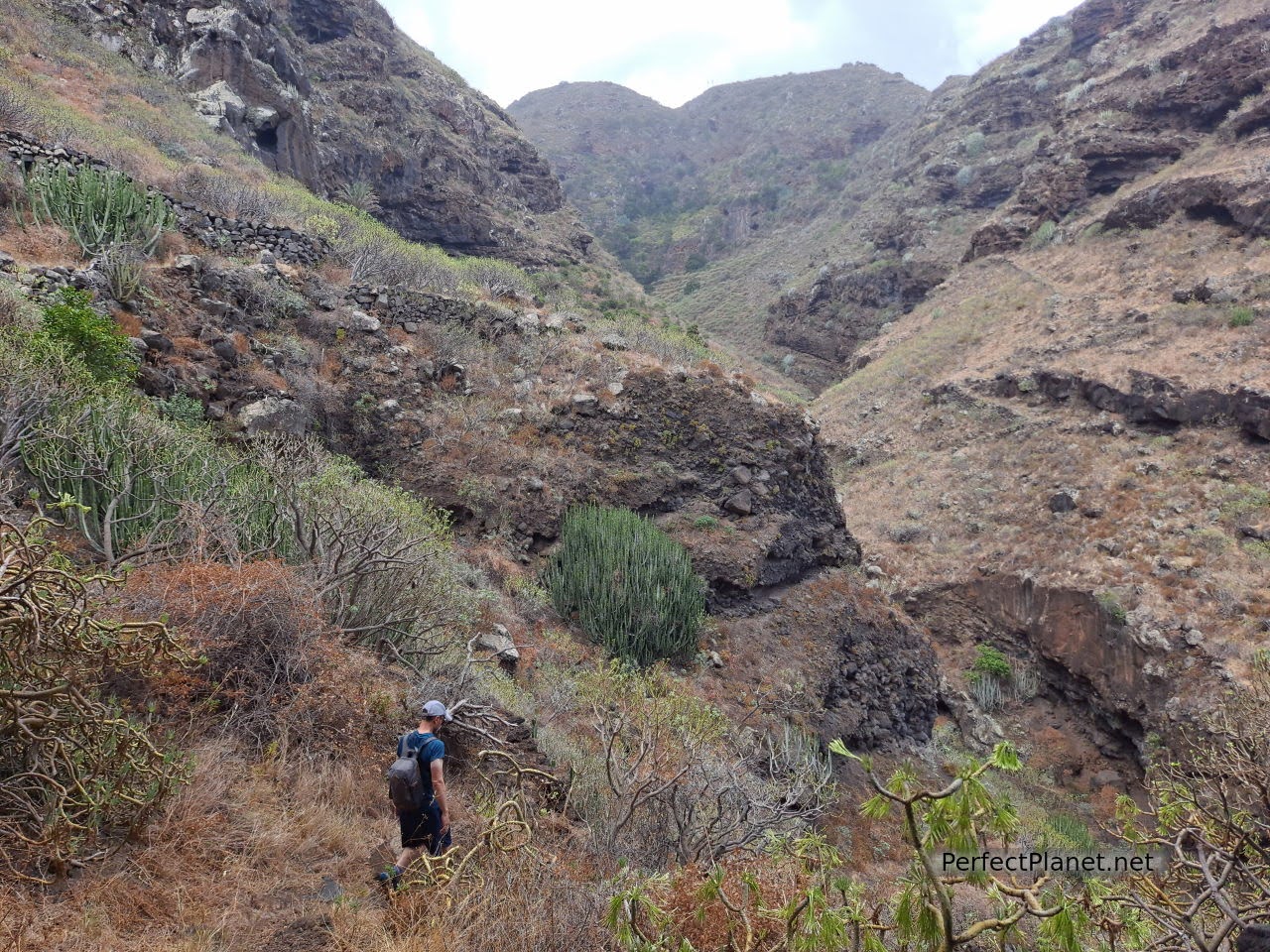
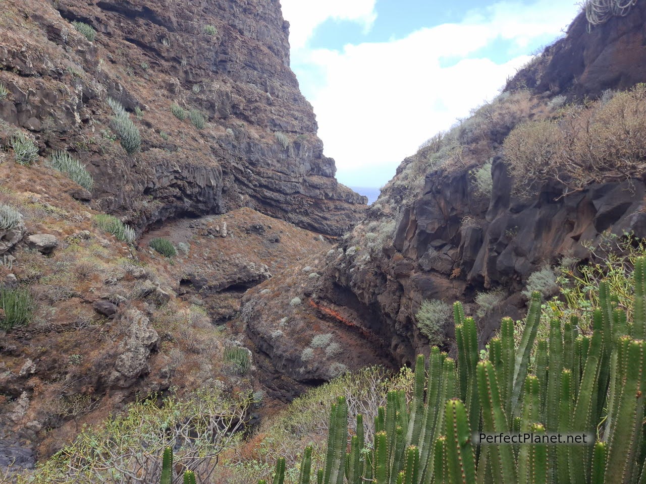
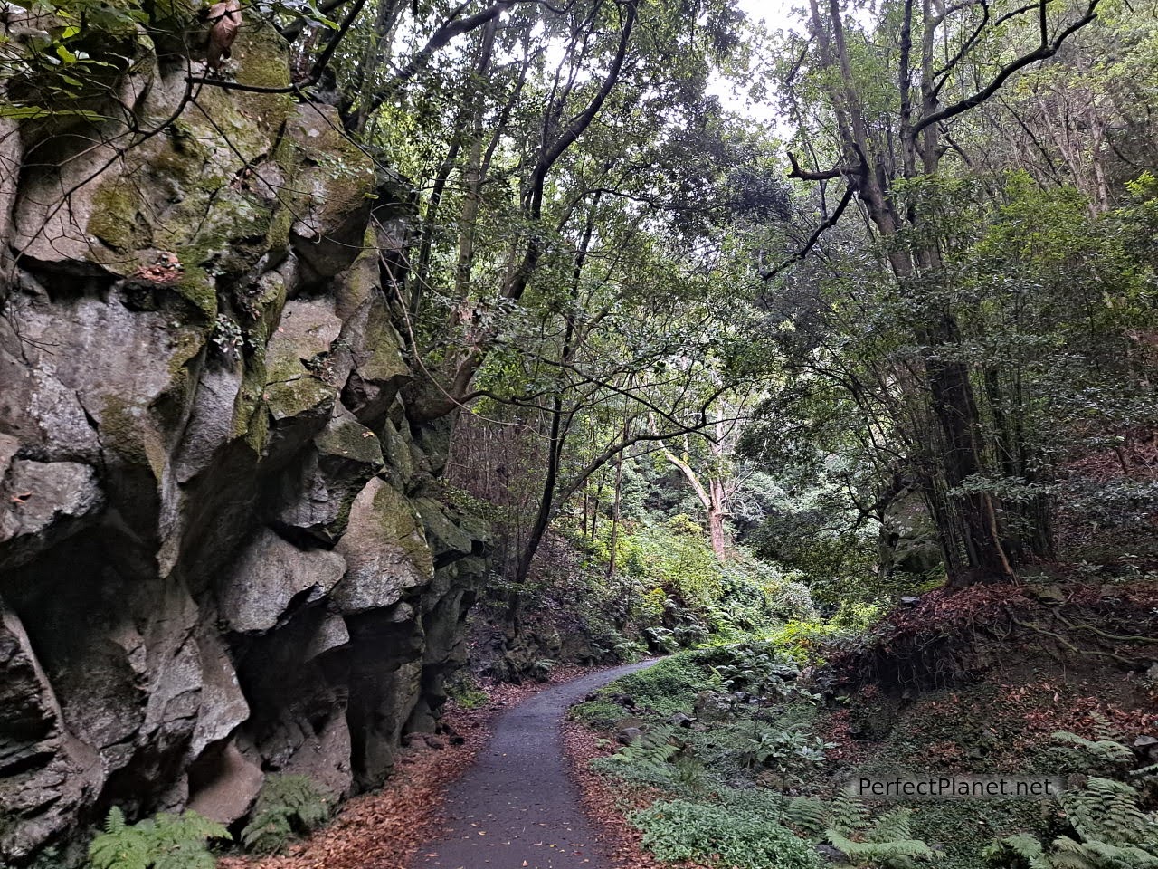
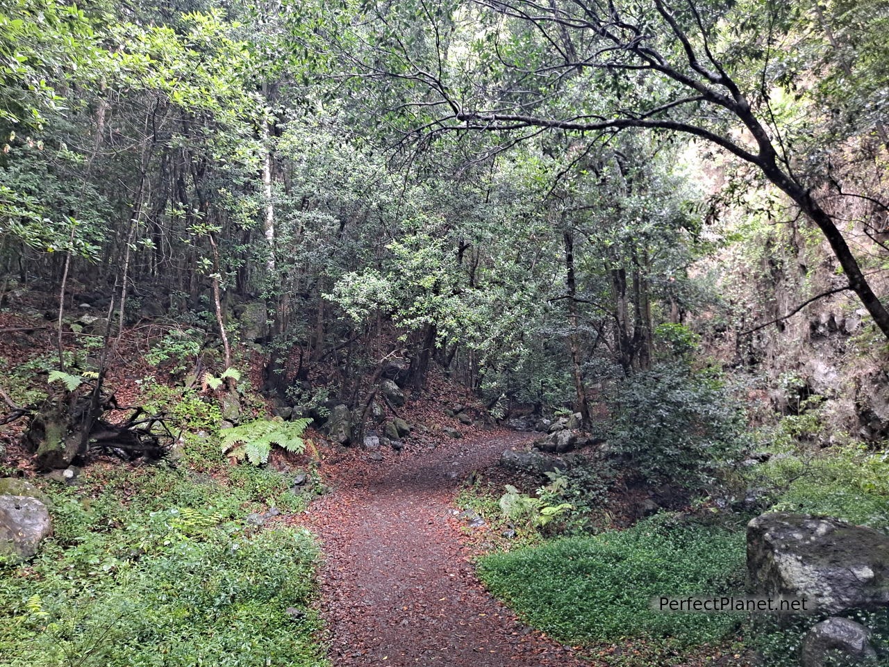
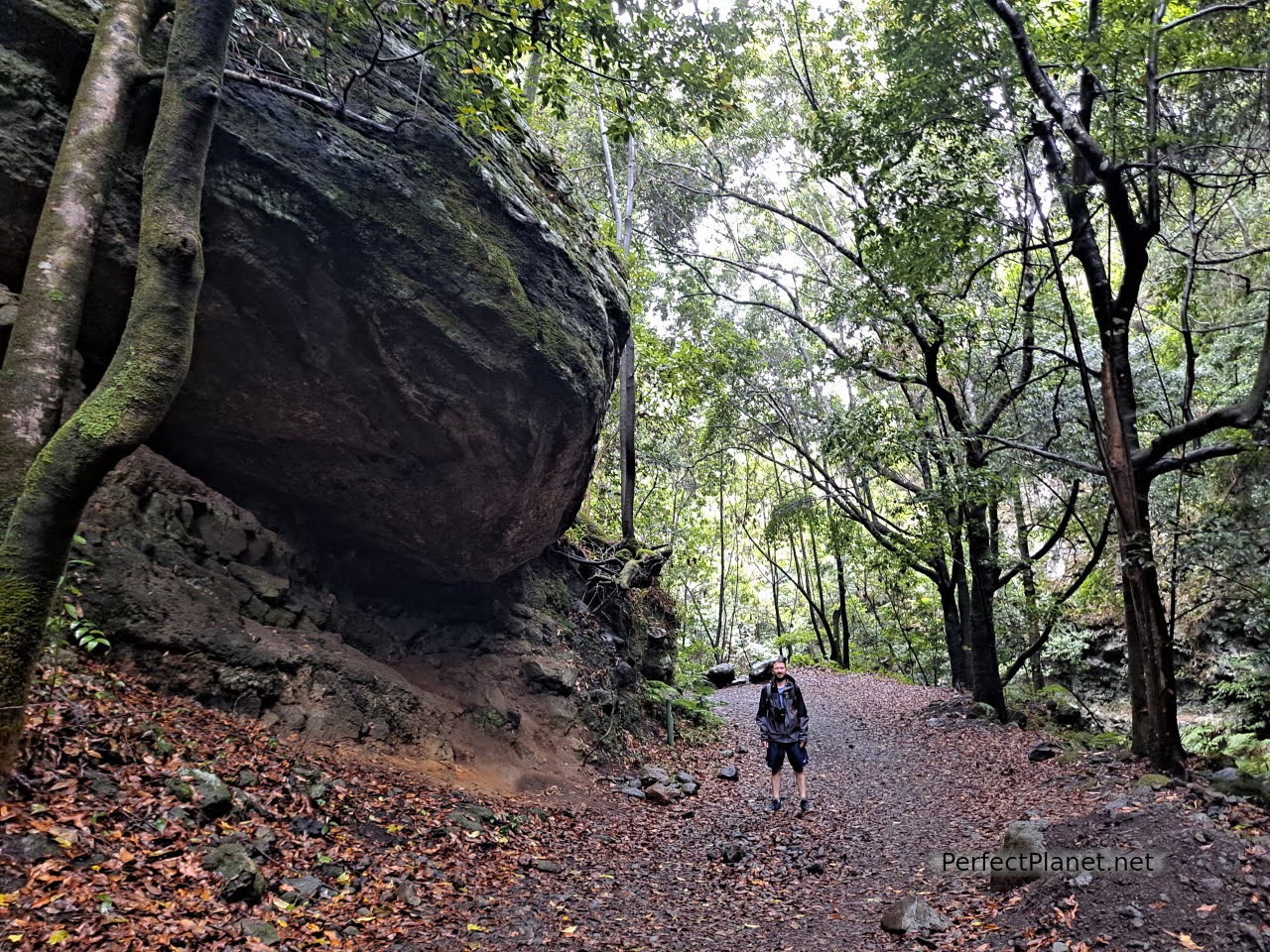
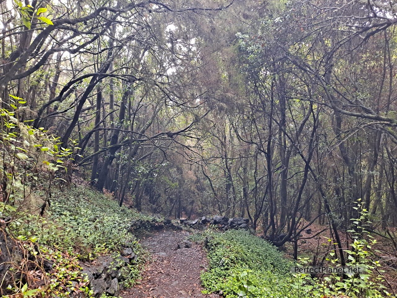
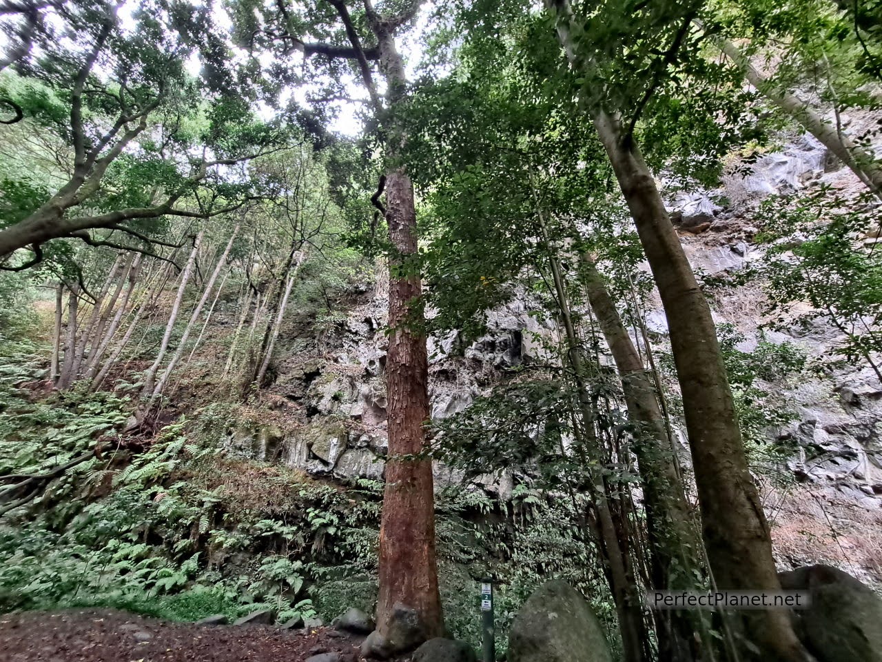
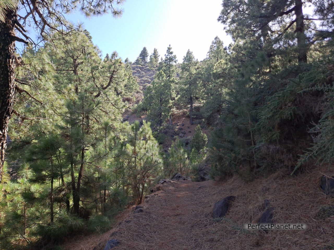
Cubo de la Galga is one of the most spectacular routes on the island of La Palma. The humid atmosphere of this rainforest makes it one of the places that impressed us the most, it seemed to transport us to other forests in distant countries in Central America or Southeast Asia.
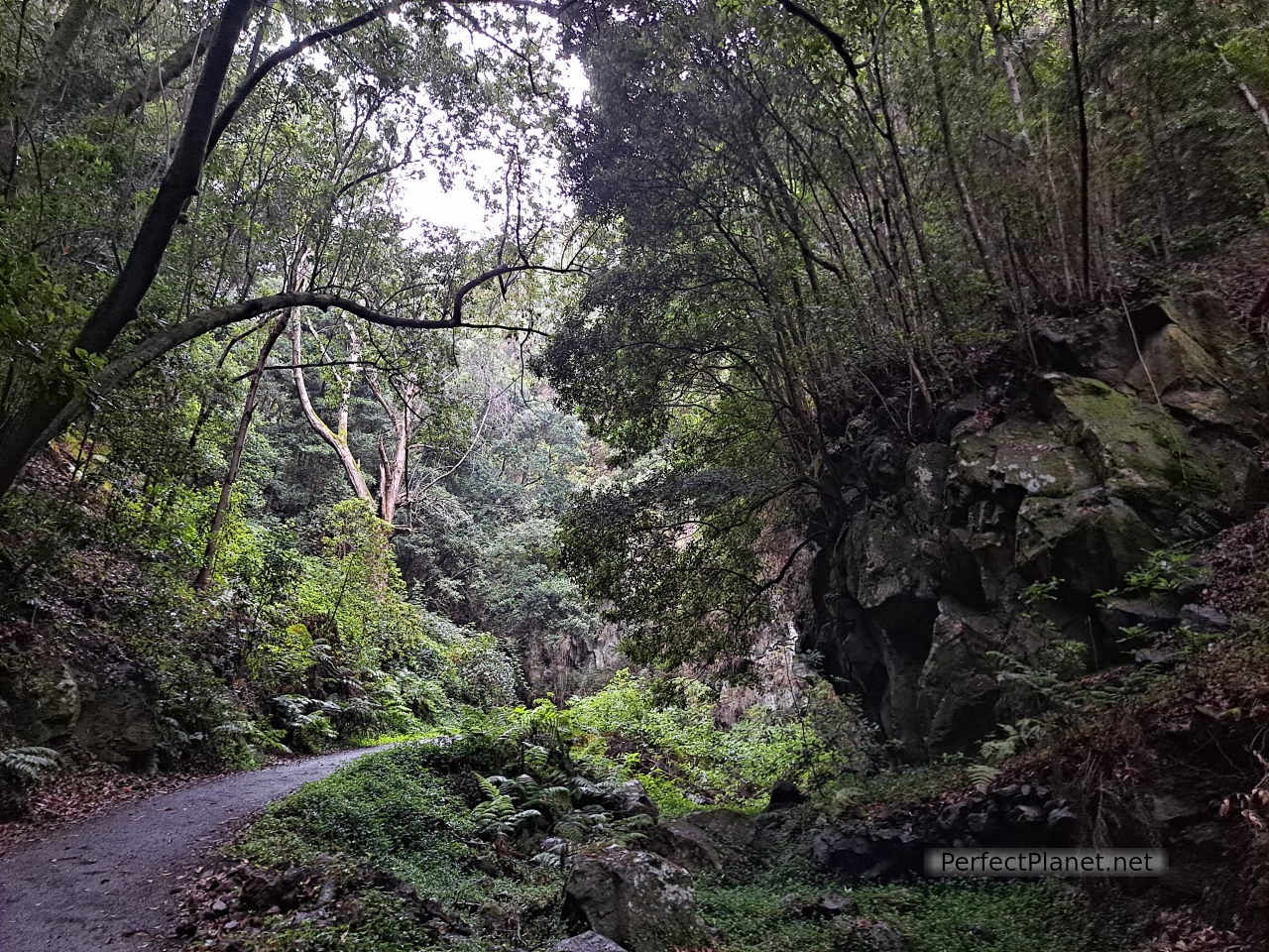
Cubo la Galga
Cubo la Galga
The access by LP1 road, about six kilometres from Puntallana, is located between two tunnels, although it is well signposted. There is a car park and an environmental information booth where you can get a map. There are several numbered points along the way that serve as self-guides and the map gives you explanations about each point. The guy at the information booth is charming and you can ask him about other areas of the island.
Cubo la Galga
Cubo la Galga

Cubo la Galga
Cubo la Galga
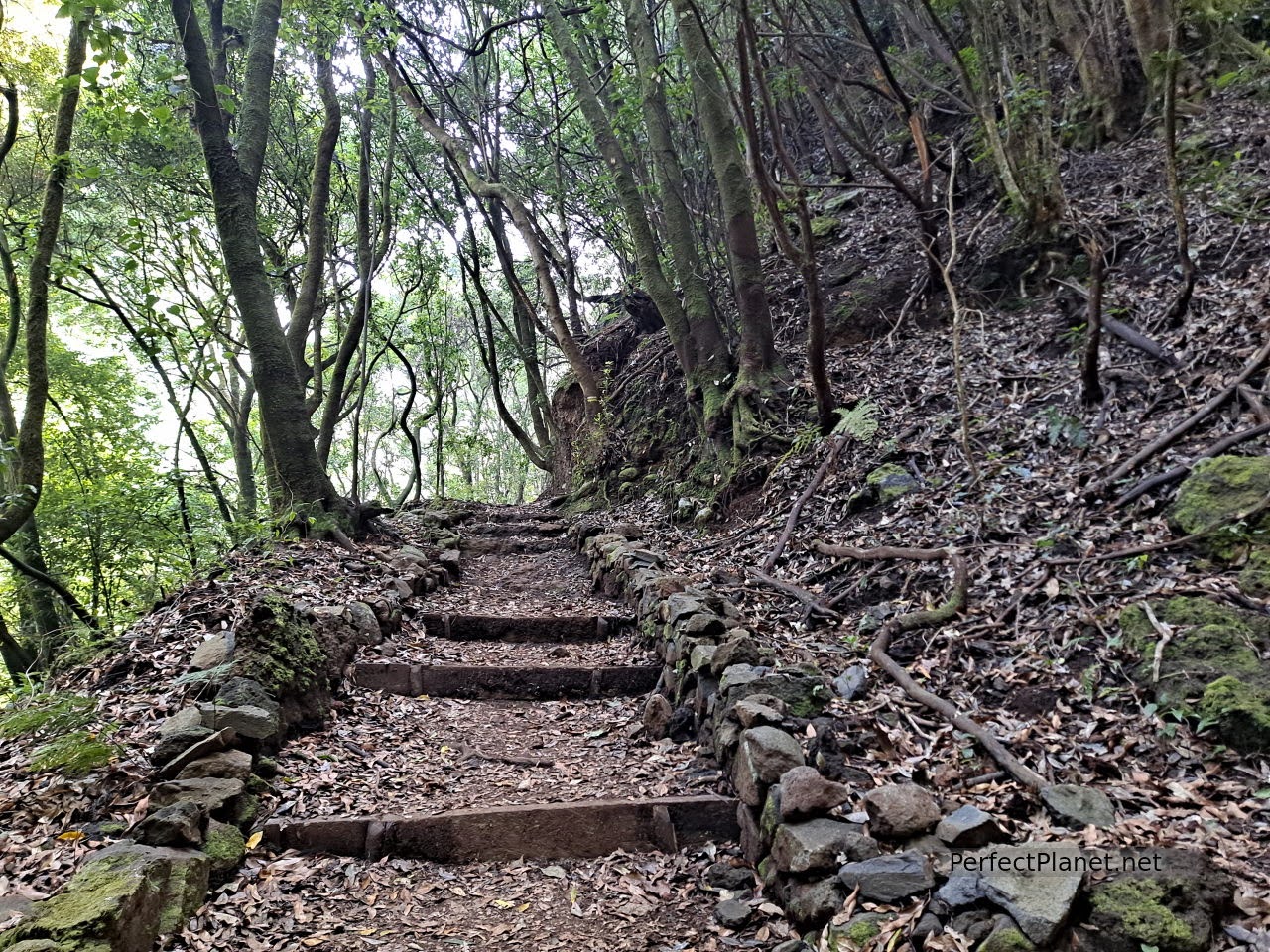
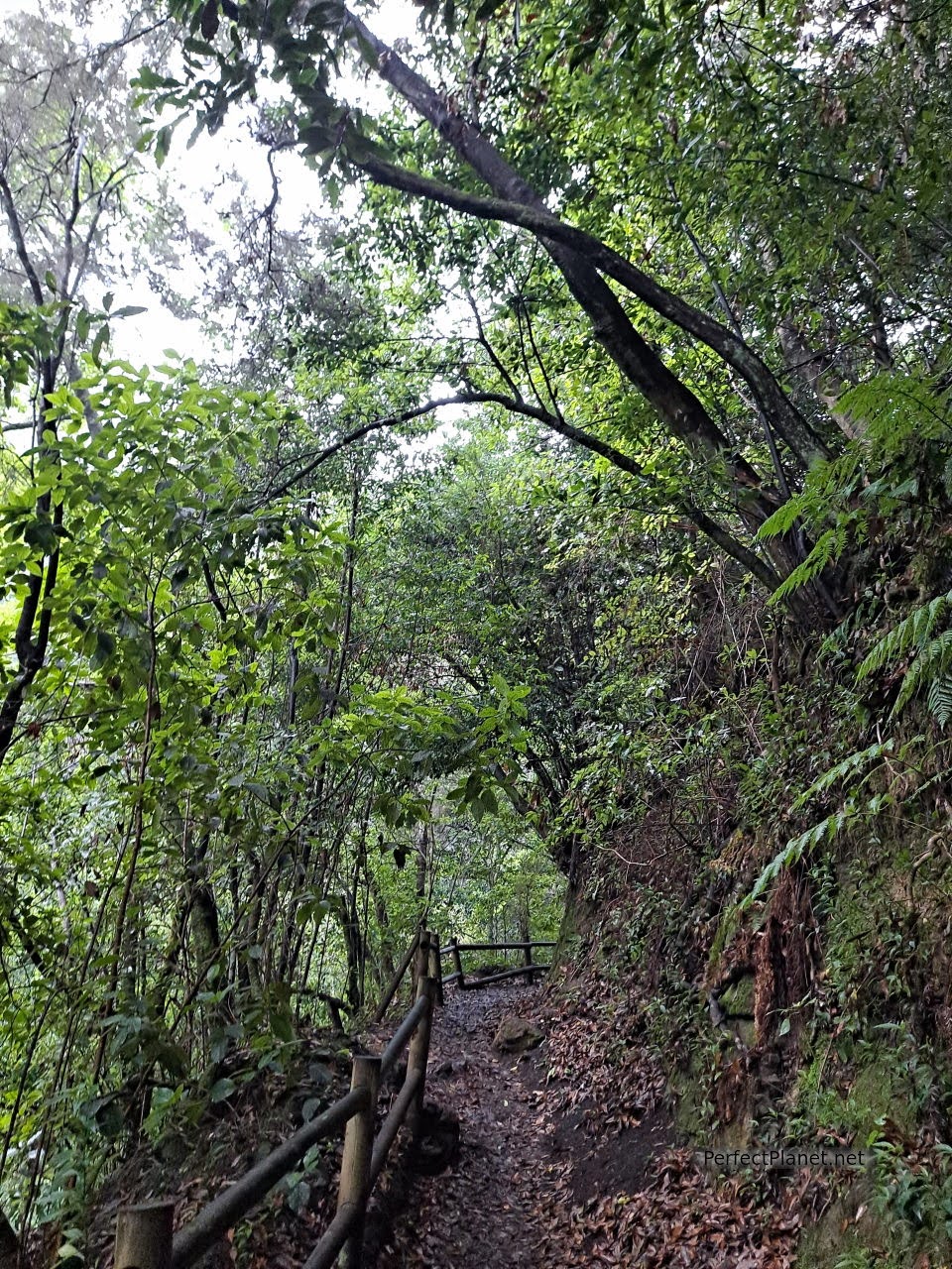
There are two routes, a long one and a shorter one of just 2 kilometres, we recommend the longer one that goes up to the viewpoint of Somada Alta.
The route starts at the car park. Little by little you enter the laurel forest that grows on both sides of the Galga ravine. The greens are so intense that you will be amazed.
Cubo la Galga
Cubo la Galga
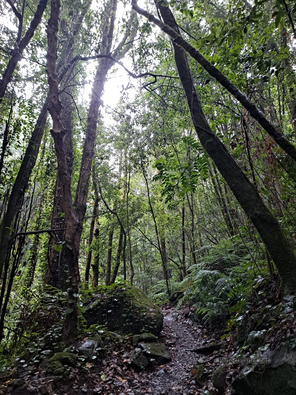
Cubo la Galga
After a couple of hundred metres there is a sign indicating La Galga on the left hand side, do not take it, go straight on until you reach the end of the numbered marks.
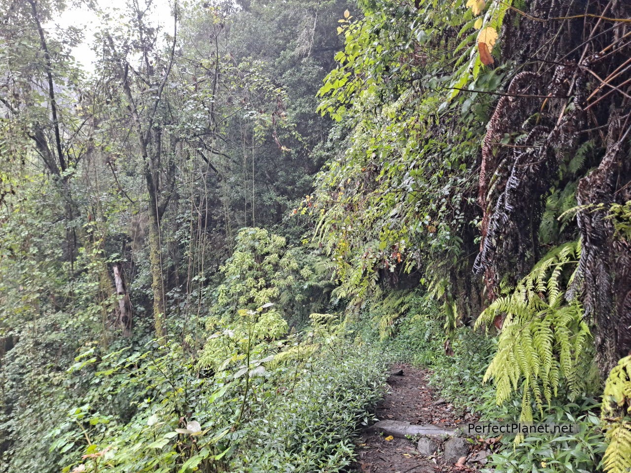
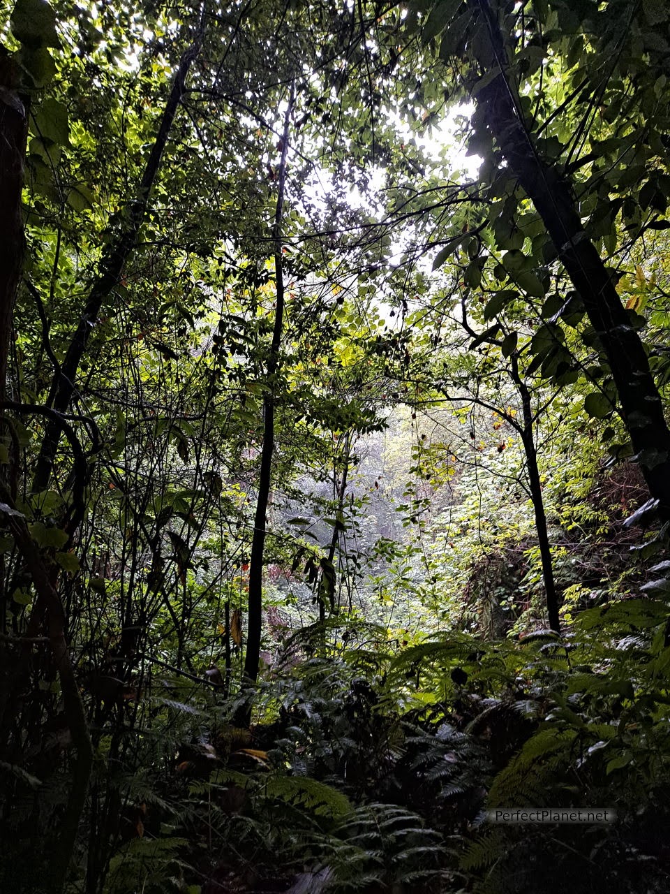
Once here, take the path on the right to go to the viewpoint of Somada Alta, you will be amazed by the size of the ferns and how the vegetation melts and becomes so thick that it is practically impossible to see anything but forest, the chirping of birds and, if you are lucky like we were, the sound of the rain. It is as if you were in the jungle of Central America or Southeast Asia, except that here there are no monkeys flying overhead.
Somada Alta viewpoint
Cubo la Galga
Cubo la Galga
Species endemic to these islands such as the viñátigo, the til or the barbuzano, and birds such as the Canary Island pigeon make this a unique place.
The photographs speak for themselves, you have to come and discover it.
Cubo la Galga
Type of route: circular.
Difficulty: low.
Distance: 10 kilometres.
Tips: good shoes and water.
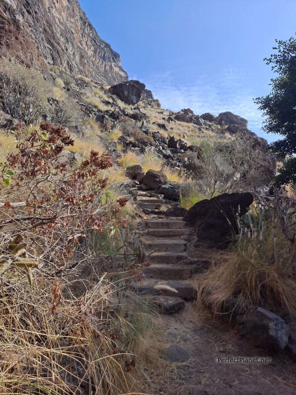
Nearby, about two kilometres away, is the San Bartolo viewpoint, which offers beautiful views of the area.
Hermitage of San Bartolo
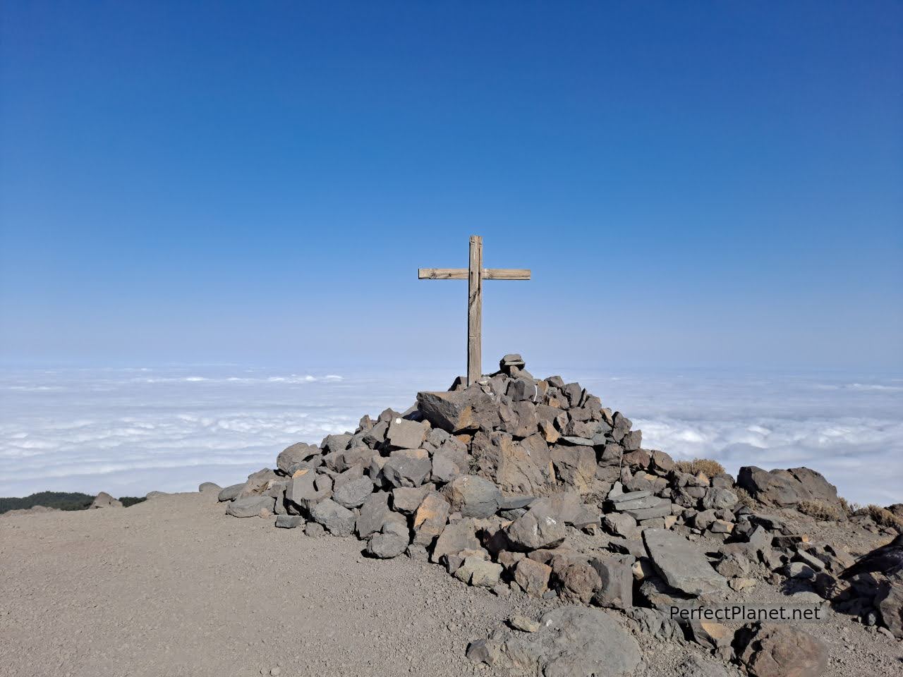
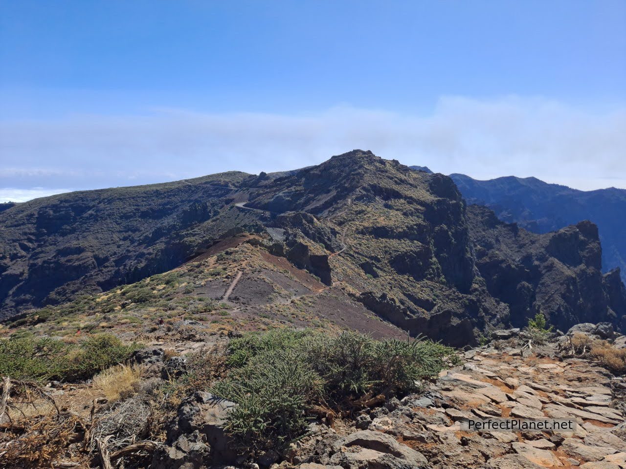
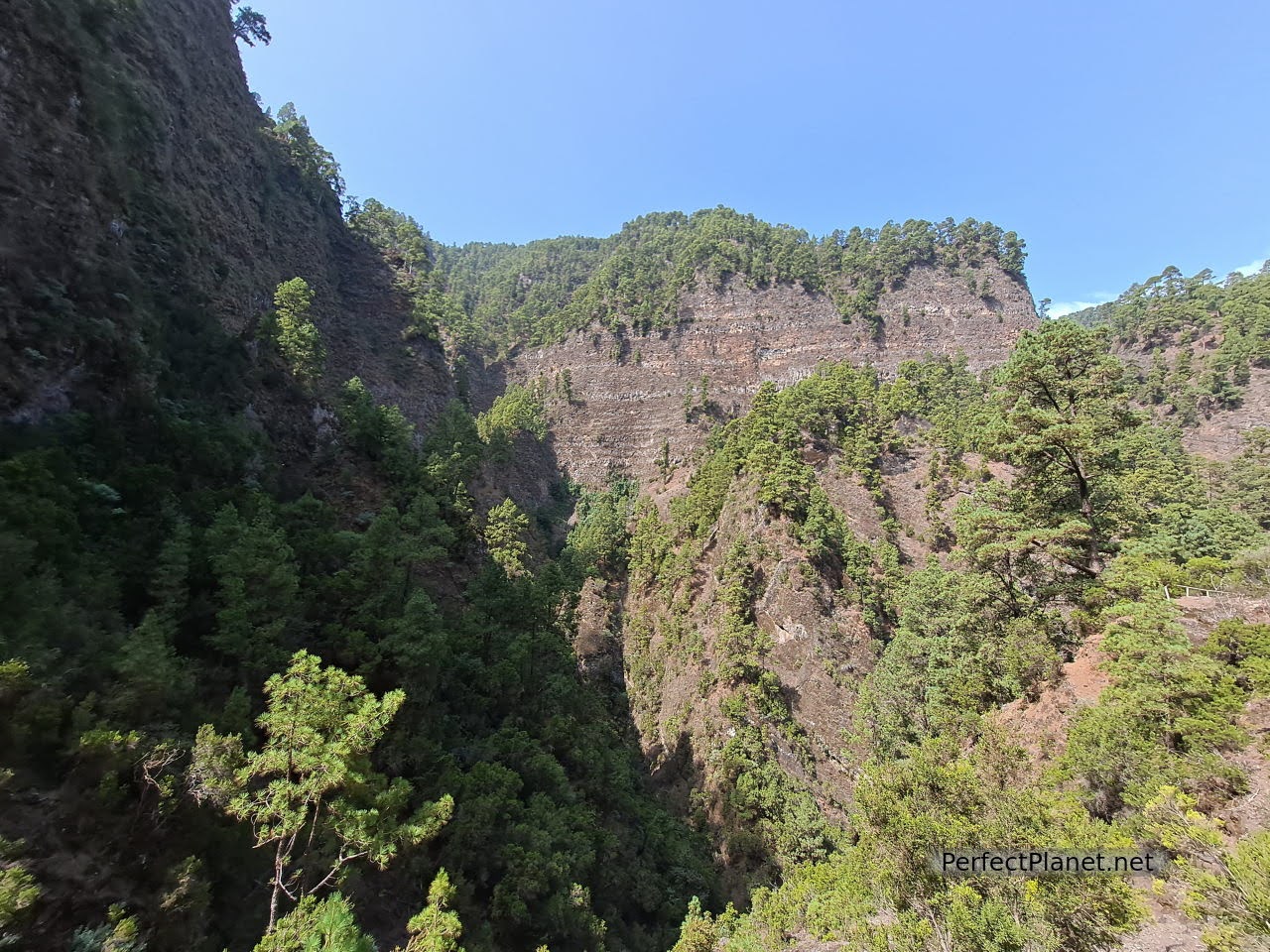
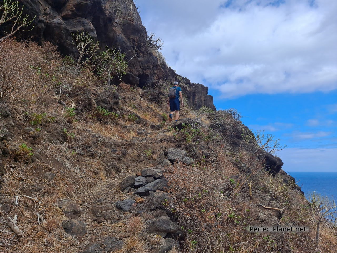
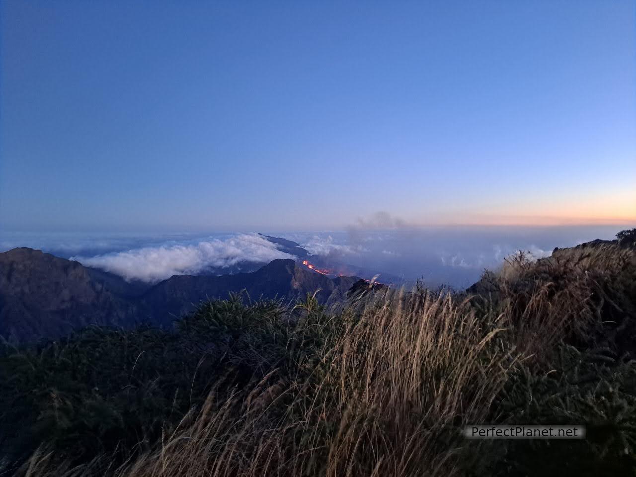
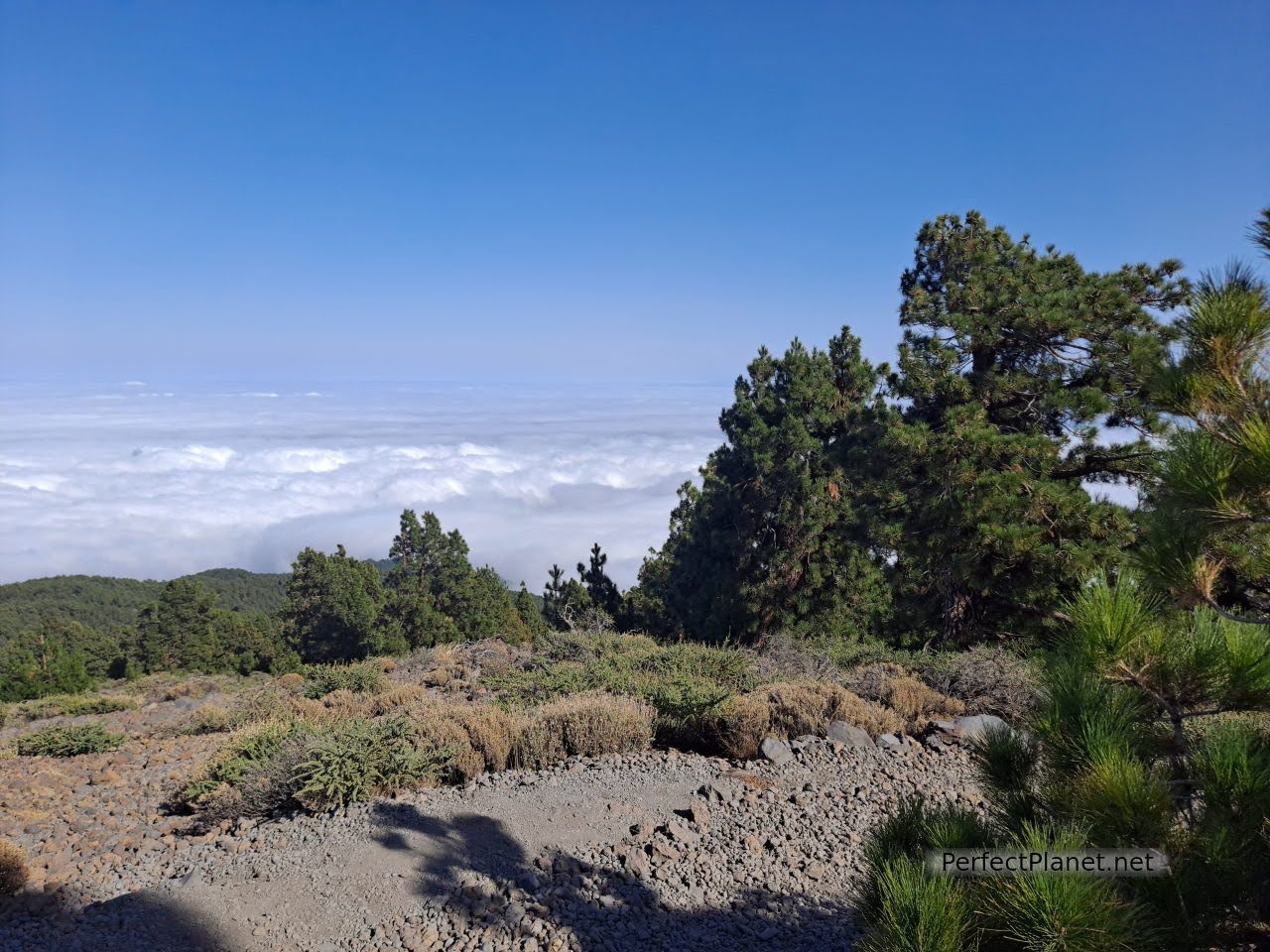
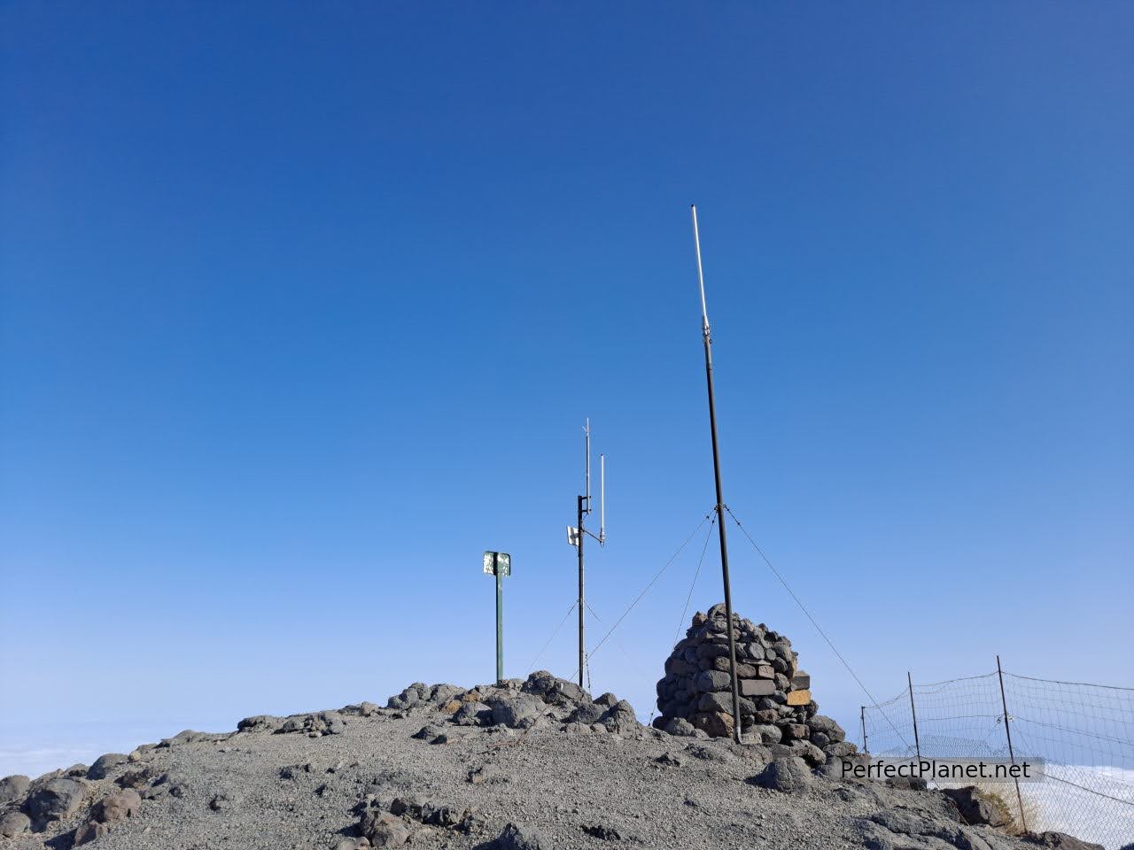
As we are a bit restless and it is our last day on the island, instead of going to rest we decide to complete the day by doing another spectacular route, the ascent to the peak of La Nieve in the La Nieve Natural Park.
Ascent to Nieve peak
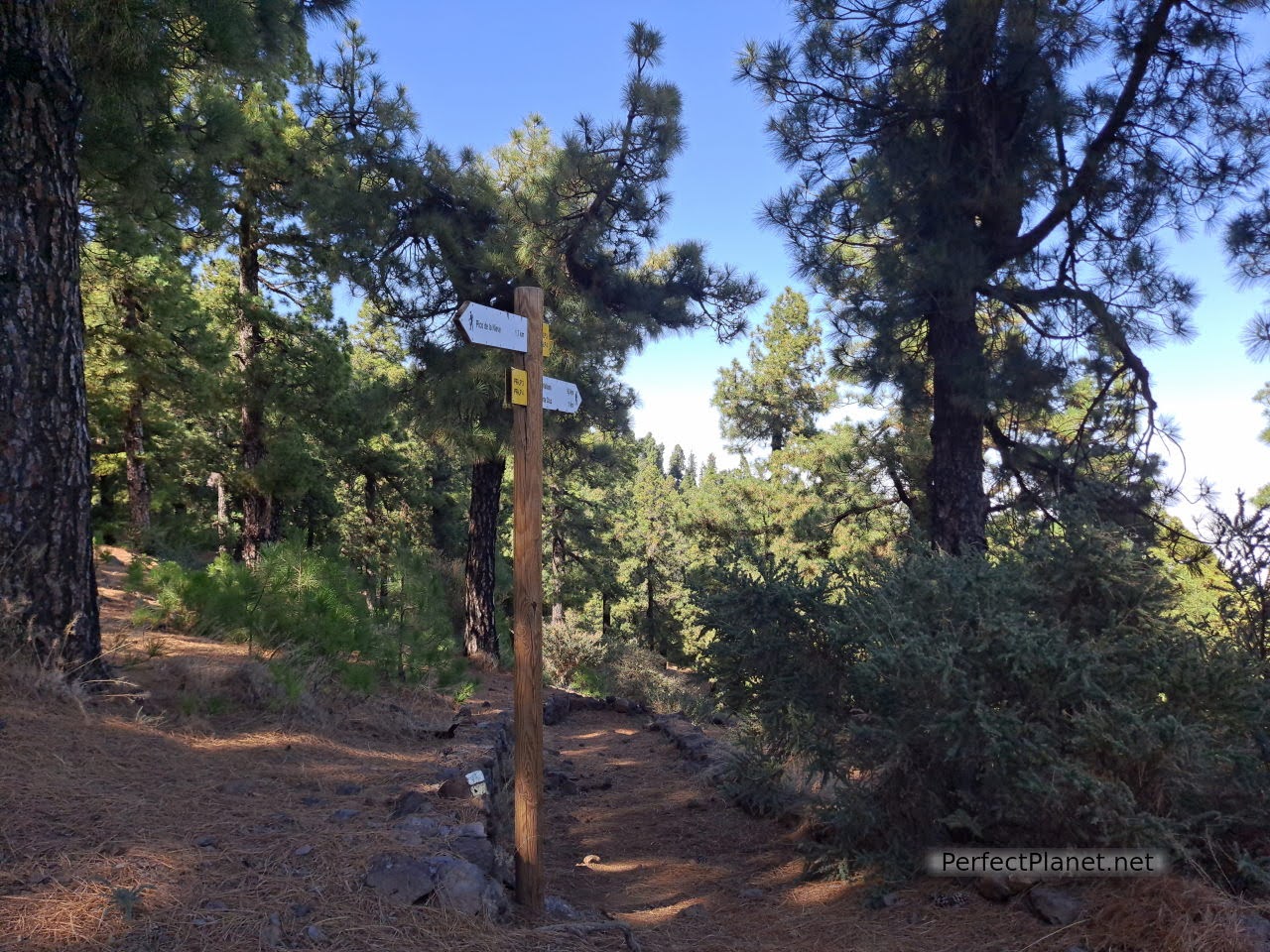
There are several options, you can get there from the Cruz peak by taking the crest route (15 kilometres one way), you can climb from Santa Cruz, from Breña Alta or from the LP4 at the signposted car park (6 kilometres round trip and 250 metres of ascent) as we did.
Ascent to Nieve peak
Ascent to Nieve peak
Teide in the background
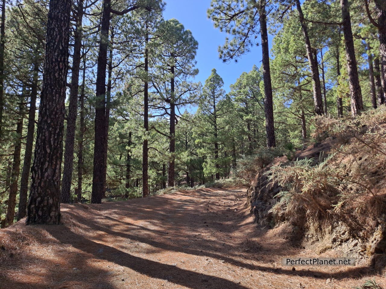
The path is very easy to follow and is well marked. We start in a spectacular Canary Island pine forest. It is said to be one of the most fire-resistant species of pine because it is capable of maintaining living cells inside the wood. Practically the whole area is prepared with hydrants to suffocate possible fires.
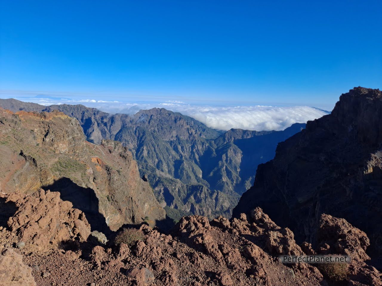
Cumbre Vieja volcano

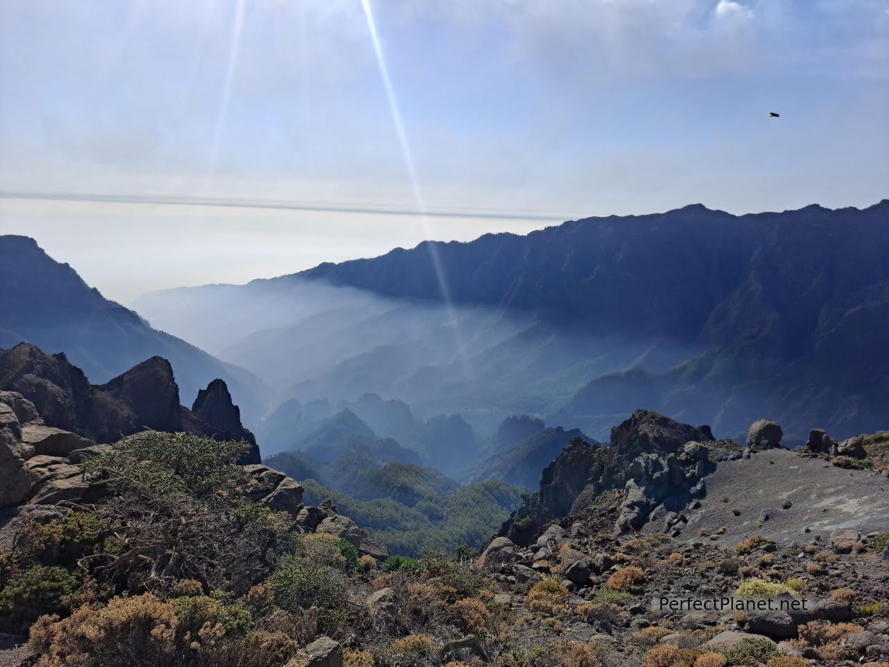
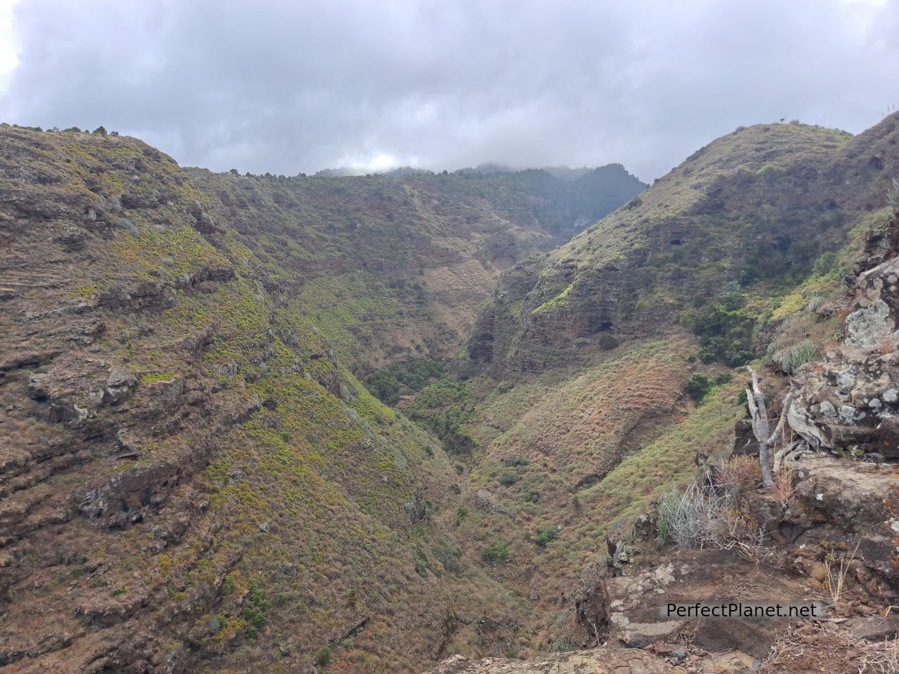
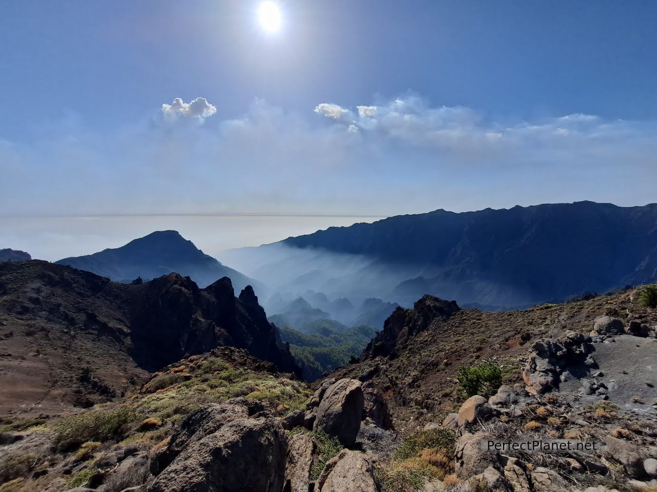
Caldera de Taburiente
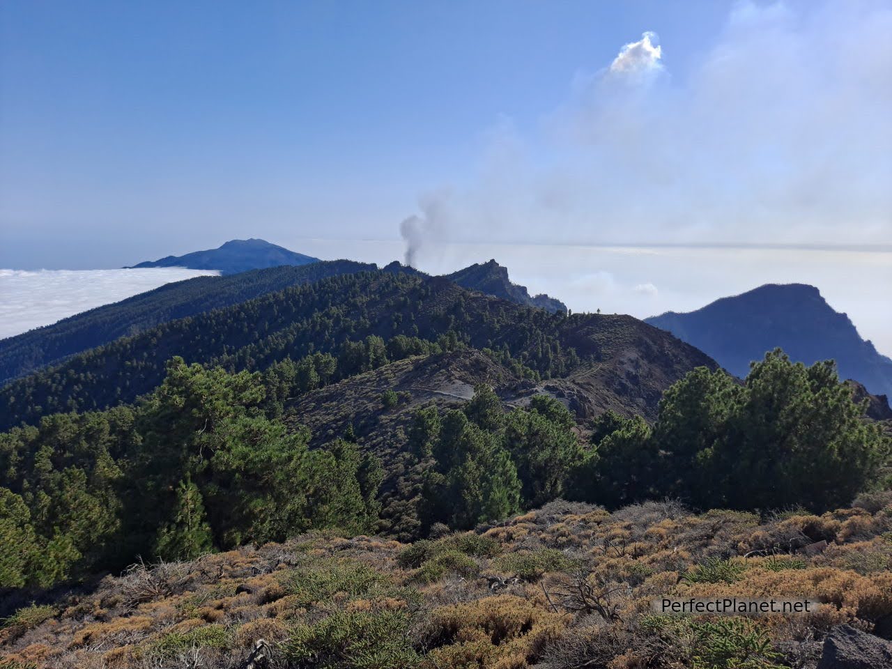
As we gain height the trees disappear. We can even see the Teide in a blur. The route crosses the GR131, which we continue along to reach the summit. A crow follows us flying between trees and information posts. As soon as he hears the sound of a bag he comes closer to see if we give him something. It is a beautiful, enormous specimen.
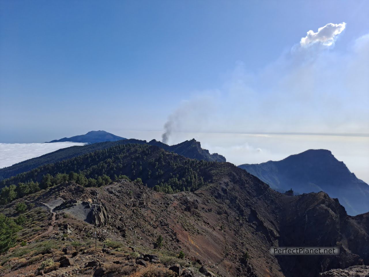
Cumbre Vieja volcano
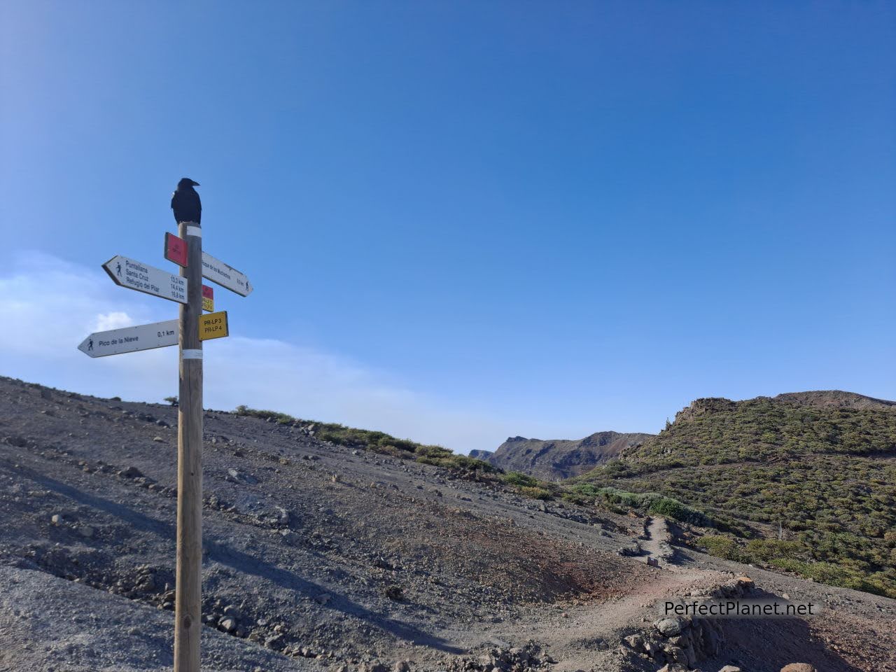
Gr131
We see for the last time on this trip the Caldera de Taburiente and the Cumbre Vieja volcano spewing out lava and ash. The sound is thunderous.
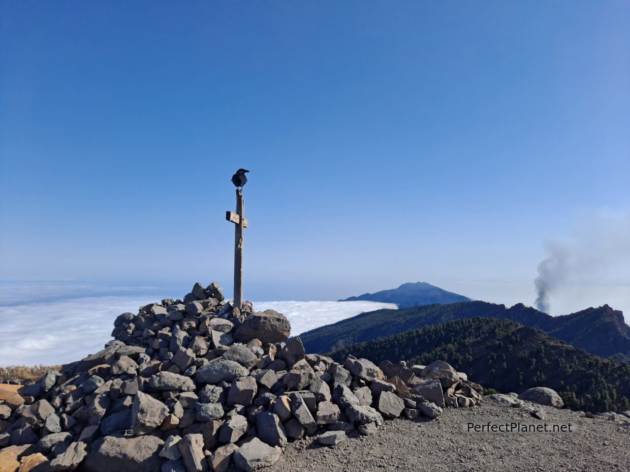
Nieve peak
Nieve peak
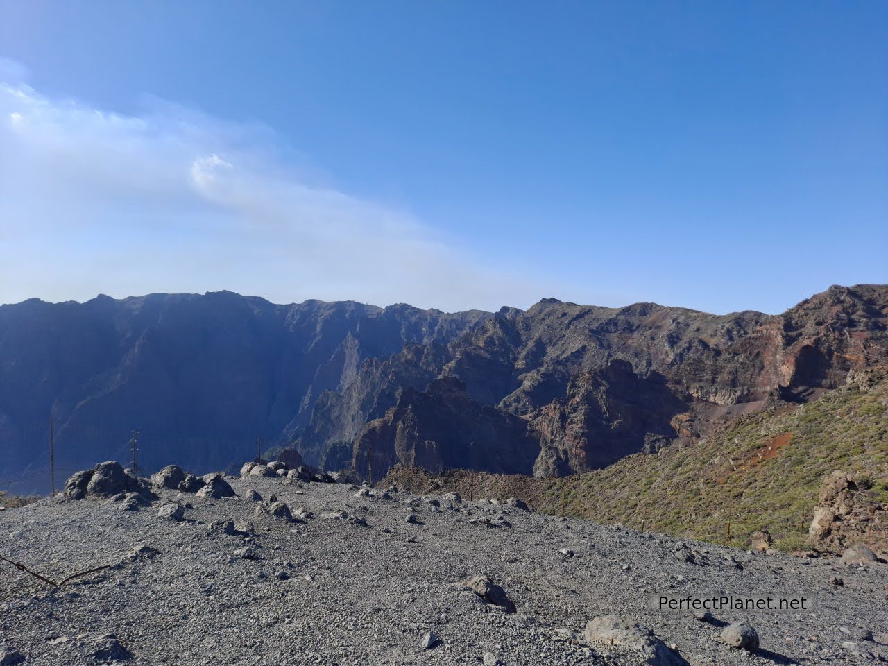
Caldera de Taburiente
Caldera de Taburiente
Wonderful views to end the day.
- Log in to post comments