The Redes Natural Park is a protected natural area located in the Principality of Asturias,
Redes
includes the councils of Sobrescobio and Campo and owes its name to the beech forest of Redes, located in the latter.
It was declared a Natural Park in 1996 and recognized by UNESCO as a Biosphere Reserve in 2001.
Redes
This spectacular place with microclimate, has numerous forests of beech, holly and oak where you can enjoy many trails and stunning waterfalls. It is home to a great diversity of fauna including brown bear, grouse and wolf.
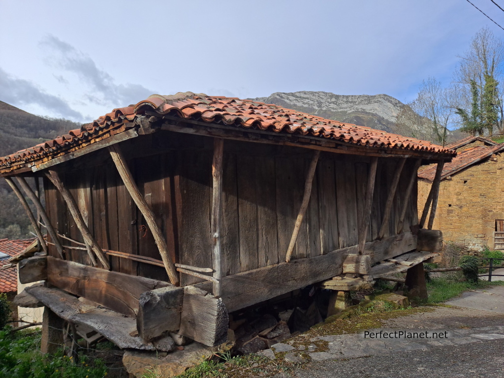
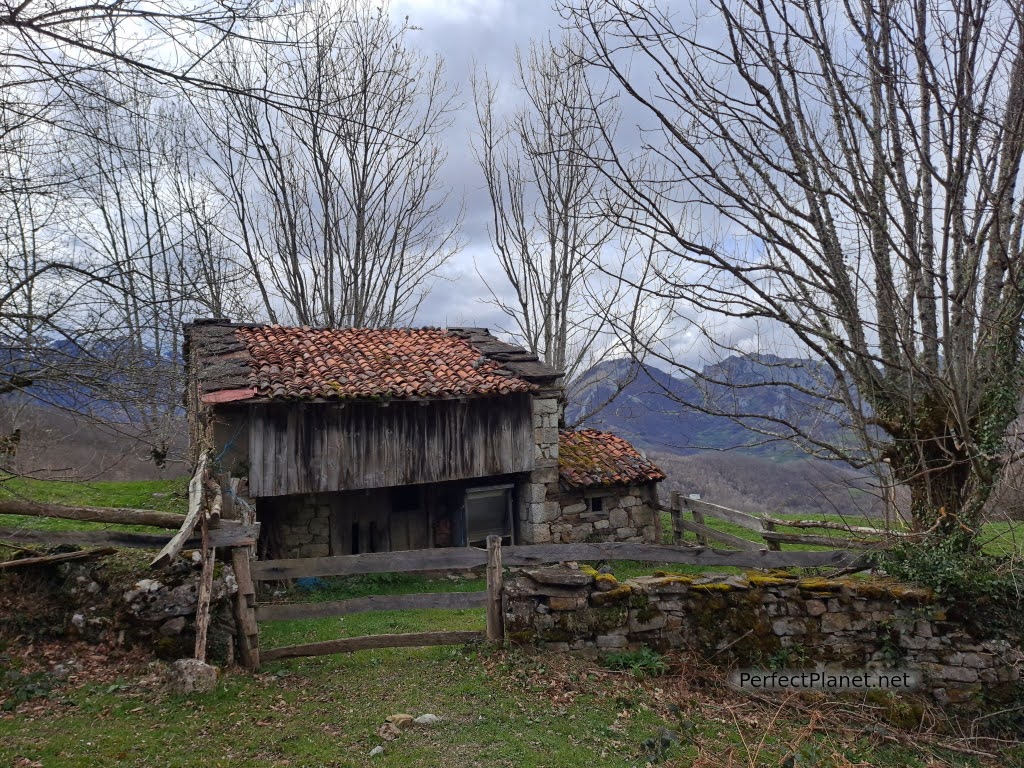
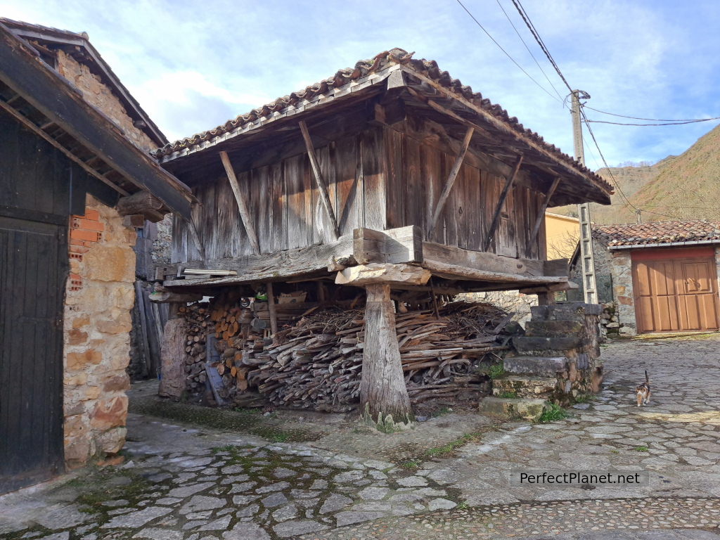
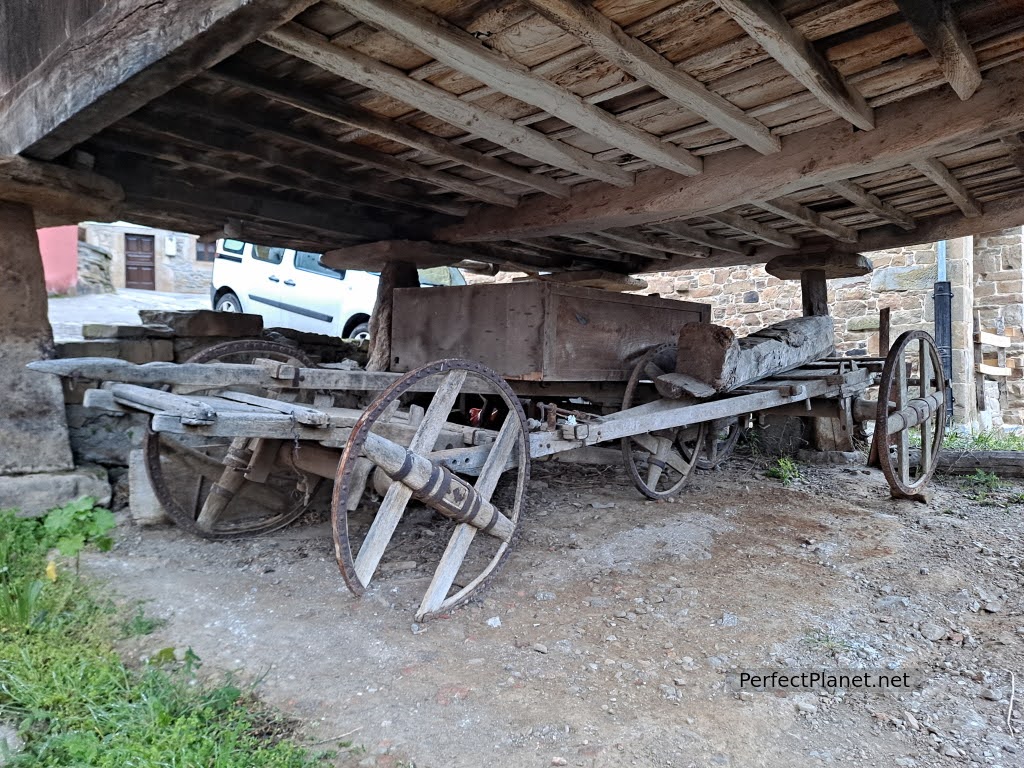
Granaries
An impressive place for lovers of hiking but also of the mountains, because although its main peaks are not very high (maximum altitude 2,104 metres, Torres peak), they are quite a challenge due to the difference in altitude to reach their summits.
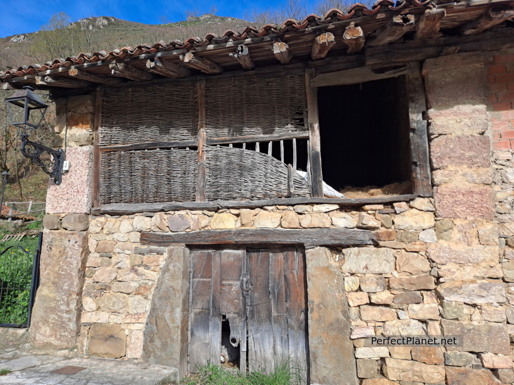
Its villages conserve traditional Asturian architecture with wooden hórreos (granaries) and constructions with cebatu walls, an interlacing of hazel sticks that are either exposed or covered with earth and lime to form a closed wall.
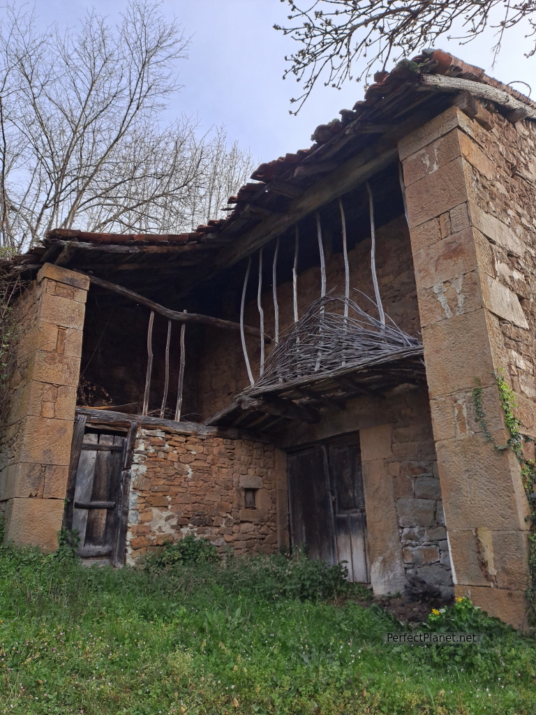
Cebatu
In some areas there are still vestiges of the mining era in the area, such as the loaders that you can see on the Alba route.
Cebatu
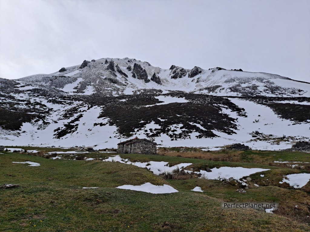
You can't leave Redes without tasting its casín cheese. Cheese made with milk from cows of the Casina breed, which graze in the high meadows in the summer, where the old buildings where the shepherds lived during the summer looking after the cattle are still preserved.
But if anything characterises this area it is the warmth and friendliness of its people who will clearly make you come back.
Granaries
Where to stay
We stayed in the rural house Los Cascayos. A beautiful cottage for 2 people located in the Asturian town of Abantro. Your hosts Diamantina and Manolo are amazing, they know the park like the back of their hand and will not hesitate to help you and even accompany you wherever you need.
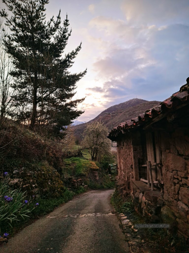
Abantro is a small village that still preserves many buildings of traditional Asturian architecture such as the hórreos. It has no services such as a bakery or supermarket but only 5 kms away you have Campo de Caso where you will find everything you need. .
Abantro
Next to Abantro, on the road is the restaurant Linares restaurant, you can eat or have a drink and it is very cheap.
In Campo we recommend the restaurant La Tropical which offers a weekend menu for 18€/pax with pote (stew) and impressive meats. We also recommend the Suspiros de Nalón bakery where you can buy not only bread and sweets, but also homemade cheese and a delicious homemade yoghurt.
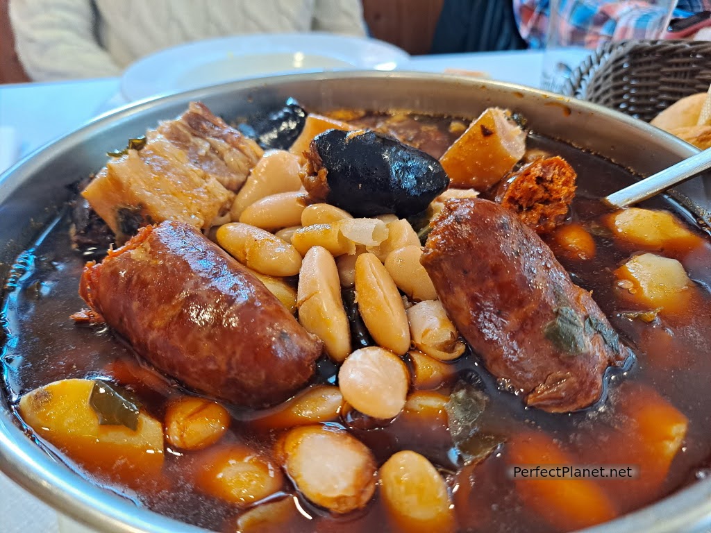
Stew
The views of the park from the house are spectacular.
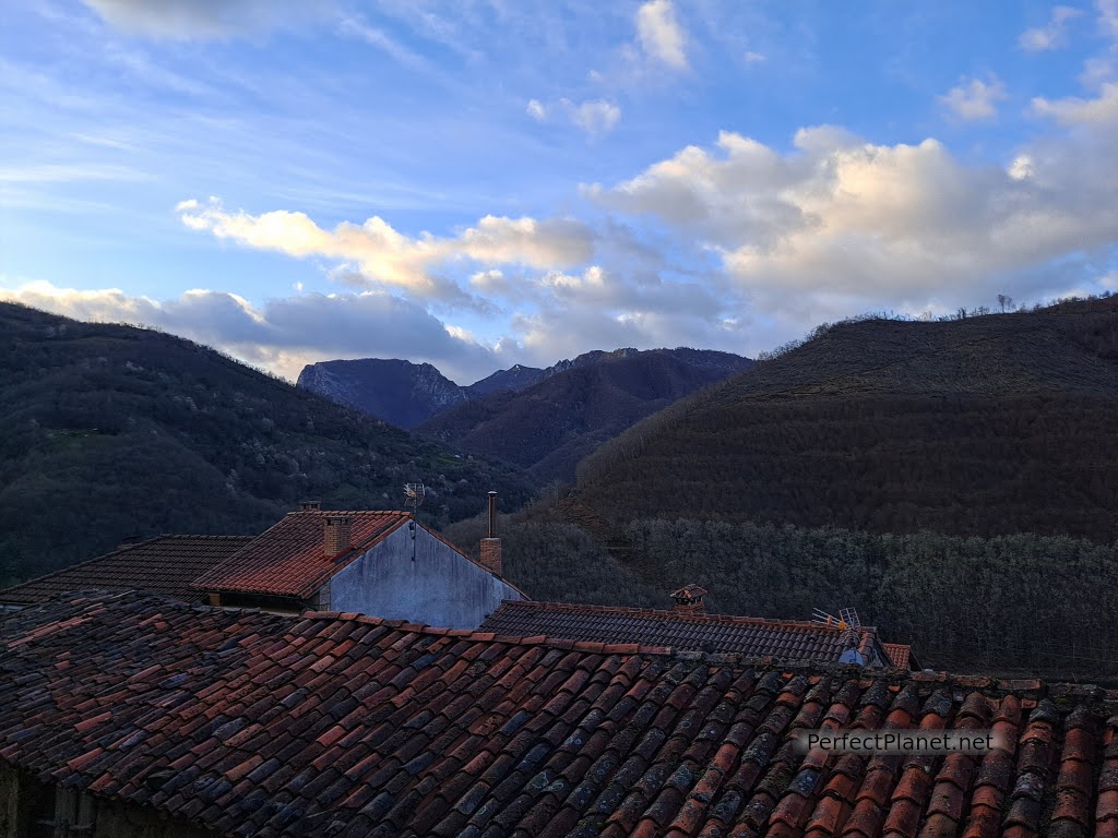
Views
We invite you to discover with us some of the most impressive routes.
Ubales lake along the Arrudos path
Campigüeños peak por la Foz de Melordaña
Alba route
Alba route
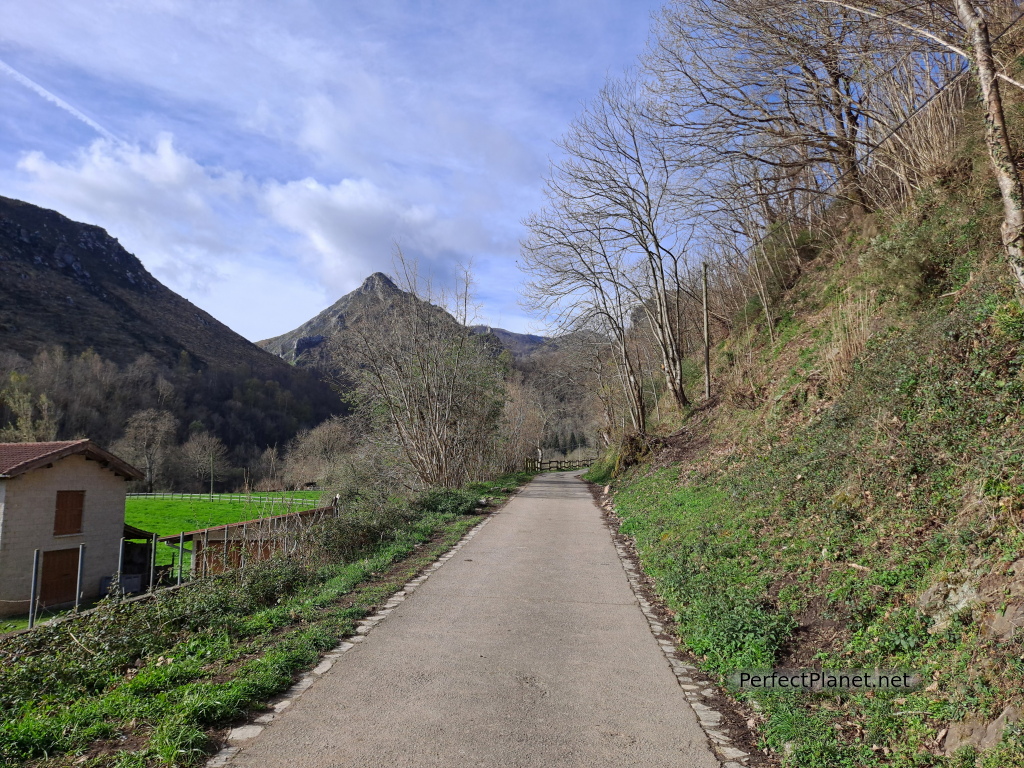
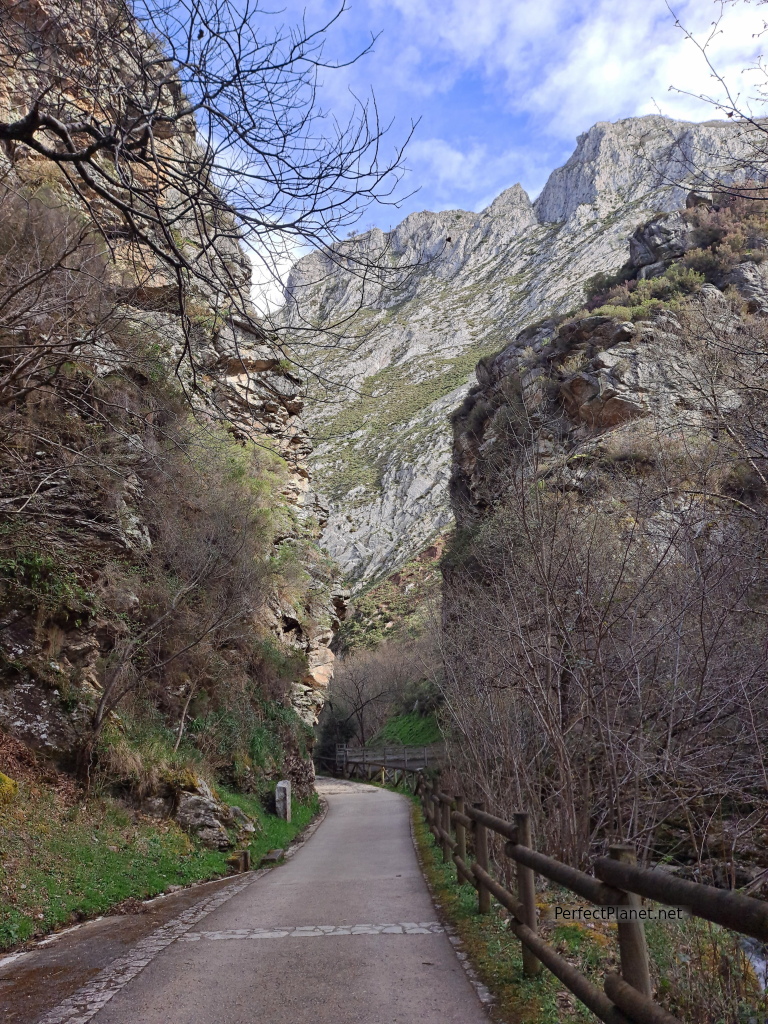
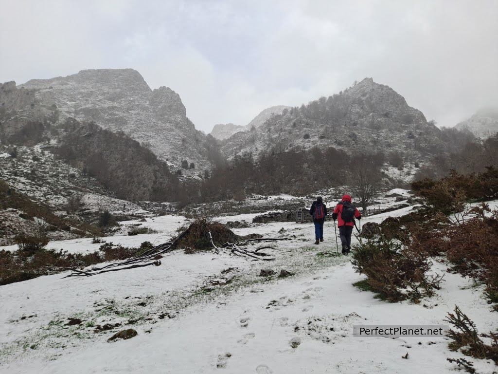
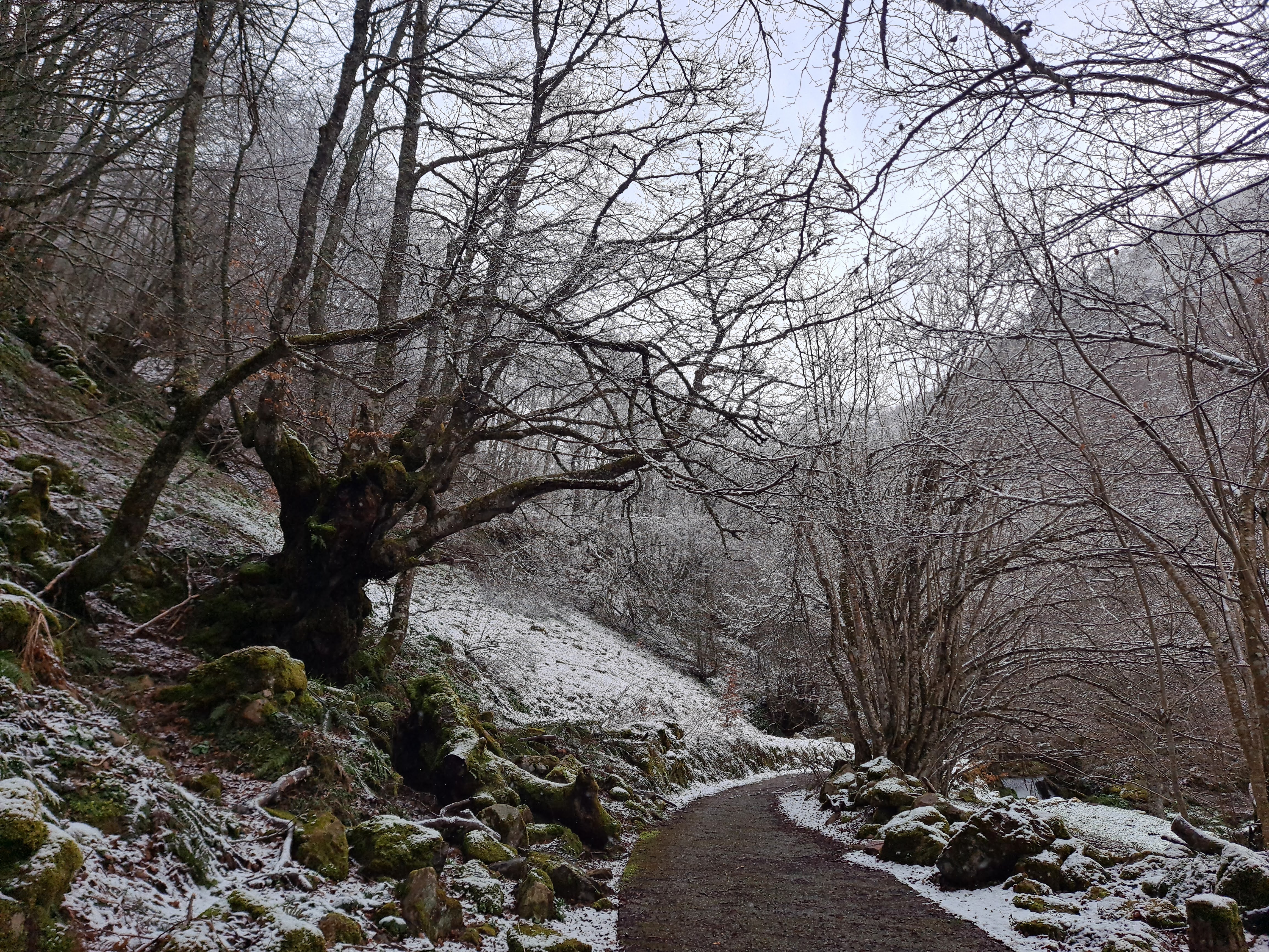
The Alba route is one of the best known and easiest routes in the Redes Natural Park. The first five kilometres are concreted and this makes it accessible for families and people with reduced mobility.
Alba route
How to get there
The route starts in the Asturian town of Soto de Agues, in the council of Sobrescobio. Take the AS117 road to Rioseco and then the SC2 to Soto de Agues.
Description
We start our route from the Asturian town of Soto de Agues, where there is a large car park. The route is linear and well signposted.
We cross Soto and enjoy the old typical Asturian constructions and the hórreos (raised granaries) that are still preserved.
Alba route
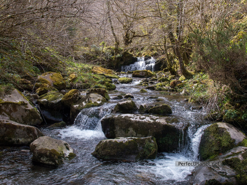
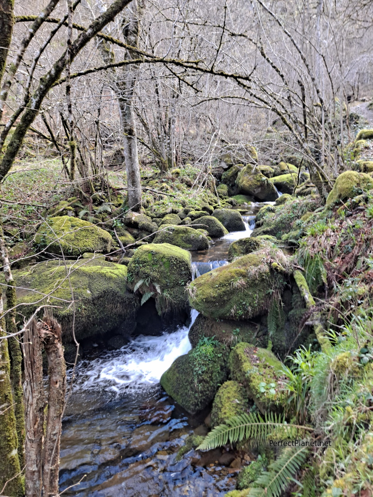
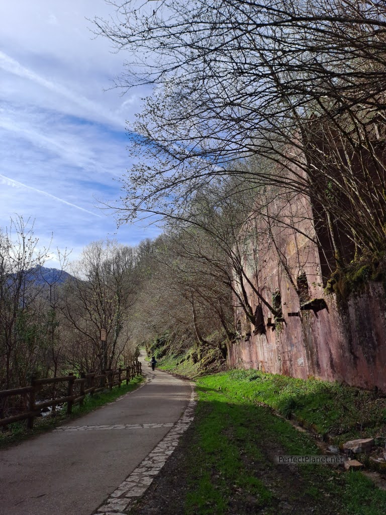
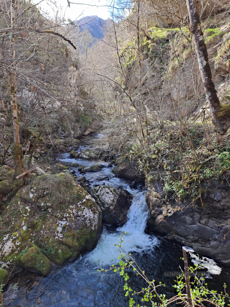
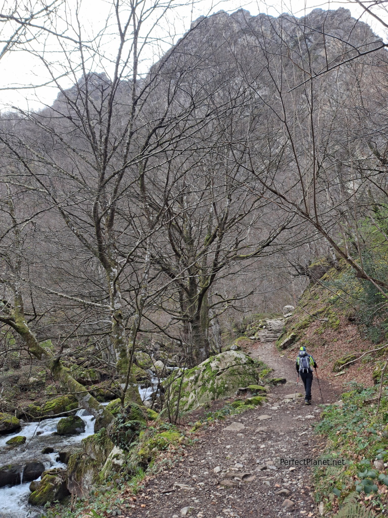
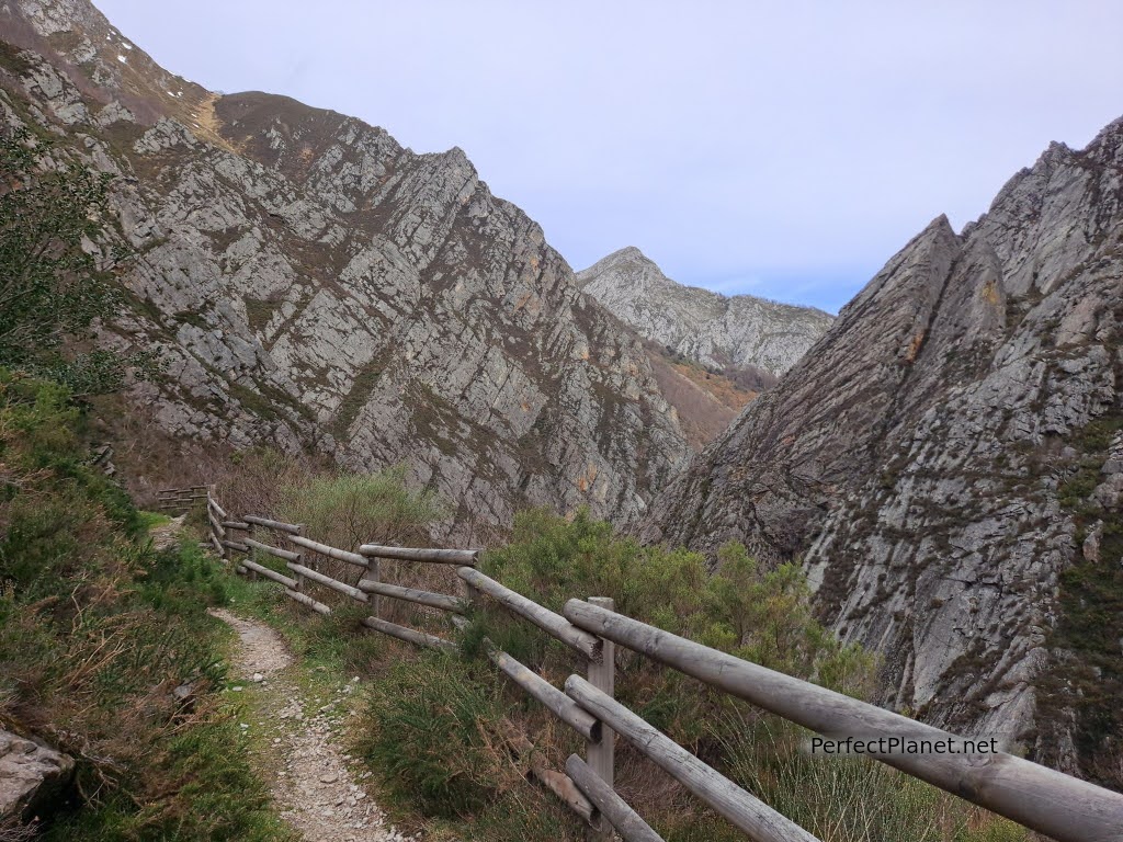
On leaving Soto we find an old washing place and the start of our route, which runs parallel to the river Alba along an asphalted path for the first 5 kilometres. Next to the river we see a trout farm that does not seem to be in use.
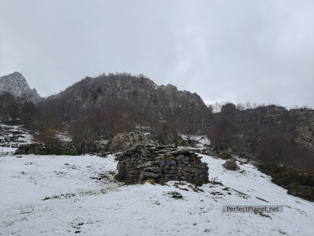
We continue along the path next to green meadows where there are still some old livestock and mining buildings. The Carmen iron mine still preserves the remains of the loading bays next to the path.
Alba route
This mine was also known as Mina de Pandames or Mina Llaímo. It was located in a very steep place which was very difficult to access and therefore difficult to exploit and transport. The ore was transported to Rioseco and from 1921 it was taken by steam tram to Laviana. This train was known as the Campurra. The mine closed in the mid-1960s.
Loading houses
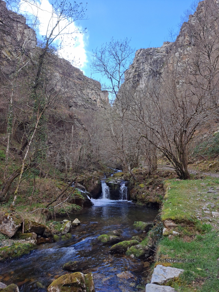
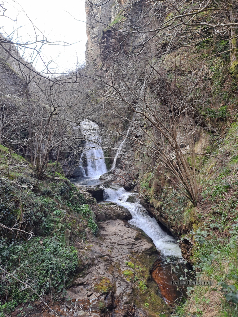
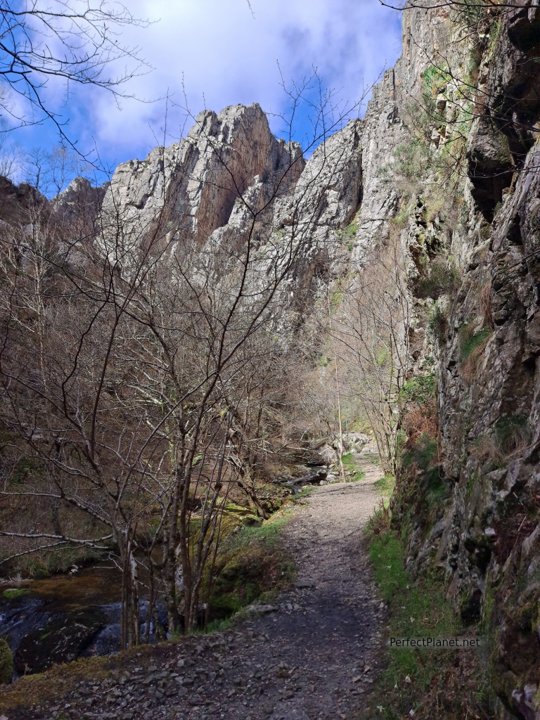
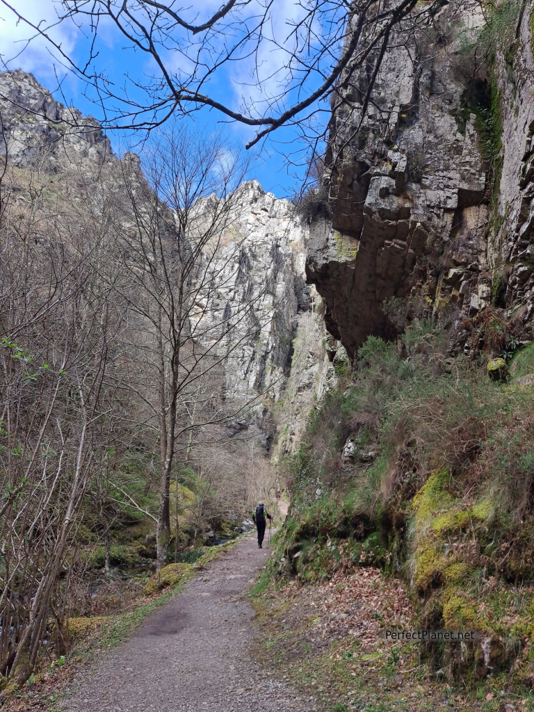
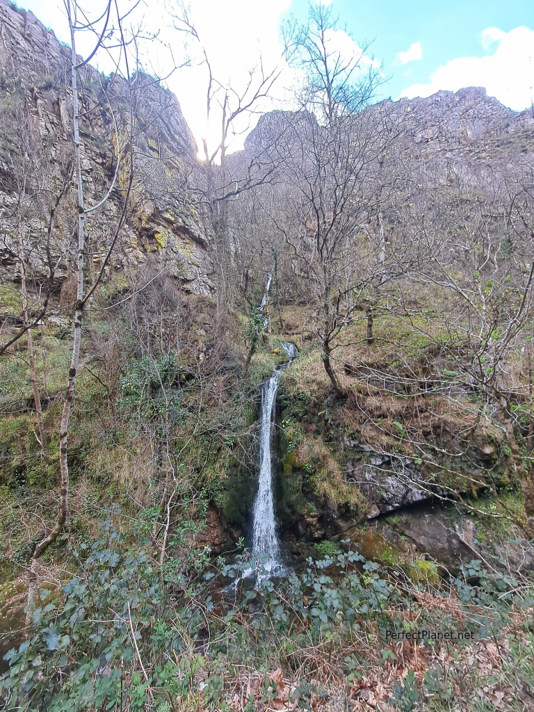
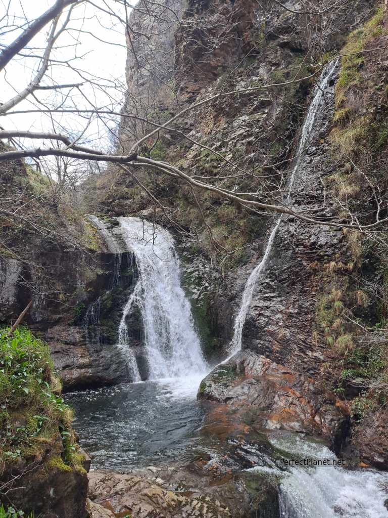
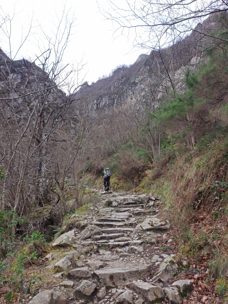
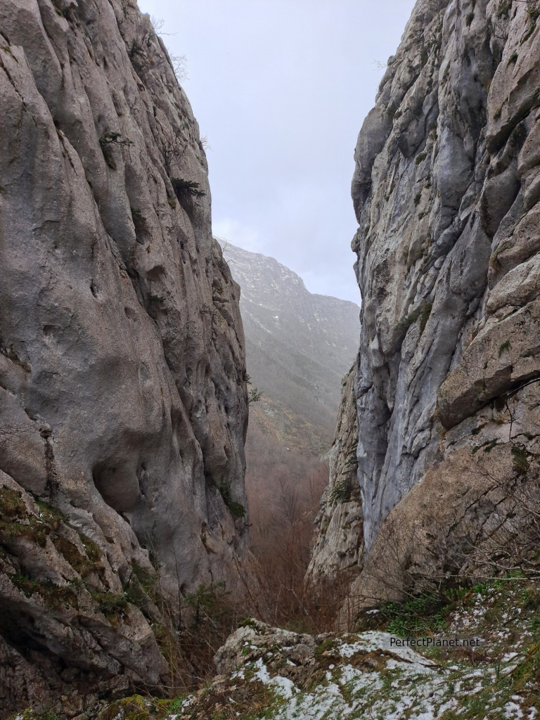
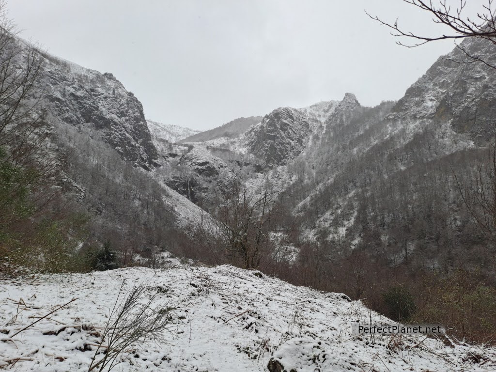
The sound of the water is constant throughout the route, the canyon gradually closes and the waterfalls become more and more spectacular.
Alba route
Once the concrete section is finished, we enter the narrow gorge.
Alba route
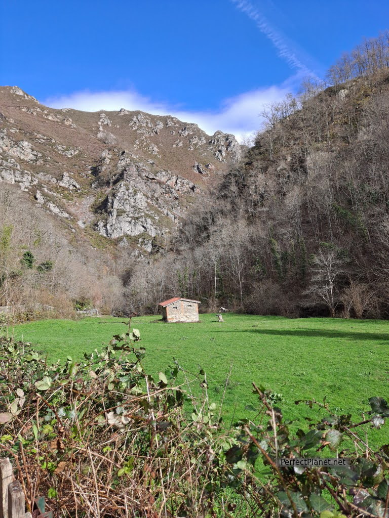
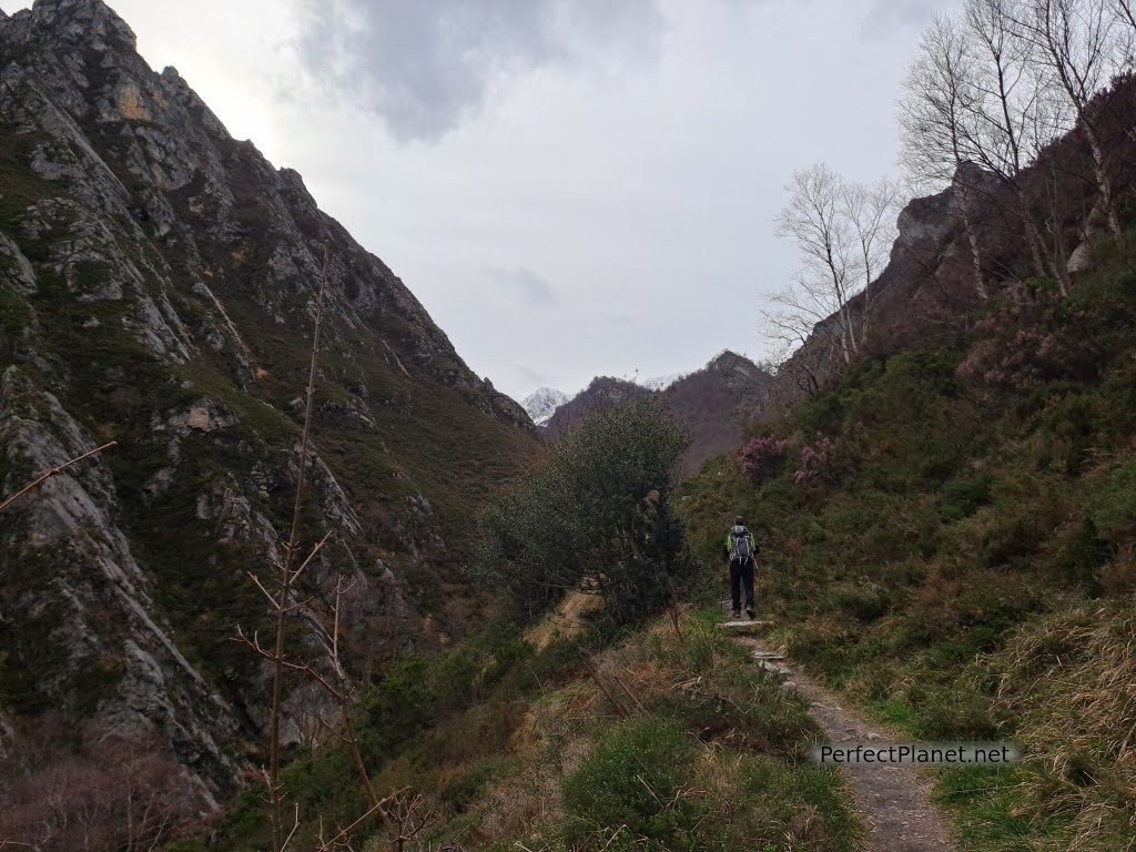
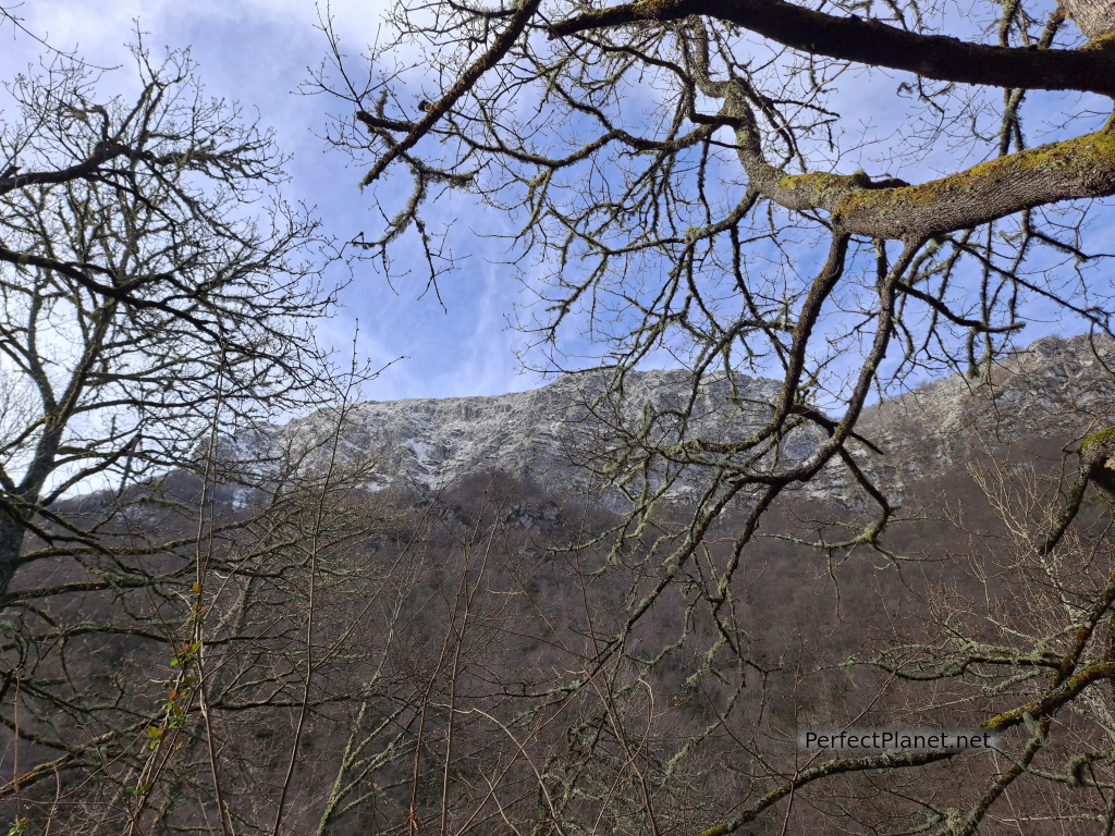
The end of the route is in the area known as La Cruz de los Ríos, where there is a small refuge and a rest area with tables. This more open area allows us to admire a landscape of meadows next to the Llaímo beech forest with Retriñón peak (1,862 m) in the background.
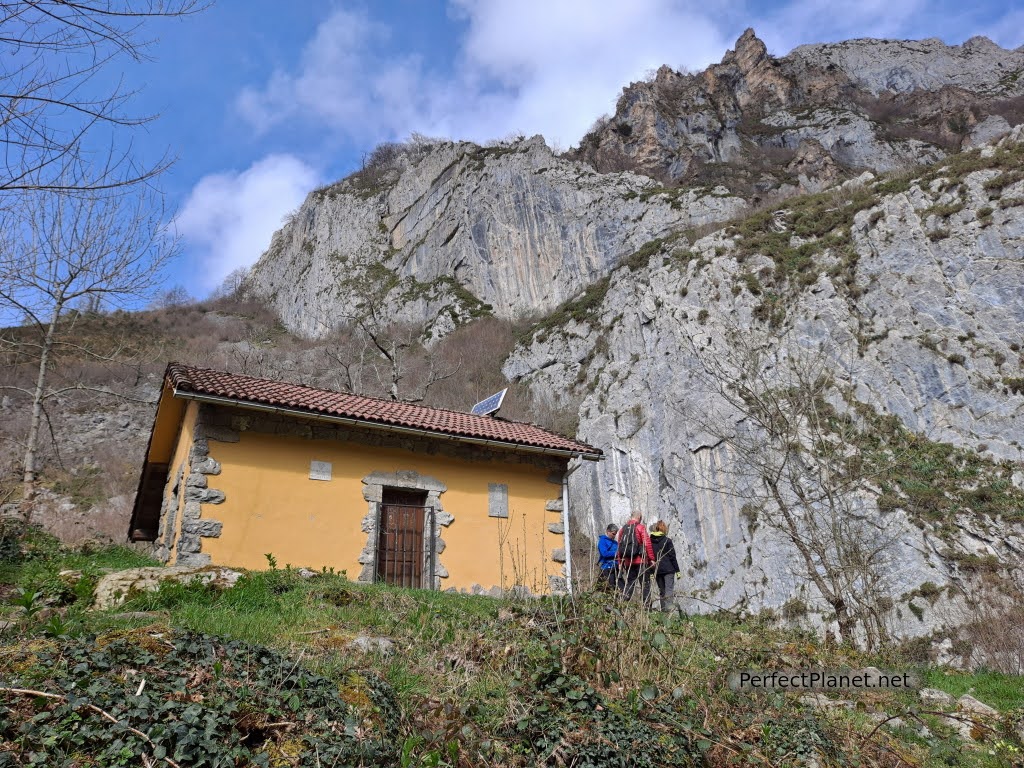
Refuge
We decide to continue up the path following the milestones into the forest.
The path continues parallel to the river where we enjoy the solitude of the forest. If we had finished the path we would have reached the foot of Retriñón but the rain and the strong wind prevented us from doing so.
Huts
Tip. There is an option to avoid part of the asphalt on the route. On the other side of the river, along the San Andrés path to the Precia la Vara bridge. It starts in Soto de Agues and for two kilometres you can enjoy the chestnut and oak forest until you reach a small viewpoint that offers beautiful views of the Llaímo forests. A little further on the path reaches the Precia la Vara bridge where you can connect again with the Alba path.
It is a very busy route, so we recommend that you get up early in the morning during the summer.
Distance 14 kilometres
Unevenness 560 metres
Linear route, partially concreted, trail PR-AS 62
Whoever makes use of this track and its additional information, in whole or in part, assumes full responsibility for the risks inherent in the practice of the activity, this information is for guidance only.
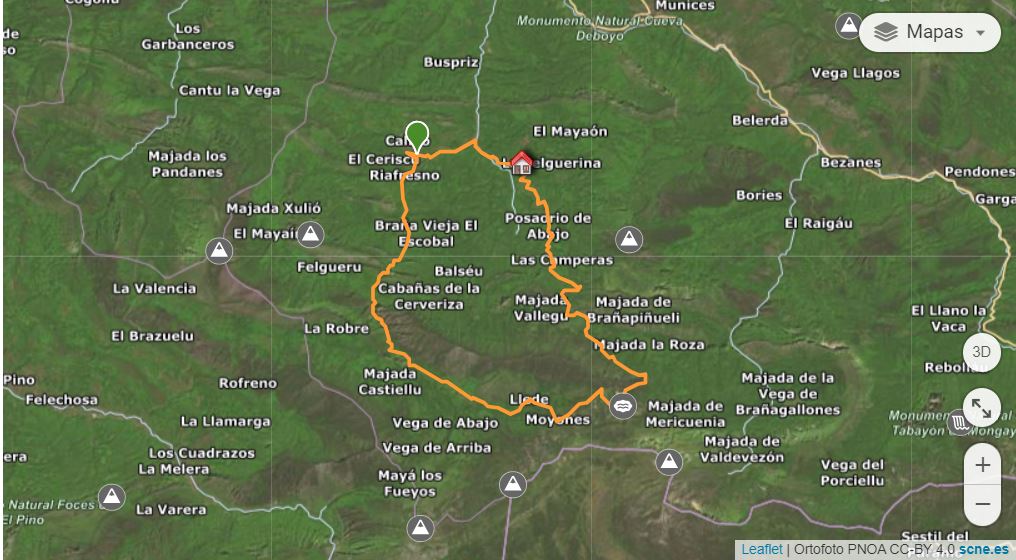
Map
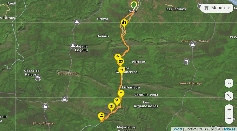
Map
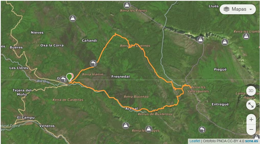
Ubales lake along the Arrudos path
One of the most impressive itineraries in the Redes Natural Park is perhaps the path from Desfiladero de los Arrudos to Lake Ubales from the Asturian town of Caleao ending in the town of Infiesta.
Arrudos path
How to get there
To get to Caleao, follow the AS117 road to Coballes, where the access road to Caleao is indicated.
Arrudos path
Tip. If you want to do the circular route and save walking the last 8 kilometres of road, you can leave one car in Infiesta and another in Caleao. Manolo from the rural house @loscascayos, accompanied us to leave the car in Infiesta and then left us in Caleao. It is a long route and walking on asphalt is not very pleasant so it is a good idea to use two vehicles or ask for a taxi.
Arrudos path
Description
We start our route in the Asturian town of Caleao. The route is marked as PR-AS61 Senda de los Arrudos. This path, parallel to the stream, will gain in height and beauty as the gorge narrows.
Arrudos path
We cross several bridges and a beautiful beech forest until we reach the end of the gorge in an area known as Collaín.
Torres peak
We cross several bridges and a beautiful beech forest until we reach the end. We continue our ascent again through the beautiful Arreballaos beech forest that ends in the green meadows of the Roxecu sheepfold where we find the remains of livestock huts.
We cross the stream (it does not carry much water and there is no bridge) following the path towards the Llede and Moyones sheepfolds. The views of the main peaks are impressive, we can see the Torres peak, Cascayón, Oso and/or Peña Viento.
Sheepfolds
Cascayon peak
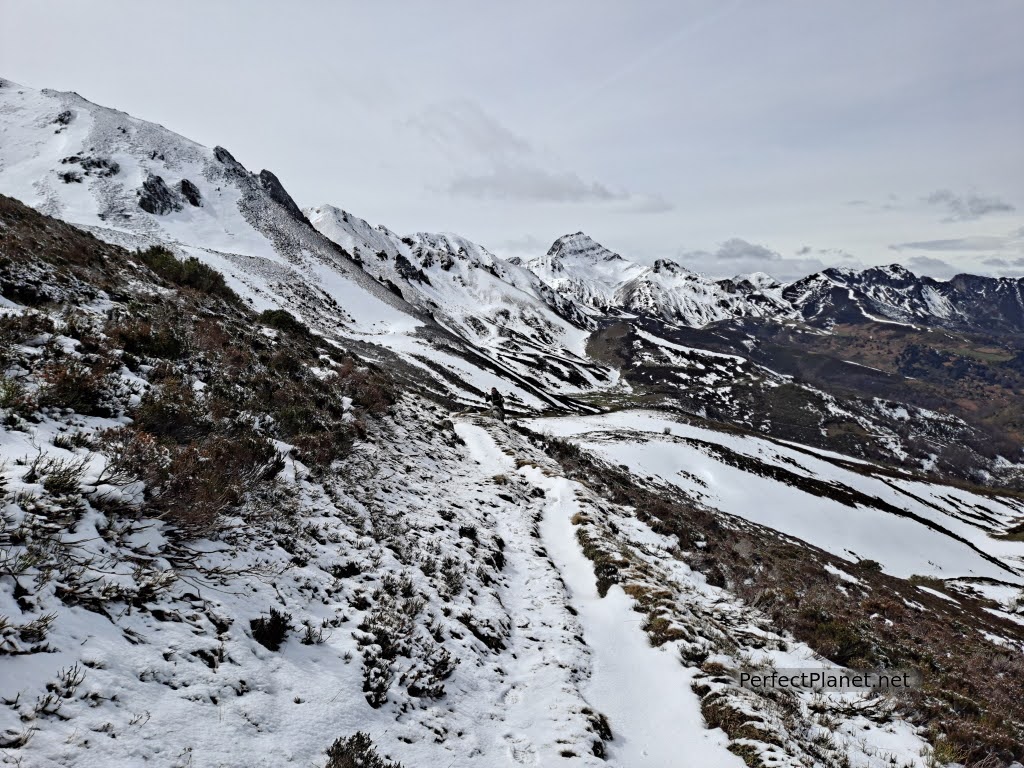
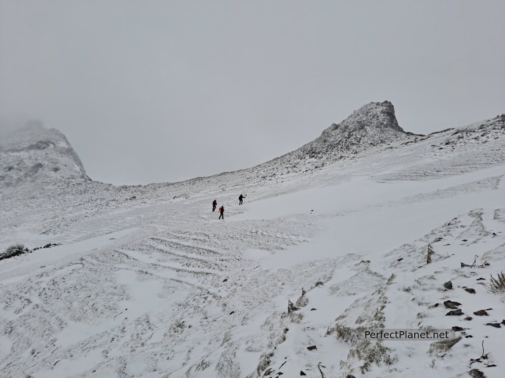
Almost reaching the Lledes sheepfold we find snow that we will not leave until we reach the path down to Infiesta.
We follow the path hidden by the snow until we reach the Ubales pass. There is so much snow that the main path is impossible to cross. We try to cross the path going up towards Cascayón peak, but the snow conditions are not good and the path is icy. We retrace our steps to go down a less dangerous belly next to the path.
We look for the path again and climb up to the foot of Lake Ubales. It is impressive.
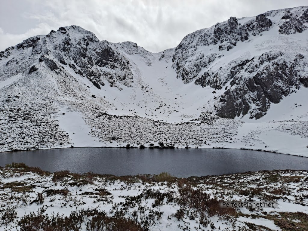
Ubales lake
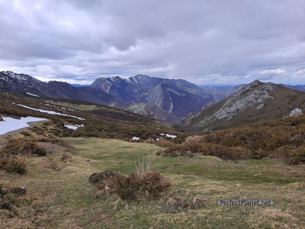
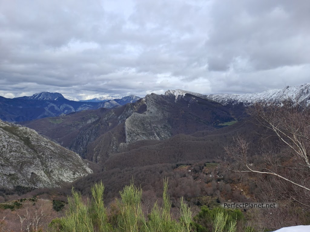
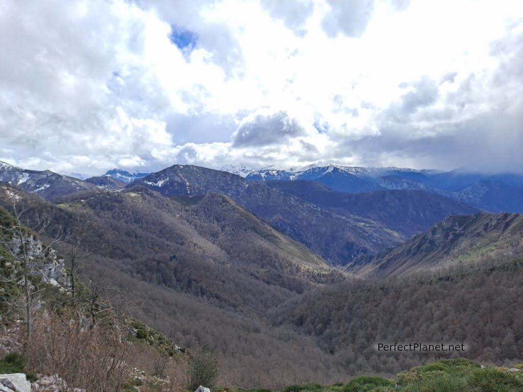
We descend along the track, from which we can see Tiatordos, Peña Ten and part of Picos de Europa.
In the distance we can see Brañagallones, another beautiful area of the park, which must be accessed by authorised vehicle or by walking the 10 kilometres of track (one way). If you want to go up by taxi, this is the link.
Views
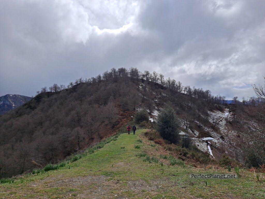
We continue to the pass of La Canalina along a wide path suitable for vehicles. We change valley and the views are magnificent again. The path is quite steep and in many areas it is concreted for vehicles.
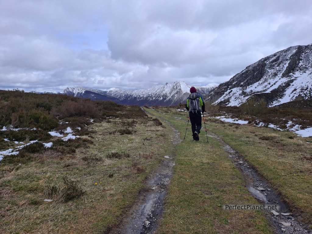
La Canalina
From the Canalina and following the path, we lose altitude until we reach the Infiesta.
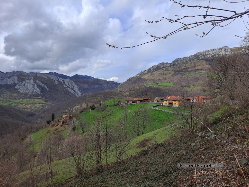
Infiesta
Circular route
Difference in altitude 1,100 metres
Distance 18 kilometres (if you have to return to Caleao to get the car it is almost 27 kilometres)
Whoever makes full or partial use of this track and its additional information, assumes full responsibility for the risks inherent in the practice of the activity, this information is for guidance purposes only.
Map
Map
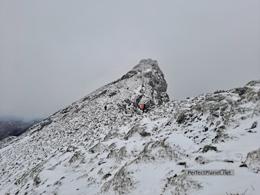
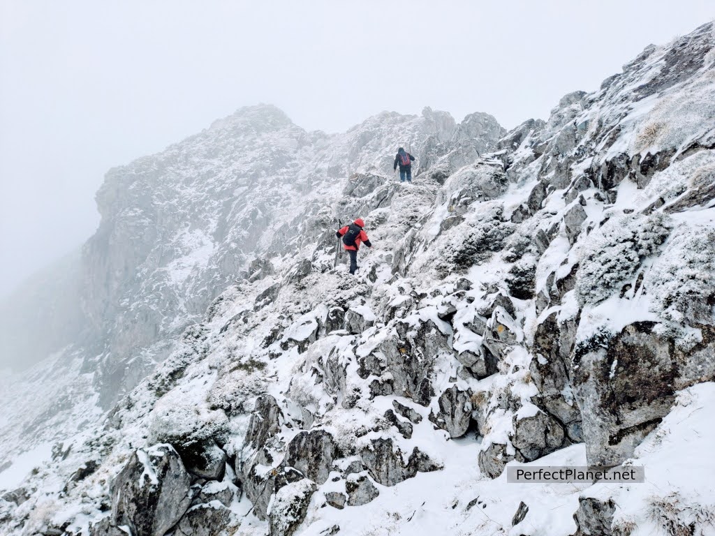
Campigüeños peak along Melordaña gorge
At 1,838 metres high, the Campigüeños peak marks the border between the Natural Park of Redes and the Natural Park of Ponga. It is not one of the best known peaks in the Park but the route and the views (weather permitting) are spectacular.
Summit
We do this route thanks to Manolo de la casa @loscascayos, an experienced mountaineer who knows Redes like the back of his hand. He acts as our guide and together with his friends Xisto and Goyo, three exceptional mountain companions, we enjoy a beautiful winter ascent of Campigüeños.
How to get there
To get to Orlé, follow the AS117 road to Caso, where you take the AS254.
Requeson peak
Description
We start our route in the Asturian town of Orlé. We take the track parallel to the river, marked with white and yellow lines until we reach the Conforcos refuge.
Once past the refuge, we take a path on the left to start the climb up the Melordaña gorge. This small ravine, which does not usually have water in its upper part (it filters), is a nice and entertaining path where you can get your hands dirty and do some climbing. The stones are slippery as it has snowed at night and you have to be careful.
Melordaña gorge
After passing the gorge we arrive at the Melordaña sheepfold where several buildings remain standing where the farmers used to spend the summer with their livestock.
There is a spring where you can refill your water. From here and for several kilometres we tread on more or less compacted snow.
We continue towards the Valloseru gorge, crossing the sheepfold and heading upwards through a beautiful beech forest.
Melordaña sheepfold
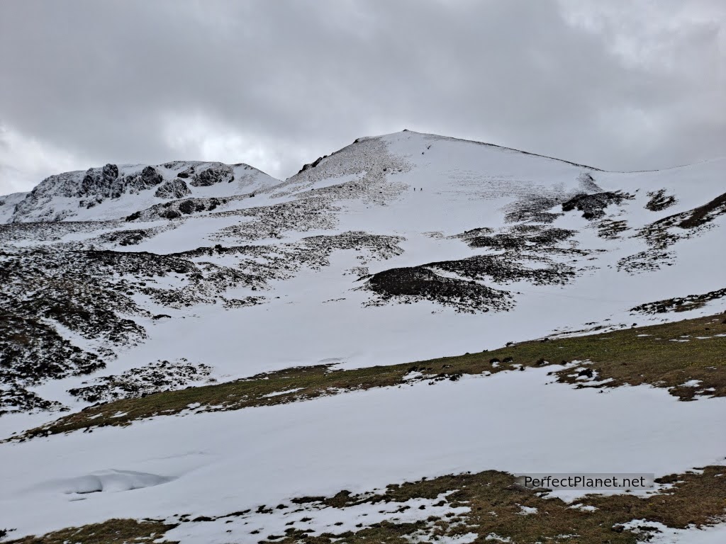
At the Valloseru fold, we turn slightly to the left, heading upwards. The idea is to reach the Campigüeños pass first but there is so much snow that we decide to climb diagonally to avoid the areas with the most snow.
From the Campigüeños pass you can climb the La Carasca peak to our right, but today the winter conditions prevent us from doing so.
Hut
We continue our ascent to the summit of Campigüeños on its south face, a little exposed with small climbs but without danger in spite of the snow and the wind that is whipping us.
At the top we are lucky enough to enjoy the views of the Ponga Park and we can see the cut in the rock wall.
Campigüeños
At the summit we are in a cloud with a lot of wind and snow, so we quickly descend the northern face, which is less rocky and easier to descend.
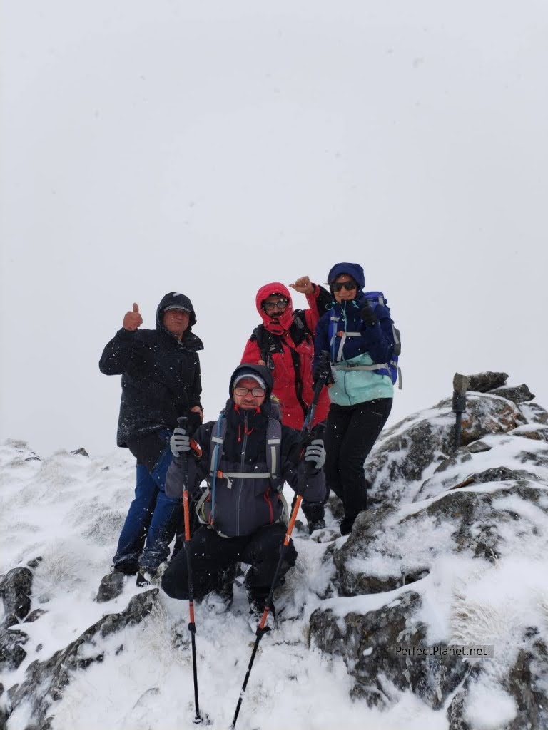
Summit
We walk in the direction of some stone walls looking for the path hidden by the snow halfway up the slope until we reach the spectacular Purupintu forest.
Summit
In the forest the path is easy to follow as there is no snow. We continue to the Mozquitón pass where we change valleys.
Views
We follow the path to the Frieru pass where we join a track that will take us back down to Orlé.
Frieru pass
Circular route
Elevation gain 1,250 metres
Distance: 18 kilometres
Moderate difficulty as it is a winter route, no technical difficulty
Whoever makes full or partial use of this track and its additional information, assumes full responsibility for the risks inherent in the practice of the activity, this information is for guidance purposes only.
Map
Map
Tabayón de Mongallu waterfall
The route starts in the Asturian town of Tarna. This small town in the council of Caso, located in the heart of the Redes Natural Park, was destroyed during the Spanish Civil War and rebuilt in its entirety, with the exception of the church of San Bartolomé, which dates from the 13th century.
How to get there
Tarna is located on the AS-17 Avilés - Puerto de Tarna road.
Description
We start our route following the concrete track that leaves from the information panel at the entrance to Tarna. We gradually climb along a wide path through the spectacular beech forest.
Path
In just one kilometre there is a variant that includes the ascent to the Rebollu del Llanu Toru mountain to look for two rocky outcrops. If you continue along the path on the right you go straight to the waterfall.
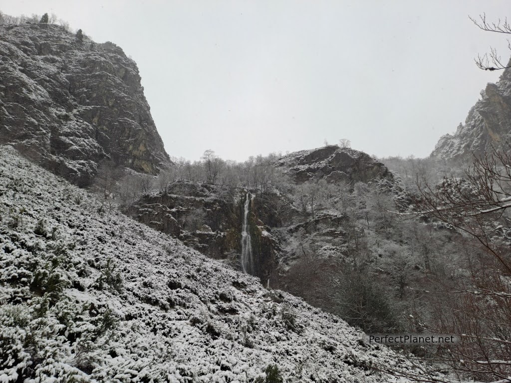
We cross several wooden bridges, several waterfalls and a fountain with a picnic area. At the end of the beech forest there is a spectacular view of the waterfall surrounded by a spectacular rock wall.
Views
We descend to the braña de la Campona. From here a small, steep path takes us to the base of this impressive waterfall with a drop of more than 60 metres.
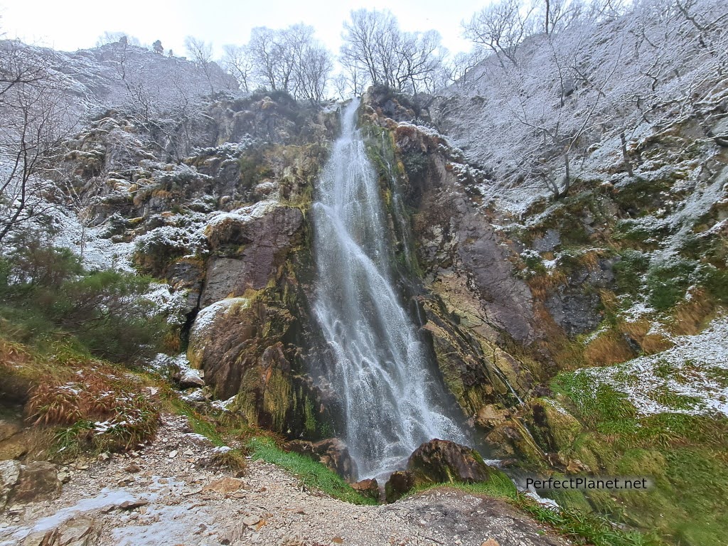
Waterfall
This route can be done at any time of the year, we did it in March with snow and the beech forest was spectacular.
Waterfall
To return, you can either retrace your steps or continue on to the Campona hut and take the path on the left that runs parallel to the river.
Circular route
Distance 11.5 kms
Unevenness 700 metres
Difficulty low, no technical difficulty
Whoever makes full or partial use of this track and its additional information, assumes full responsibility for the risks inherent in the practice of the activity, this information is for guidance purposes only.
Map
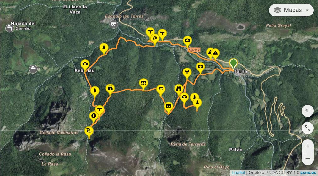
Map
- Log in to post comments